
| Memorials | : | 0 |
| Location | : | Chetwode, Aylesbury Vale District, England |
| Coordinate | : | 51.9630520, -1.0694610 |
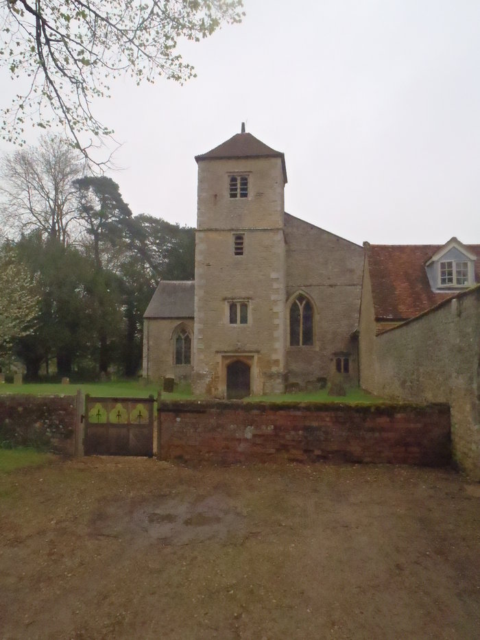
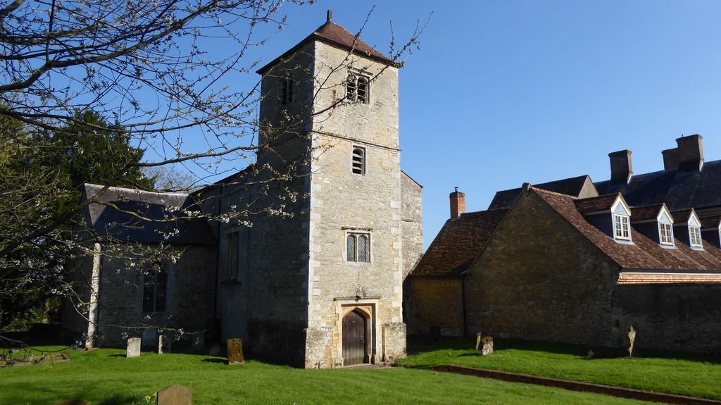
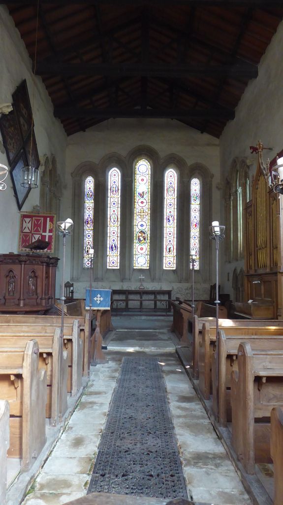
| Description | : | In 1244 Sir Ralphe de Norwich founded an Augustinian priory at Chetwode. In 1460, owing to its poverty, the priory was dissolved and annexed to the nearby Nutley Abbey in Long Crendon. This led to the first recognition of Chetwode as a village rather than just a priory. The Church of England parish church of Saint Mary and Saint Nicholas and was once part of the Augustinian priory church. However the parish church had become ruinous in the 15th century and this building replaced it as the parish church in 1480. The stonework is a fine example of the work... Read More |
frequently asked questions (FAQ):
-
Where is Ss Mary and Nicholas Churchyard?
Ss Mary and Nicholas Churchyard is located at Chetwode, Aylesbury Vale District ,Buckinghamshire ,England.
-
Ss Mary and Nicholas Churchyard cemetery's updated grave count on graveviews.com?
0 memorials
-
Where are the coordinates of the Ss Mary and Nicholas Churchyard?
Latitude: 51.9630520
Longitude: -1.0694610
Nearby Cemetories:
1. St James Churchyard
Barton Harthshorn, Aylesbury Vale District, England
Coordinate: 51.9730300, -1.0686650
2. St. John the Baptist Churchyard
Preston Bissett, Aylesbury Vale District, England
Coordinate: 51.9637380, -1.0440980
3. St Michael & All Angels Churchyard
Newton Purcell, Cherwell District, England
Coordinate: 51.9723110, -1.0915630
4. Holy Trinity
Godington, Cherwell District, England
Coordinate: 51.9452700, -1.0667470
5. St. Michael and All Angels
Finmere, Cherwell District, England
Coordinate: 51.9931740, -1.0740240
6. Tingewick Cemetery
Tingewick, Aylesbury Vale District, England
Coordinate: 51.9917800, -1.0514420
7. St Michaels and All Angels Churchyard
Fringford, Cherwell District, England
Coordinate: 51.9573680, -1.1189880
8. St. Mary's Churchyard
Tingewick, Aylesbury Vale District, England
Coordinate: 51.9919690, -1.0432400
9. Assumption of BVM Churchyard
Twyford, Aylesbury Vale District, England
Coordinate: 51.9345860, -1.0341060
10. Holy Trinity Churchyard
Gawcott-with-Lenborough, Aylesbury Vale District, England
Coordinate: 51.9809000, -1.0114000
11. All Saints Churchyard
Hillesden, Aylesbury Vale District, England
Coordinate: 51.9582028, -1.0045972
12. St. Edmund and St. George Churchyard
Hethe, Cherwell District, England
Coordinate: 51.9604830, -1.1384690
13. SS Mary & Edburga Churchyard
Stratton Audley, Cherwell District, England
Coordinate: 51.9294810, -1.1164160
14. Mixbury All Saints Churchyard
Mixbury, Cherwell District, England
Coordinate: 52.0010100, -1.1131800
15. Holy Trinity Churchyard
Hethe, Cherwell District, England
Coordinate: 51.9615600, -1.1452100
16. Saint John the Evangelist Churchyard
Buckingham, Aylesbury Vale District, England
Coordinate: 51.9996500, -1.0174090
17. St. Mary's Churchyard
Cottisford, Cherwell District, England
Coordinate: 51.9749070, -1.1464410
18. St. Giles' Churchyard
Water Stratford, Aylesbury Vale District, England
Coordinate: 52.0136475, -1.0515046
19. St. Augustine's Churchyard
Westbury, Aylesbury Vale District, England
Coordinate: 52.0154200, -1.0941150
20. St Mary the Virgin Churchyard
Hardwick, Cherwell District, England
Coordinate: 51.9616750, -1.1615570
21. Old St Peter and St Paul Churchyard
Buckingham, Aylesbury Vale District, England
Coordinate: 51.9966610, -0.9908980
22. Buckingham Cemetery
Buckingham, Aylesbury Vale District, England
Coordinate: 52.0011610, -0.9962420
23. St. Edward the Confessor Churchyard
Shalstone, Aylesbury Vale District, England
Coordinate: 52.0225079, -1.0666653
24. St Mary the Virgin Churchyard
Marsh Gibbon, Aylesbury Vale District, England
Coordinate: 51.9038310, -1.0601060