
| Memorials | : | 5 |
| Location | : | Godington, Cherwell District, England |
| Coordinate | : | 51.9452700, -1.0667470 |
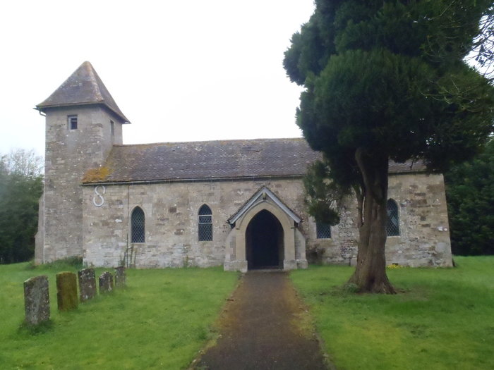
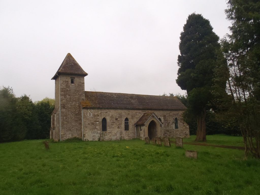
| Description | : | The earliest written record of the parish church is from 1221, when the Abbess of the Benedictine Elstow Abbey in Bedfordshire disputed with a later Richard de Camville which one of them held the advowson of the parish. The Abbey won, and retained the right until its dissolution in 1539. After this the Crown held the advowson until 1608, when it was sold to Sir Henry Fowkes who immediately sold it on to Corpus Christi College, Oxford. The Fermors were recusants and with their support the majority of Godington parishioners remained Roman Catholic. In 1739 Roman Catholics still outnumbered Anglicans in... Read More |
frequently asked questions (FAQ):
-
Where is Holy Trinity?
Holy Trinity is located at Godington, Cherwell District ,Oxfordshire , OX27 9XXEngland.
-
Holy Trinity cemetery's updated grave count on graveviews.com?
5 memorials
-
Where are the coordinates of the Holy Trinity?
Latitude: 51.9452700
Longitude: -1.0667470
Nearby Cemetories:
1. Ss Mary and Nicholas Churchyard
Chetwode, Aylesbury Vale District, England
Coordinate: 51.9630520, -1.0694610
2. Assumption of BVM Churchyard
Twyford, Aylesbury Vale District, England
Coordinate: 51.9345860, -1.0341060
3. St. John the Baptist Churchyard
Preston Bissett, Aylesbury Vale District, England
Coordinate: 51.9637380, -1.0440980
4. St James Churchyard
Barton Harthshorn, Aylesbury Vale District, England
Coordinate: 51.9730300, -1.0686650
5. St Michael & All Angels Churchyard
Newton Purcell, Cherwell District, England
Coordinate: 51.9723110, -1.0915630
6. St Michaels and All Angels Churchyard
Fringford, Cherwell District, England
Coordinate: 51.9573680, -1.1189880
7. SS Mary & Edburga Churchyard
Stratton Audley, Cherwell District, England
Coordinate: 51.9294810, -1.1164160
8. All Saints Churchyard
Hillesden, Aylesbury Vale District, England
Coordinate: 51.9582028, -1.0045972
9. St Mary the Virgin Churchyard
Marsh Gibbon, Aylesbury Vale District, England
Coordinate: 51.9038310, -1.0601060
10. Marsh Gibbon Cemetery
Bicester, Cherwell District, England
Coordinate: 51.9000250, -1.0607810
11. St. Edmund and St. George Churchyard
Hethe, Cherwell District, England
Coordinate: 51.9604830, -1.1384690
12. Tingewick Cemetery
Tingewick, Aylesbury Vale District, England
Coordinate: 51.9917800, -1.0514420
13. St. Michael and All Angels
Finmere, Cherwell District, England
Coordinate: 51.9931740, -1.0740240
14. St. Mary's Churchyard
Tingewick, Aylesbury Vale District, England
Coordinate: 51.9919690, -1.0432400
15. Holy Trinity Churchyard
Gawcott-with-Lenborough, Aylesbury Vale District, England
Coordinate: 51.9809000, -1.0114000
16. Holy Trinity Churchyard
Hethe, Cherwell District, England
Coordinate: 51.9615600, -1.1452100
17. Bethel Congregational Church
Launton, Cherwell District, England
Coordinate: 51.8979200, -1.1151020
18. St Michael and All Angels Churchyard
Edgcott, Aylesbury Vale District, England
Coordinate: 51.8995450, -1.0132210
19. St Marys Churchyard
Launton, Cherwell District, England
Coordinate: 51.9006740, -1.1230300
20. St. Mary's Churchyard
Cottisford, Cherwell District, England
Coordinate: 51.9749070, -1.1464410
21. St. Michael Churchyard
Steeple Claydon, Aylesbury Vale District, England
Coordinate: 51.9345150, -0.9752060
22. St Laurence Churchyard
Caversfield, Cherwell District, England
Coordinate: 51.9223030, -1.1571690
23. St Mary the Virgin Churchyard
Hardwick, Cherwell District, England
Coordinate: 51.9616750, -1.1615570
24. Saint John the Evangelist Churchyard
Buckingham, Aylesbury Vale District, England
Coordinate: 51.9996500, -1.0174090