
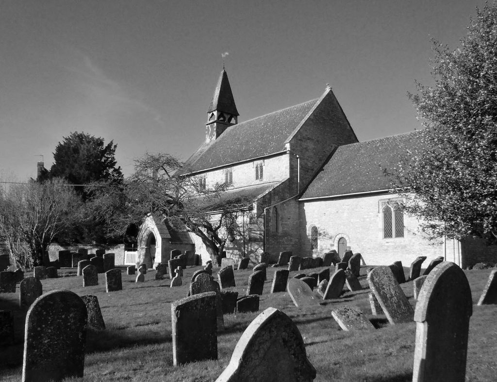
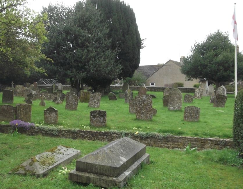
| Memorials | : | 7 |
| Location | : | Hethe, Cherwell District, England |
| Coordinate | : | 51.9604830, -1.1384690 |
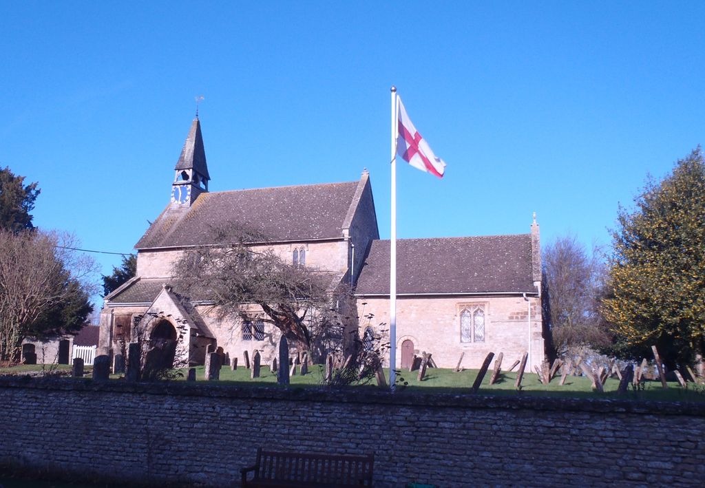
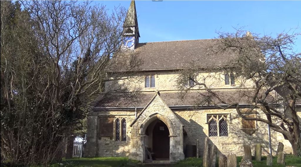
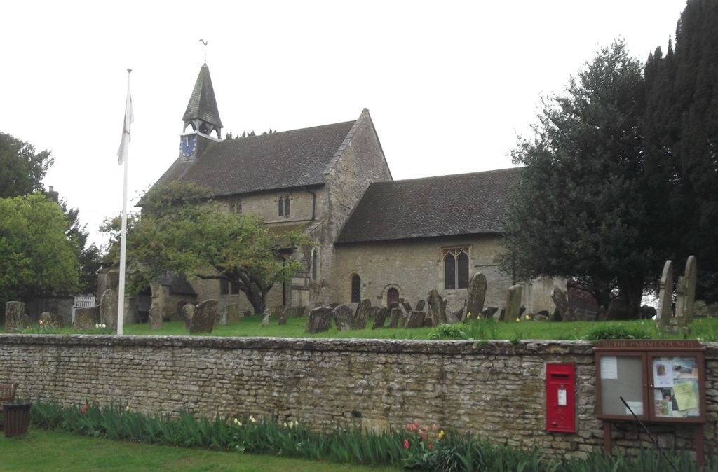
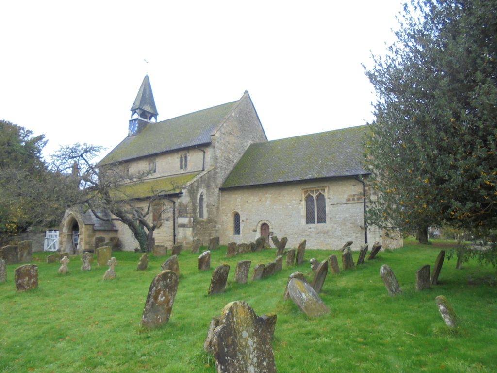
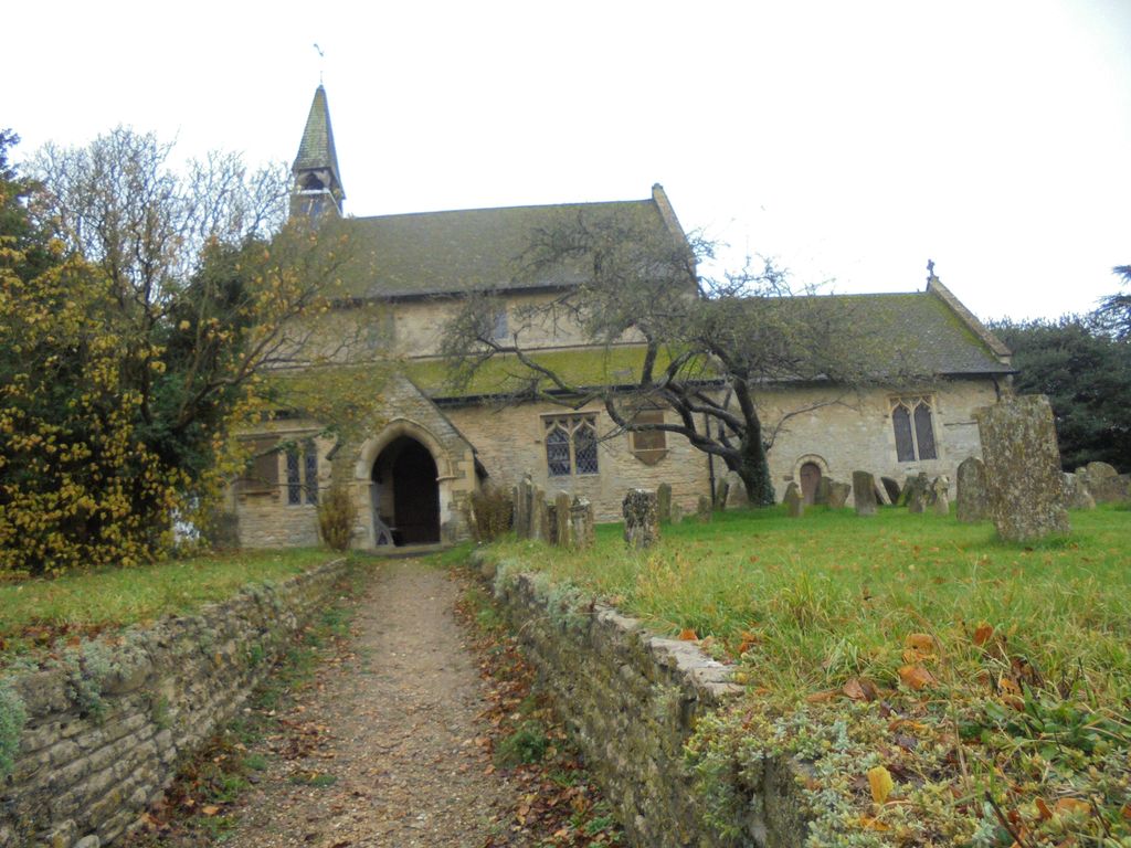
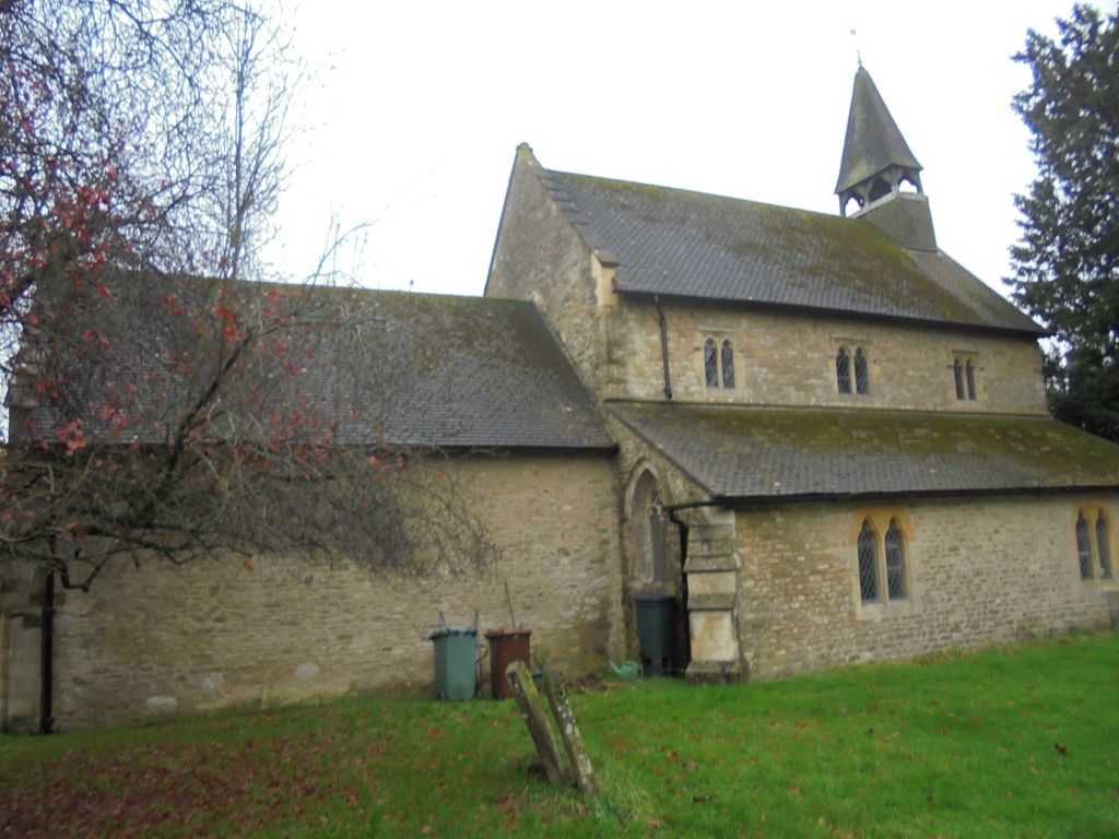
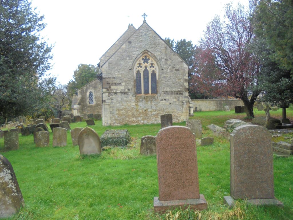
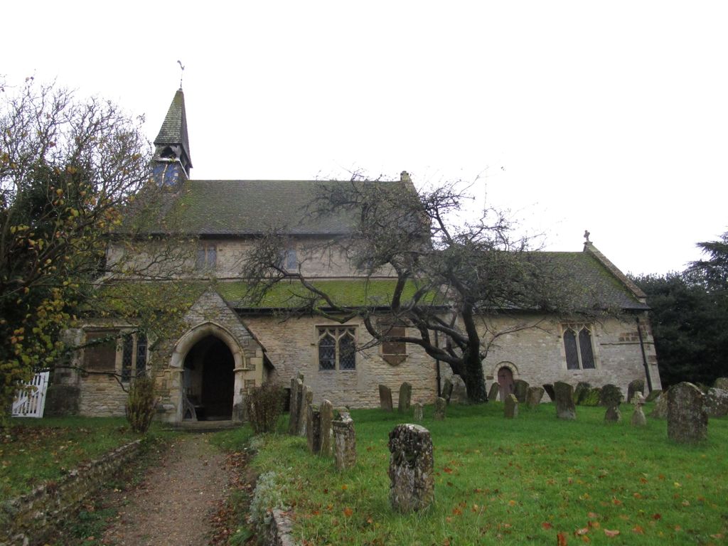
| Description | : | The Church of England parish church of Saint Edmund and Saint George is known to have existed by 1154, when it was given to the Augustinian Priory at Kenilworth, later Kenilworth Abbey. Both the west wall of the nave and the south wall of the chancel survive from this time, each retaining a Norman lancet window and the latter a priest's doorway from the same period. The east end of the chancel was rebuilt early in the 13th century when a Decorated Gothic east window was inserted. In the 15th century a Perpendicular Gothic clerestory was added to the nave.... Read More |
frequently asked questions (FAQ):
-
Where is St. Edmund and St. George Churchyard?
St. Edmund and St. George Churchyard is located at Hethe, Cherwell District ,Oxfordshire ,England.
-
St. Edmund and St. George Churchyard cemetery's updated grave count on graveviews.com?
7 memorials
-
Where are the coordinates of the St. Edmund and St. George Churchyard?
Latitude: 51.9604830
Longitude: -1.1384690
Nearby Cemetories:
1. Holy Trinity Churchyard
Hethe, Cherwell District, England
Coordinate: 51.9615600, -1.1452100
2. St Michaels and All Angels Churchyard
Fringford, Cherwell District, England
Coordinate: 51.9573680, -1.1189880
3. St Mary the Virgin Churchyard
Hardwick, Cherwell District, England
Coordinate: 51.9616750, -1.1615570
4. St. Mary's Churchyard
Cottisford, Cherwell District, England
Coordinate: 51.9749070, -1.1464410
5. St Peters Churchyard
Stoke Lyne, Cherwell District, England
Coordinate: 51.9505340, -1.1771680
6. St Michael & All Angels Churchyard
Newton Purcell, Cherwell District, England
Coordinate: 51.9723110, -1.0915630
7. SS Mary & Edburga Churchyard
Stratton Audley, Cherwell District, England
Coordinate: 51.9294810, -1.1164160
8. St Laurence Churchyard
Caversfield, Cherwell District, England
Coordinate: 51.9223030, -1.1571690
9. Ss Mary and Nicholas Churchyard
Chetwode, Aylesbury Vale District, England
Coordinate: 51.9630520, -1.0694610
10. Mixbury All Saints Churchyard
Mixbury, Cherwell District, England
Coordinate: 52.0010100, -1.1131800
11. St James Churchyard
Barton Harthshorn, Aylesbury Vale District, England
Coordinate: 51.9730300, -1.0686650
12. St Peter's Churchyard
Bucknell, Cherwell District, England
Coordinate: 51.9263400, -1.1861700
13. Holy Trinity
Godington, Cherwell District, England
Coordinate: 51.9452700, -1.0667470
14. St. Mary's Churchyard
Ardley, Cherwell District, England
Coordinate: 51.9422140, -1.2122580
15. Fewcott All Saints Churchyard
Albury, South Oxfordshire District, England
Coordinate: 51.9477100, -1.2170700
16. St. Michael and All Angels
Finmere, Cherwell District, England
Coordinate: 51.9931740, -1.0740240
17. All Saints Churchyard
Croughton, South Northamptonshire Borough, England
Coordinate: 51.9977370, -1.2065760
18. Croughton Cemetery
Croughton, South Northamptonshire Borough, England
Coordinate: 52.0014880, -1.2031960
19. St. John the Baptist Churchyard
Preston Bissett, Aylesbury Vale District, England
Coordinate: 51.9637380, -1.0440980
20. St Marys Churchyard
Launton, Cherwell District, England
Coordinate: 51.9006740, -1.1230300
21. Bicester Priory
Bicester, Cherwell District, England
Coordinate: 51.9000000, -1.1500000
22. St. Augustine's Churchyard
Westbury, Aylesbury Vale District, England
Coordinate: 52.0154200, -1.0941150
23. Fritwell Parish Council Cemetery
Fritwell, Cherwell District, England
Coordinate: 51.9599490, -1.2380650
24. St Olave Churchyard
Fritwell, Cherwell District, England
Coordinate: 51.9596980, -1.2381180