
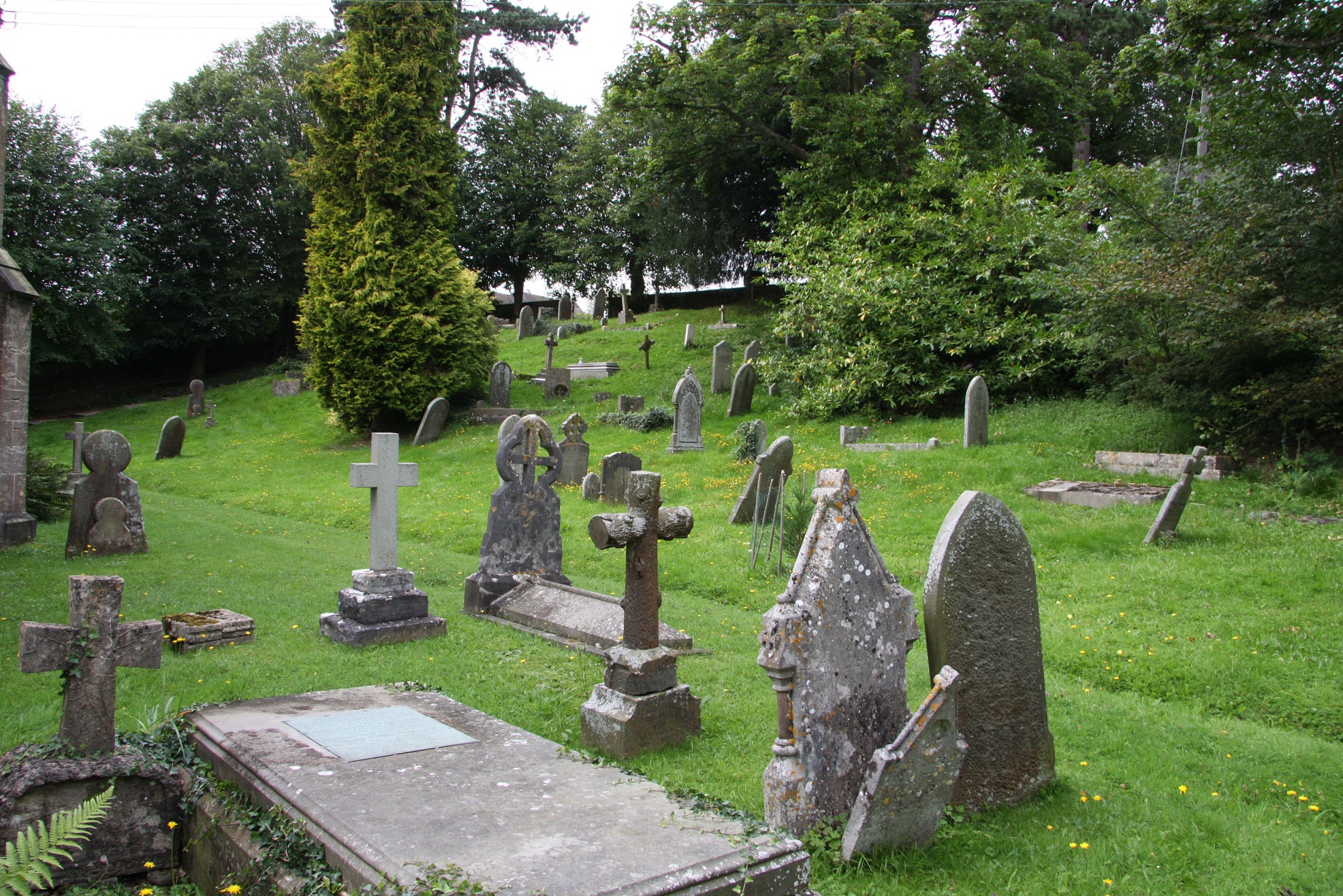
| Memorials | : | 53 |
| Location | : | Oakridge, Stroud District, England |
| Coordinate | : | 51.7291209, -2.1276180 |
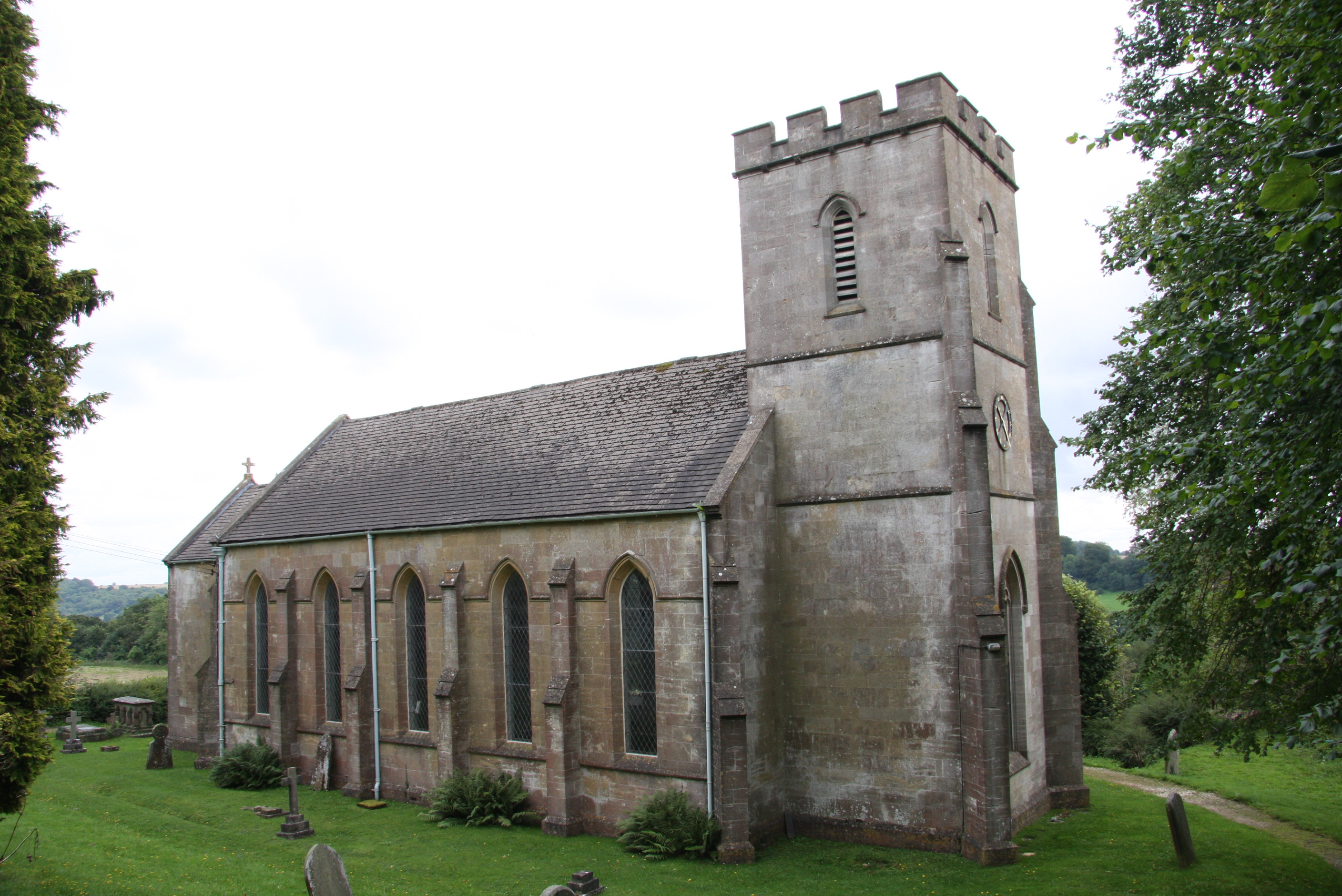
| Description | : | St Bartholomew Church was built in 1837 at the instigation of Thomas Keble, then vicar of Bisley. The architect was Robert Stokes of Cheltenham, and the funding of the construction was supported by many colleagues of Thomas Keble in the “Oxford” Movement. It was the first of the Chapels of Ease in the large Bisley parish but became a parish church when the Parish of Oakridge was formed some years later. It is a very simple building consisting of nave, chancel, tower and porch with ashlar finish externally and white painted walls and ceiling internally. It does contain... Read More |
frequently asked questions (FAQ):
-
Where is St Bartholemew Church?
St Bartholemew Church is located at Oakridge, Stroud District ,Gloucestershire , GL6 7NSEngland.
-
St Bartholemew Church cemetery's updated grave count on graveviews.com?
53 memorials
-
Where are the coordinates of the St Bartholemew Church?
Latitude: 51.7291209
Longitude: -2.1276180

Nearby Cemetories:
1. St. John the Baptist Churchyard
France Lynch, Stroud District, England
Coordinate: 51.7265600, -2.1445600
2. Chalford Baptist Tabernacle Churchyard
Chalford, Stroud District, England
Coordinate: 51.7226610, -2.1443260
3. France Lynch Congregational Chapelyard
Chalford, Stroud District, England
Coordinate: 51.7251000, -2.1485300
4. Christ Church Churchyard
Chalford, Stroud District, England
Coordinate: 51.7214500, -2.1577900
5. Bisley Burial Ground
Bisley, Stroud District, England
Coordinate: 51.7493640, -2.1389080
6. Eastcombe Baptist Churchyard
Eastcombe, Stroud District, England
Coordinate: 51.7378009, -2.1606789
7. All Saints Churchyard
Bisley, Stroud District, England
Coordinate: 51.7520580, -2.1409380
8. St. Michael's and All Angels Churchyard
Bisley, Stroud District, England
Coordinate: 51.7301150, -2.1715900
9. St. Mary of the Angels Churchyard
Chalford, Stroud District, England
Coordinate: 51.7219000, -2.1708000
10. St. Kenelm's Churchyard
Sapperton, Cotswold District, England
Coordinate: 51.7294000, -2.0775000
11. Brimscombe Cemetery
Brimscombe, Stroud District, England
Coordinate: 51.7165900, -2.1900600
12. Holy Trinity Churchyard
Minchinhampton, Stroud District, England
Coordinate: 51.7063600, -2.1860700
13. Minchinhampton Baptist Churchyard
Minchinhampton, Stroud District, England
Coordinate: 51.7039614, -2.1853756
14. Stroud Hill Cemetery
Stroud, Stroud District, England
Coordinate: 51.7415670, -2.2002660
15. Stroud Old Cemetery
Stroud, Stroud District, England
Coordinate: 51.7337658, -2.2094599
16. Holy Trinity Churchyard
Slad, Stroud District, England
Coordinate: 51.7647770, -2.1866550
17. St. Andrew's Churchyard
Miserden, Stroud District, England
Coordinate: 51.7787500, -2.0940500
18. St Peter Churchyard
Rodmarton, Cotswold District, England
Coordinate: 51.6812230, -2.0841920
19. Holy Cross Churchyard
Avening, Cotswold District, England
Coordinate: 51.6806190, -2.1755620
20. St. Laurence Churchyard
Stroud, Stroud District, England
Coordinate: 51.7459470, -2.2153950
21. St Matthew Churchyard
Coates, Cotswold District, England
Coordinate: 51.7077470, -2.0411010
22. Holy Trinity Churchyard
Amberley, Stroud District, England
Coordinate: 51.7087660, -2.2177170
23. Amberley Methodist Church - Littleworth Wesleyan C
Amberley, Stroud District, England
Coordinate: 51.7123580, -2.2202540
24. Rodborough Tabernacle
Rodborough, Stroud District, England
Coordinate: 51.7345300, -2.2245700