
| Memorials | : | 15 |
| Location | : | Chalford, Stroud District, England |
| Coordinate | : | 51.7251000, -2.1485300 |
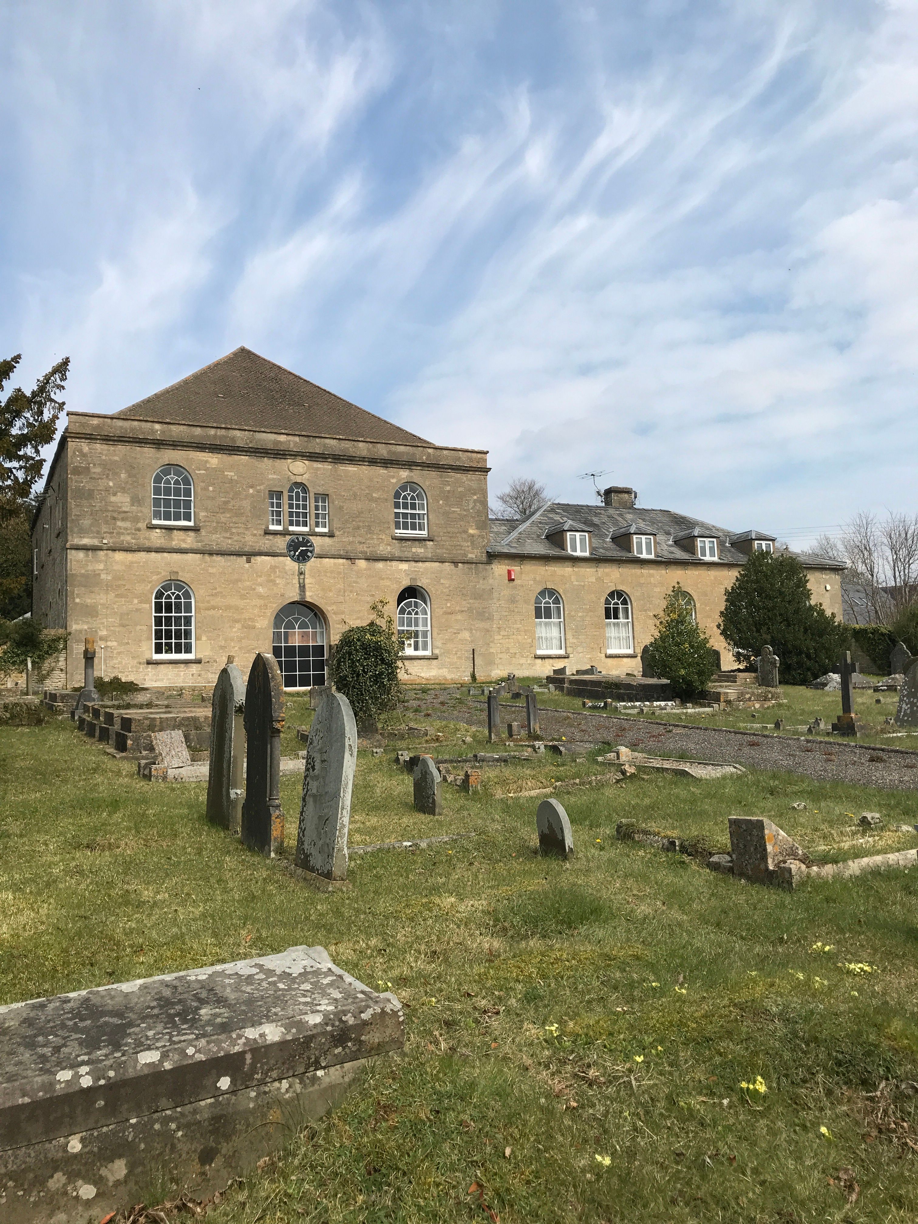
| Description | : | Former Congregational chapel and school room, now disused, but has Listed Building status.Listing NGR: SO8984102976. Grade: II.Date first listed: 16-May-1986 Datestone: 'FRANCE MEETING / REBUILT 1819'; school room added 1854. Squared and dressed limestone front, coursed rubble sides and rear; concrete tile to chapel, Welsh slate to school room. Various late C18 and early Cl9 monuments, many transferred from an earlier chapel. |
frequently asked questions (FAQ):
-
Where is France Lynch Congregational Chapelyard?
France Lynch Congregational Chapelyard is located at Chalford, Stroud District ,Gloucestershire ,England.
-
France Lynch Congregational Chapelyard cemetery's updated grave count on graveviews.com?
15 memorials
-
Where are the coordinates of the France Lynch Congregational Chapelyard?
Latitude: 51.7251000
Longitude: -2.1485300
Nearby Cemetories:
1. St. John the Baptist Churchyard
France Lynch, Stroud District, England
Coordinate: 51.7265600, -2.1445600
2. Chalford Baptist Tabernacle Churchyard
Chalford, Stroud District, England
Coordinate: 51.7226610, -2.1443260
3. Christ Church Churchyard
Chalford, Stroud District, England
Coordinate: 51.7214500, -2.1577900
4. St Bartholemew Church
Oakridge, Stroud District, England
Coordinate: 51.7291209, -2.1276180
5. St. Mary of the Angels Churchyard
Chalford, Stroud District, England
Coordinate: 51.7219000, -2.1708000
6. Eastcombe Baptist Churchyard
Eastcombe, Stroud District, England
Coordinate: 51.7378009, -2.1606789
7. St. Michael's and All Angels Churchyard
Bisley, Stroud District, England
Coordinate: 51.7301150, -2.1715900
8. Bisley Burial Ground
Bisley, Stroud District, England
Coordinate: 51.7493640, -2.1389080
9. Brimscombe Cemetery
Brimscombe, Stroud District, England
Coordinate: 51.7165900, -2.1900600
10. All Saints Churchyard
Bisley, Stroud District, England
Coordinate: 51.7520580, -2.1409380
11. Holy Trinity Churchyard
Minchinhampton, Stroud District, England
Coordinate: 51.7063600, -2.1860700
12. Minchinhampton Baptist Churchyard
Minchinhampton, Stroud District, England
Coordinate: 51.7039614, -2.1853756
13. Stroud Hill Cemetery
Stroud, Stroud District, England
Coordinate: 51.7415670, -2.2002660
14. Stroud Old Cemetery
Stroud, Stroud District, England
Coordinate: 51.7337658, -2.2094599
15. St. Kenelm's Churchyard
Sapperton, Cotswold District, England
Coordinate: 51.7294000, -2.0775000
16. Holy Trinity Churchyard
Amberley, Stroud District, England
Coordinate: 51.7087660, -2.2177170
17. Holy Trinity Churchyard
Slad, Stroud District, England
Coordinate: 51.7647770, -2.1866550
18. Amberley Methodist Church - Littleworth Wesleyan C
Amberley, Stroud District, England
Coordinate: 51.7123580, -2.2202540
19. St. Laurence Churchyard
Stroud, Stroud District, England
Coordinate: 51.7459470, -2.2153950
20. Amberley Church Cemetery
Amberley, Stroud District, England
Coordinate: 51.7091900, -2.2196100
21. Holy Cross Churchyard
Avening, Cotswold District, England
Coordinate: 51.6806190, -2.1755620
22. Rodborough Tabernacle
Rodborough, Stroud District, England
Coordinate: 51.7345300, -2.2245700
23. St. Mary Magdalene Churchyard
Rodborough, Stroud District, England
Coordinate: 51.7384180, -2.2284060
24. St Mary's Churchyard
Woodchester, Stroud District, England
Coordinate: 51.7224900, -2.2333920