
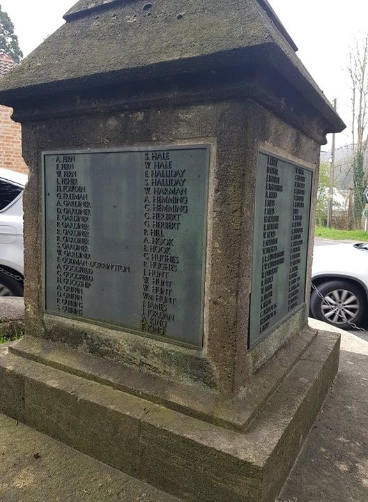
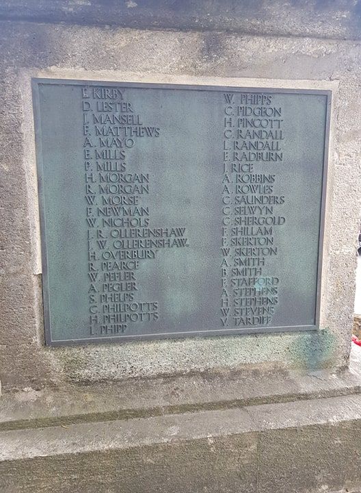
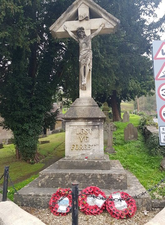
| Memorials | : | 82 |
| Location | : | Chalford, Stroud District, England |
| Coordinate | : | 51.7214500, -2.1577900 |
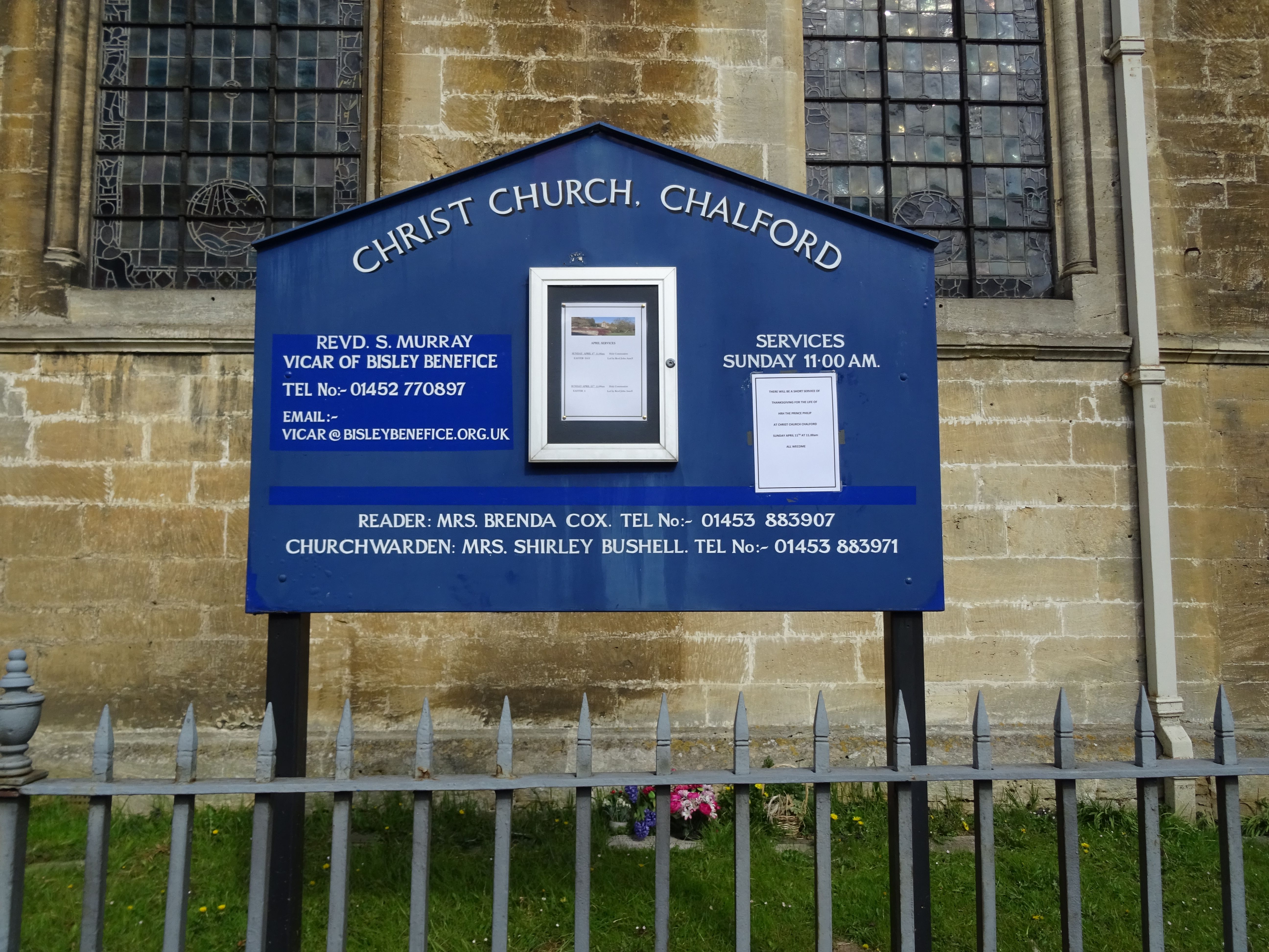
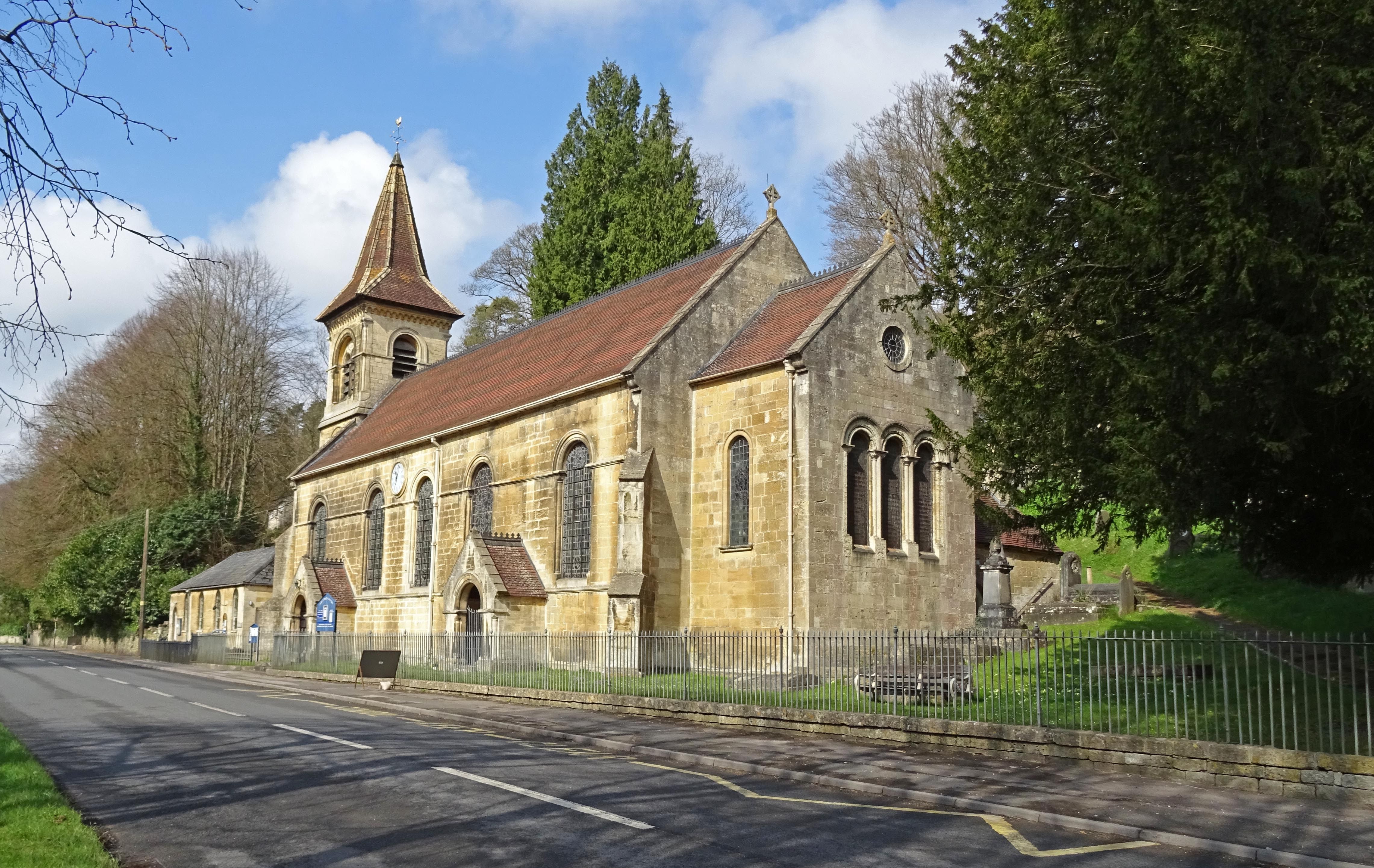
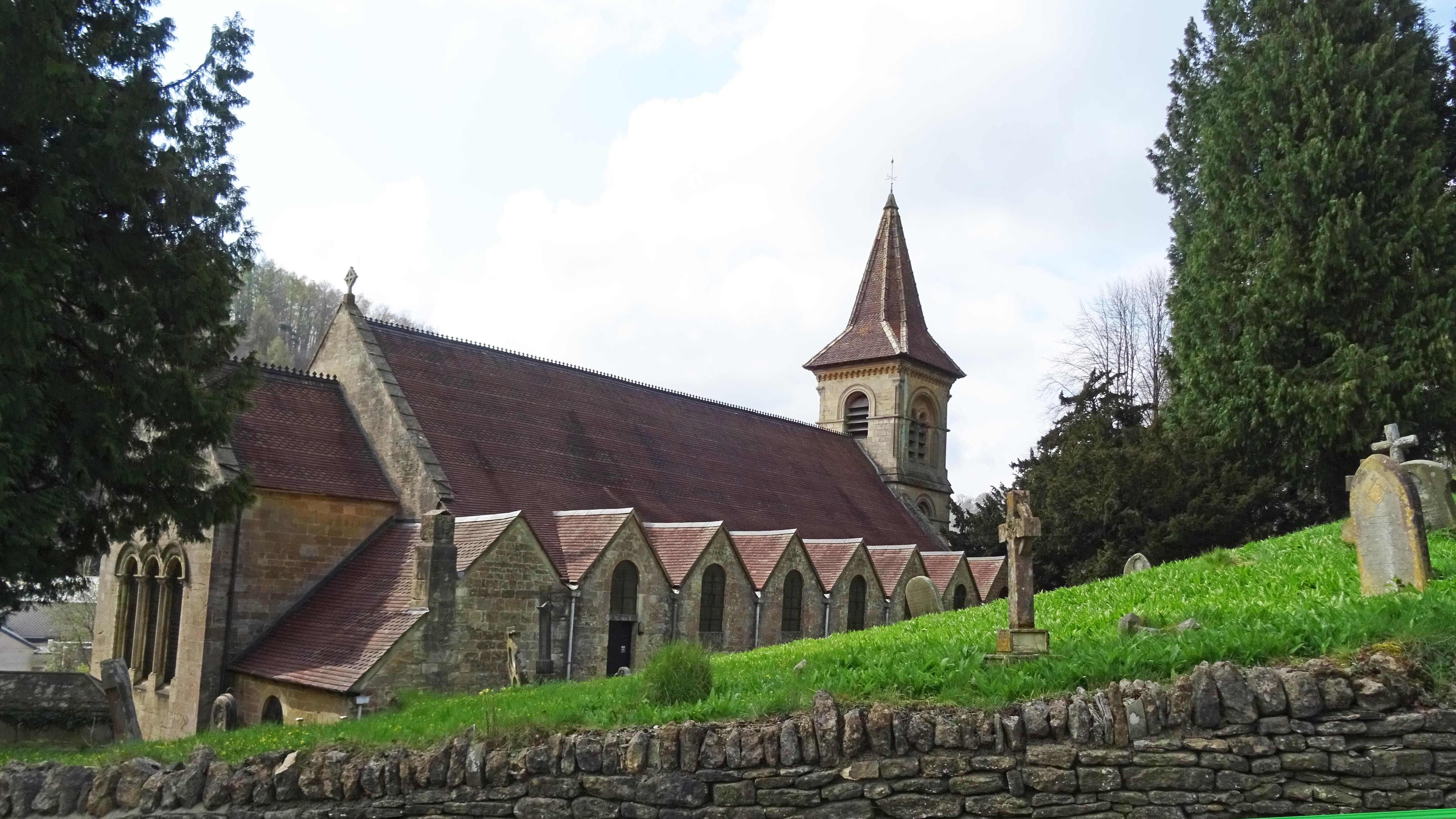
| Description | : | Chalford is a village in the Frome Valley of the Cotswolds in Gloucestershire, England. It is about 4 miles east and upstream of Stroud. It gives its name to Chalford parish, which covers the villages of Chalford, Chalford Hill, France Lynch, Bussage and Brownshill, spread over 2 miles of the Cotswold countryside. At this point the valley is also called the Golden Valley. The name Chalford may be derived from Calf (Way) Ford, or possibly from the Old English cealj or Chalk and Ford (river crossing point). The 18th century church stands on the main Stroud to Cirencester road... Read More |
frequently asked questions (FAQ):
-
Where is Christ Church Churchyard?
Christ Church Churchyard is located at Chalford, Stroud District ,Gloucestershire , GL6 8PPEngland.
-
Christ Church Churchyard cemetery's updated grave count on graveviews.com?
82 memorials
-
Where are the coordinates of the Christ Church Churchyard?
Latitude: 51.7214500
Longitude: -2.1577900

Nearby Cemetories:
1. France Lynch Congregational Chapelyard
Chalford, Stroud District, England
Coordinate: 51.7251000, -2.1485300
2. St. Mary of the Angels Churchyard
Chalford, Stroud District, England
Coordinate: 51.7219000, -2.1708000
3. Chalford Baptist Tabernacle Churchyard
Chalford, Stroud District, England
Coordinate: 51.7226610, -2.1443260
4. St. John the Baptist Churchyard
France Lynch, Stroud District, England
Coordinate: 51.7265600, -2.1445600
5. St. Michael's and All Angels Churchyard
Bisley, Stroud District, England
Coordinate: 51.7301150, -2.1715900
6. Eastcombe Baptist Churchyard
Eastcombe, Stroud District, England
Coordinate: 51.7378009, -2.1606789
7. St Bartholemew Church
Oakridge, Stroud District, England
Coordinate: 51.7291209, -2.1276180
8. Brimscombe Cemetery
Brimscombe, Stroud District, England
Coordinate: 51.7165900, -2.1900600
9. Holy Trinity Churchyard
Minchinhampton, Stroud District, England
Coordinate: 51.7063600, -2.1860700
10. Minchinhampton Baptist Churchyard
Minchinhampton, Stroud District, England
Coordinate: 51.7039614, -2.1853756
11. Bisley Burial Ground
Bisley, Stroud District, England
Coordinate: 51.7493640, -2.1389080
12. All Saints Churchyard
Bisley, Stroud District, England
Coordinate: 51.7520580, -2.1409380
13. Stroud Hill Cemetery
Stroud, Stroud District, England
Coordinate: 51.7415670, -2.2002660
14. Stroud Old Cemetery
Stroud, Stroud District, England
Coordinate: 51.7337658, -2.2094599
15. Holy Trinity Churchyard
Amberley, Stroud District, England
Coordinate: 51.7087660, -2.2177170
16. Amberley Methodist Church - Littleworth Wesleyan C
Amberley, Stroud District, England
Coordinate: 51.7123580, -2.2202540
17. Amberley Church Cemetery
Amberley, Stroud District, England
Coordinate: 51.7091900, -2.2196100
18. Holy Cross Churchyard
Avening, Cotswold District, England
Coordinate: 51.6806190, -2.1755620
19. St. Laurence Churchyard
Stroud, Stroud District, England
Coordinate: 51.7459470, -2.2153950
20. Rodborough Tabernacle
Rodborough, Stroud District, England
Coordinate: 51.7345300, -2.2245700
21. St Mary's Churchyard
Woodchester, Stroud District, England
Coordinate: 51.7224900, -2.2333920
22. Holy Trinity Churchyard
Slad, Stroud District, England
Coordinate: 51.7647770, -2.1866550
23. St. Mary Magdalene Churchyard
Rodborough, Stroud District, England
Coordinate: 51.7384180, -2.2284060
24. Priory Church of the Annunciation Churchyard
Woodchester, Stroud District, England
Coordinate: 51.7080680, -2.2305250