
| Memorials | : | 0 |
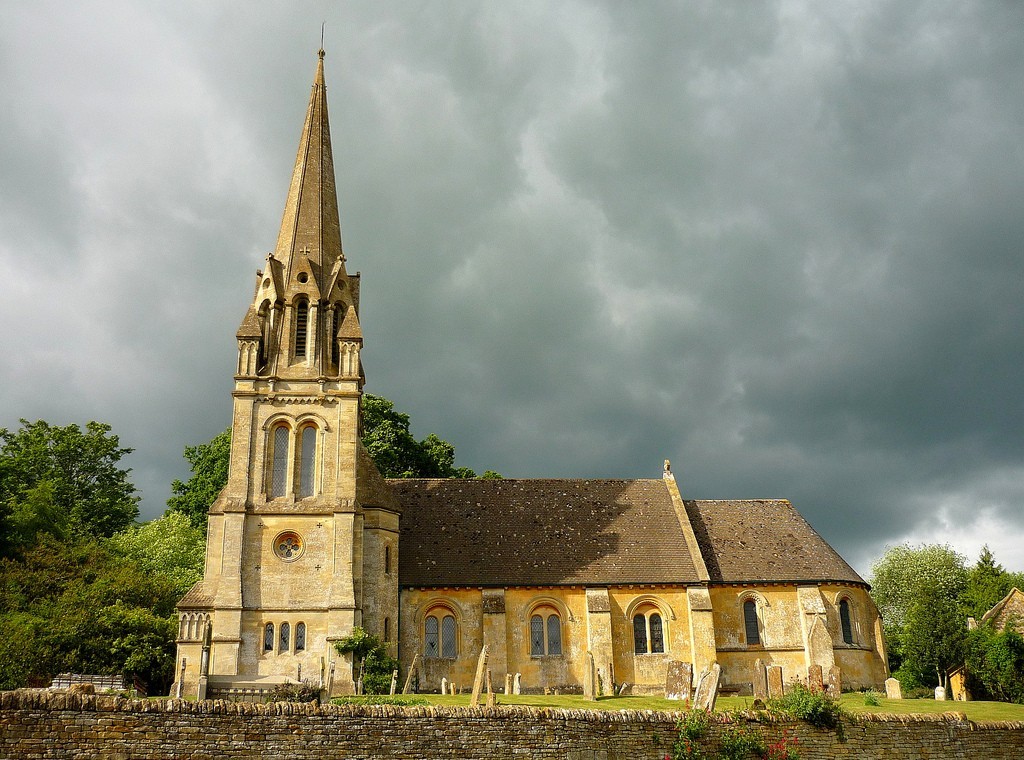
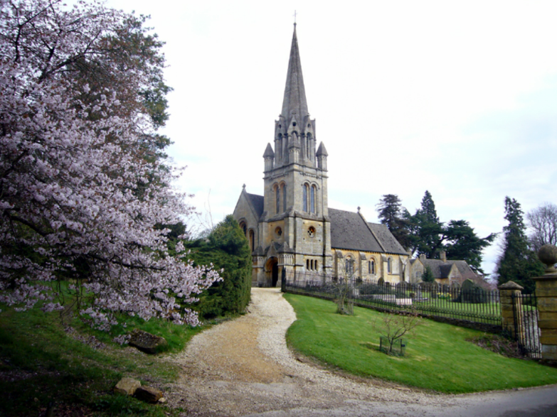
| Location | : | Batsford, Cotswold District, England |
| Coordinate | : | 52.0030800, -1.7291600 |
| Description | : | The present church was built in 1861-1862 and occupies the site of an earlier church built in 1774, which in turn was preceded by a medieval church. |
frequently asked questions (FAQ):
-
Where is St Marys Churchyard?
St Marys Churchyard is located at Batsford, Cotswold District ,Gloucestershire , GL56 9QBEngland.
-
St Marys Churchyard cemetery's updated grave count on graveviews.com?
0 memorials
-
Where are the coordinates of the St Marys Churchyard?
Latitude: 52.0030800
Longitude: -1.7291600
Nearby Cemetories:
1. St. Peter and St. Paul's Churchyard
Blockley, Cotswold District, England
Coordinate: 52.0124600, -1.7617000
2. St Leonard's
Moreton-in-Marsh, Cotswold District, England
Coordinate: 52.0087019, -1.6822226
3. St. James Churchyard
Longborough, Cotswold District, England
Coordinate: 51.9658220, -1.7407990
4. Stretton Cemetery
Stretton-on-Fosse, Stratford-on-Avon District, England
Coordinate: 52.0413935, -1.6733470
5. St. Peter's Churchyard
Stretton-on-Fosse, Stratford-on-Avon District, England
Coordinate: 52.0430778, -1.6754209
6. St Paul Churchyard
Broadwell, Cotswold District, England
Coordinate: 51.9476200, -1.7095100
7. St Michael and All Angels Church
Great Wolford, Stratford-on-Avon District, England
Coordinate: 52.0091000, -1.6367450
8. St Lawrence Churchyard
Bourton-on-the-Hill, Cotswold District, England
Coordinate: 52.0531830, -1.7758910
9. St James Churchyard
Chipping Campden, Cotswold District, England
Coordinate: 52.0532670, -1.7758760
10. St Catherine's Cemetery
Chipping Campden, Cotswold District, England
Coordinate: 52.0495800, -1.7850600
11. St Lawrence's Church
Barton-on-the-Heath, Stratford-on-Avon District, England
Coordinate: 51.9918300, -1.6272375
12. St Mary's Churchyard
Upper Swell, Cotswold District, England
Coordinate: 51.9398030, -1.7441910
13. St. Mary the Virgin Churchyard
Chastleton, West Oxfordshire District, England
Coordinate: 51.9595360, -1.6395330
14. St. Edward Churchyard
Stow-on-the-Wold, Cotswold District, England
Coordinate: 51.9299810, -1.7238290
15. Stow-on-the-Wold Cemetery
Stow-on-the-Wold, Cotswold District, England
Coordinate: 51.9264100, -1.7254670
16. St Barnabas & St Nicholas Churchyard
Burmington, Stratford-on-Avon District, England
Coordinate: 52.0393000, -1.6170100
17. St Barnabas Churchyard
Snowshill, Tewkesbury Borough, England
Coordinate: 52.0017600, -1.8608100
18. St Andrew's Church
Aston Subedge, Cotswold District, England
Coordinate: 52.0729286, -1.7994658
19. St. Eadburgha New Churchyard
Broadway, Wychavon District, England
Coordinate: 52.0223000, -1.8591500
20. Shipston Cemetery
Shipston-on-Stour, Stratford-on-Avon District, England
Coordinate: 52.0534039, -1.6225776
21. St Saviour's Roman Catholic Churchyard
Broadway, Wychavon District, England
Coordinate: 52.0385690, -1.8569250
22. St Nicholas Churchyard
Oddington, Cotswold District, England
Coordinate: 51.9278340, -1.6597080
23. St Peter Churchyard
Daylesford, Cotswold District, England
Coordinate: 51.9310080, -1.6479680
24. St Eadburgha Churchyard
Broadway, Wychavon District, England
Coordinate: 52.0343100, -1.8632560