
| Memorials | : | 0 |
| Location | : | Hatfield, Welwyn Hatfield District, England |
| Coordinate | : | 51.7614490, -0.2120150 |
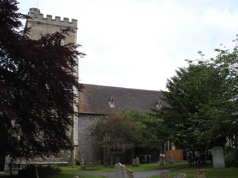
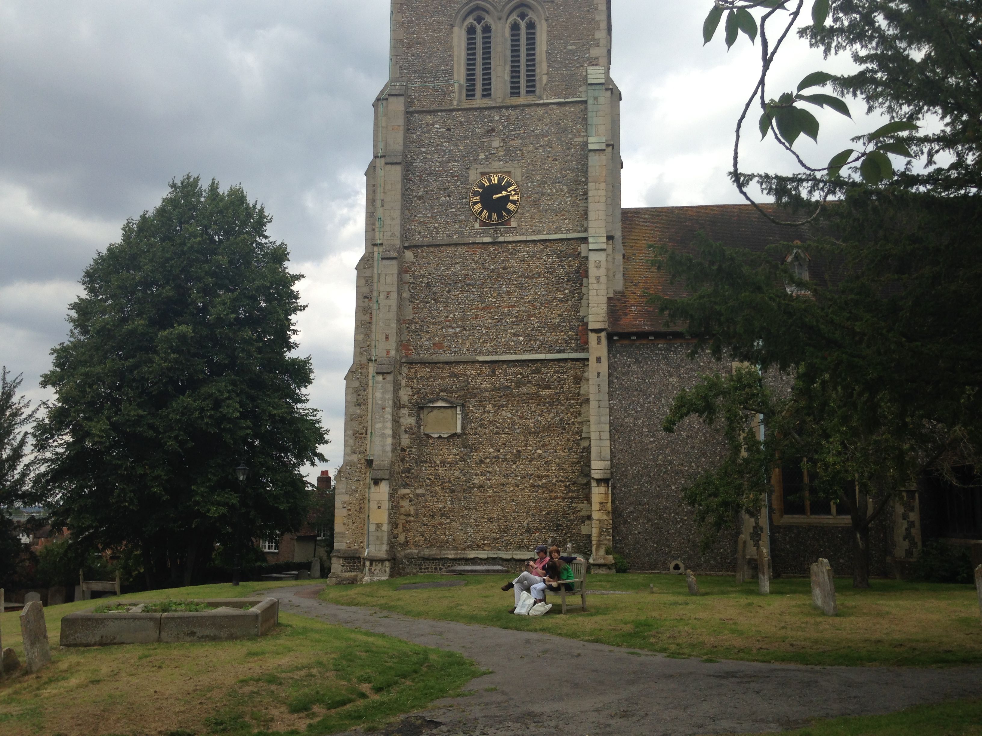
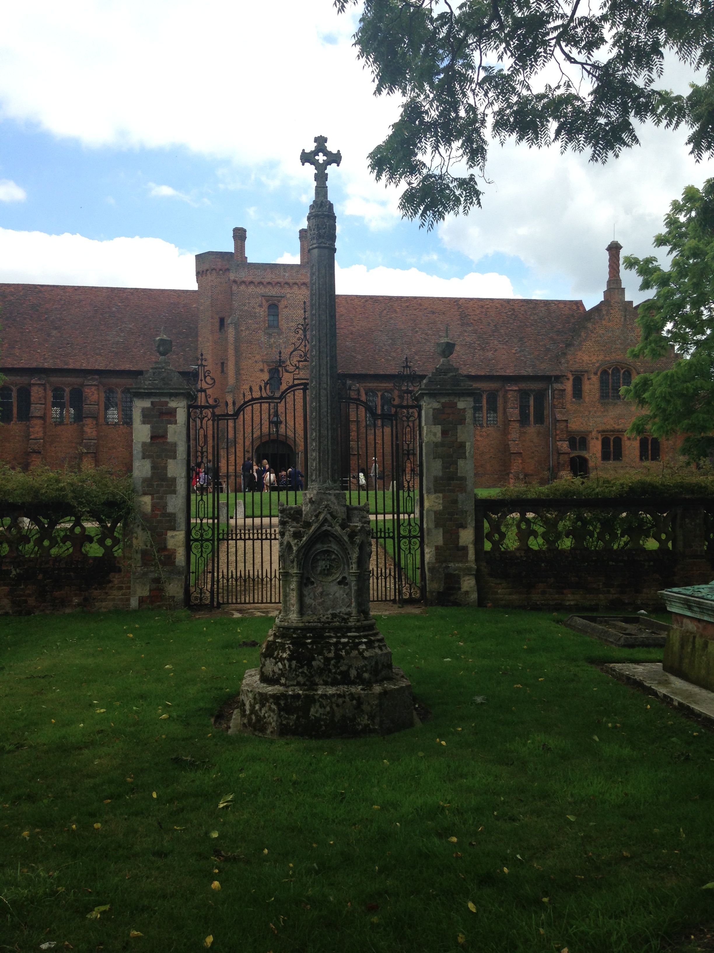
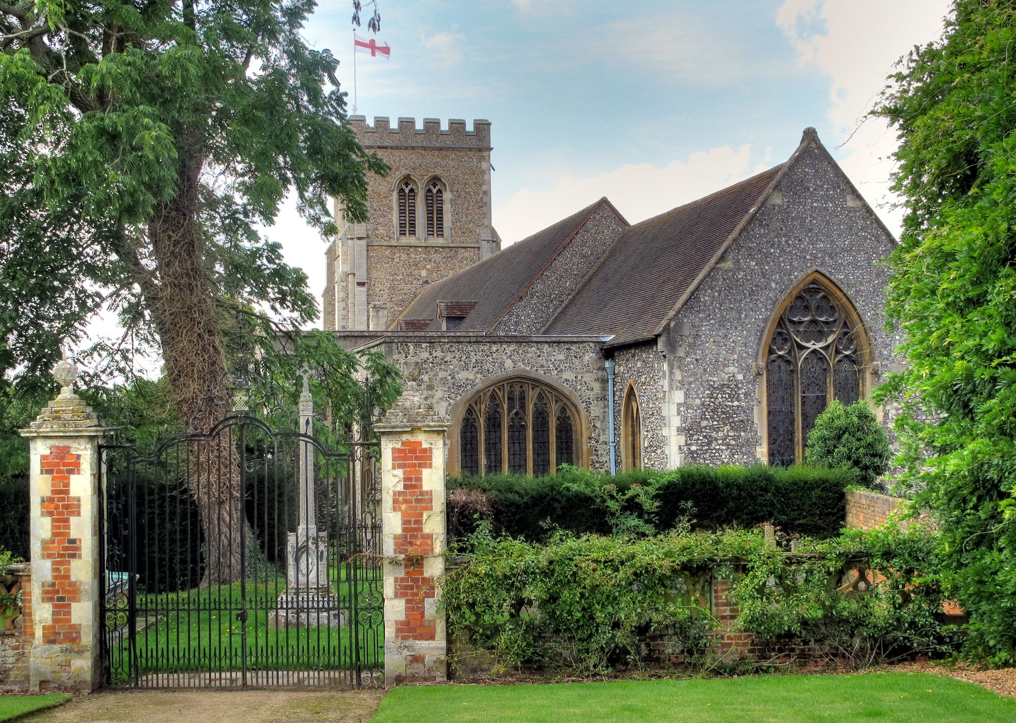
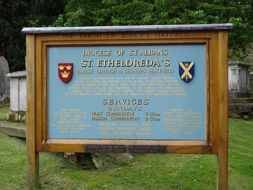
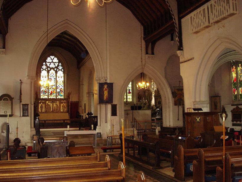
| Description | : | St. Ethelreda’s, dedicated to an Anglo-Saxon princess, stands at the top of a hill beside the walls of Hatfield House in the old village of Hatfield. Dating from the 13th century, the church contains a 15th century tower, major renovation occurred in the 19th century. Three prime ministers are buried here. The church and churchyard contain many interesting memorials. |
frequently asked questions (FAQ):
-
Where is St. Etheldreda Churchyard?
St. Etheldreda Churchyard is located at Within Hatfield Park Hatfield, Welwyn Hatfield District ,Hertfordshire , AL9 5ANEngland.
-
St. Etheldreda Churchyard cemetery's updated grave count on graveviews.com?
0 memorials
-
Where are the coordinates of the St. Etheldreda Churchyard?
Latitude: 51.7614490
Longitude: -0.2120150
Nearby Cemetories:
1. Hatfield Estate
Hatfield, Welwyn Hatfield District, England
Coordinate: 51.7606100, -0.2092010
2. St. Luke's Churchyard
Hatfield, Welwyn Hatfield District, England
Coordinate: 51.7643980, -0.2237710
3. Welwyn Hatfield Lawn Cemetery
Welwyn Hatfield, Welwyn Hatfield District, England
Coordinate: 51.7422400, -0.2315670
4. St. Mary's Churchyard
Essendon, Welwyn Hatfield District, England
Coordinate: 51.7630460, -0.1561580
5. St John the Evangelist Churchyard
Lemsford, Welwyn Hatfield District, England
Coordinate: 51.7934510, -0.2355890
6. St. Andrew's Churchyard
Little Berkhamsted, East Hertfordshire District, England
Coordinate: 51.7547390, -0.1295270
7. St John the Evangelist Churchyard
Digswell, Welwyn Hatfield District, England
Coordinate: 51.8186190, -0.2051940
8. St Leonard Churchyard & Extension
Sandridge, St Albans District, England
Coordinate: 51.7813690, -0.3036580
9. St Peter Churchyard
Ayot St Peter, Welwyn Hatfield District, England
Coordinate: 51.8201700, -0.2331800
10. London Road Cemetery
St Albans, St Albans District, England
Coordinate: 51.7333610, -0.3066110
11. St. Giles Churchyard
South Mimms, Hertsmere Borough, England
Coordinate: 51.6961860, -0.2329300
12. Hatfield Road Cemetery
St Albans, St Albans District, England
Coordinate: 51.7523003, -0.3192620
13. Saint Mary
Bayford, East Hertfordshire District, England
Coordinate: 51.7629540, -0.1035070
14. St. Mary's Churchyard
Welwyn, Welwyn Hatfield District, England
Coordinate: 51.8311660, -0.2151400
15. St. Mary's Churchyard
Potters Bar, Hertsmere Borough, England
Coordinate: 51.6926910, -0.1849770
16. Welwyn Cemetery
Welwyn, Welwyn Hatfield District, England
Coordinate: 51.8331340, -0.2199520
17. St. Helen's Churchyard
Wheathampstead, St Albans District, England
Coordinate: 51.8124510, -0.2946400
18. Wheathampstead United Churchyard
Wheathampstead, St Albans District, England
Coordinate: 51.8108170, -0.2972210
19. St Mary Churchyard
Hertingfordbury, East Hertfordshire District, England
Coordinate: 51.7919480, -0.1043700
20. St Margaret Churchyard
Ridge, Hertsmere Borough, England
Coordinate: 51.6897880, -0.2455900
21. Saint Bololph's Churchyard
Shenley, Hertsmere Borough, England
Coordinate: 51.7030296, -0.2890460
22. St Peter's Churchyard
St Albans, St Albans District, England
Coordinate: 51.7555400, -0.3350270
23. Hill End Hospital Cemetery
St Albans, St Albans District, England
Coordinate: 51.6982051, -0.2901128
24. Dagnall Lane Baptist Chapel
St Albans, St Albans District, England
Coordinate: 51.7526990, -0.3405156