
| Memorials | : | 55 |
| Location | : | Lemsford, Welwyn Hatfield District, England |
| Coordinate | : | 51.7934510, -0.2355890 |
frequently asked questions (FAQ):
-
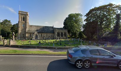
Where is St John the Evangelist Churchyard?
St John the Evangelist Churchyard is located at Brocket Road Lemsford, Welwyn Hatfield District ,Hertfordshire , AL8 7TREngland.
-
St John the Evangelist Churchyard cemetery's updated grave count on graveviews.com?
55 memorials
-
Where are the coordinates of the St John the Evangelist Churchyard?
Latitude: 51.7934510
Longitude: -0.2355890
Nearby Cemetories:
1. St Peter Churchyard
Ayot St Peter, Welwyn Hatfield District, England
Coordinate: 51.8201700, -0.2331800
2. St. Luke's Churchyard
Hatfield, Welwyn Hatfield District, England
Coordinate: 51.7643980, -0.2237710
3. St John the Evangelist Churchyard
Digswell, Welwyn Hatfield District, England
Coordinate: 51.8186190, -0.2051940
4. St. Etheldreda Churchyard
Hatfield, Welwyn Hatfield District, England
Coordinate: 51.7614490, -0.2120150
5. Hatfield Estate
Hatfield, Welwyn Hatfield District, England
Coordinate: 51.7606100, -0.2092010
6. St. Mary's Churchyard
Welwyn, Welwyn Hatfield District, England
Coordinate: 51.8311660, -0.2151400
7. Welwyn Cemetery
Welwyn, Welwyn Hatfield District, England
Coordinate: 51.8331340, -0.2199520
8. St. Helen's Churchyard
Wheathampstead, St Albans District, England
Coordinate: 51.8124510, -0.2946400
9. Wheathampstead United Churchyard
Wheathampstead, St Albans District, England
Coordinate: 51.8108170, -0.2972210
10. St Leonard Churchyard & Extension
Sandridge, St Albans District, England
Coordinate: 51.7813690, -0.3036580
11. Ayot St Lawrence Old Churchyard
Ayot St Lawrence, Welwyn Hatfield District, England
Coordinate: 51.8377038, -0.2678795
12. St Lawrence Churchyard
Ayot St Lawrence, Welwyn Hatfield District, England
Coordinate: 51.8379490, -0.2717340
13. Welwyn Hatfield Lawn Cemetery
Welwyn Hatfield, Welwyn Hatfield District, England
Coordinate: 51.7422400, -0.2315670
14. St. Mary's Churchyard
Essendon, Welwyn Hatfield District, England
Coordinate: 51.7630460, -0.1561580
15. Hatfield Road Cemetery
St Albans, St Albans District, England
Coordinate: 51.7523003, -0.3192620
16. Ss Peter and Paul Churchyard
Kimpton, North Hertfordshire District, England
Coordinate: 51.8527990, -0.2918240
17. St Mary Churchyard
Childwickbury, St Albans District, England
Coordinate: 51.7836980, -0.3473020
18. Childwickbury Manor
Childwickbury, St Albans District, England
Coordinate: 51.7809460, -0.3499100
19. St Peter's Churchyard
St Albans, St Albans District, England
Coordinate: 51.7555400, -0.3350270
20. Knebworth Cemetery
Knebworth, North Hertfordshire District, England
Coordinate: 51.8595280, -0.1867730
21. St Andrew Church
Bramfield, East Hertfordshire District, England
Coordinate: 51.8241000, -0.1266000
22. London Road Cemetery
St Albans, St Albans District, England
Coordinate: 51.7333610, -0.3066110
23. St. Andrew's Churchyard
Little Berkhamsted, East Hertfordshire District, England
Coordinate: 51.7547390, -0.1295270
24. Dagnall Lane Baptist Chapel
St Albans, St Albans District, England
Coordinate: 51.7526990, -0.3405156