
| Memorials | : | 2 |
| Location | : | Guilsborough, Daventry District, England |
| Coordinate | : | 52.3480310, -1.0089780 |
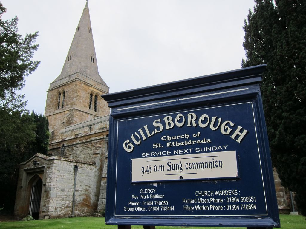
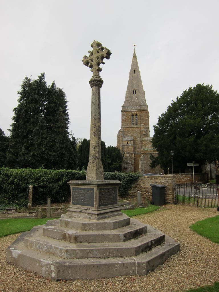
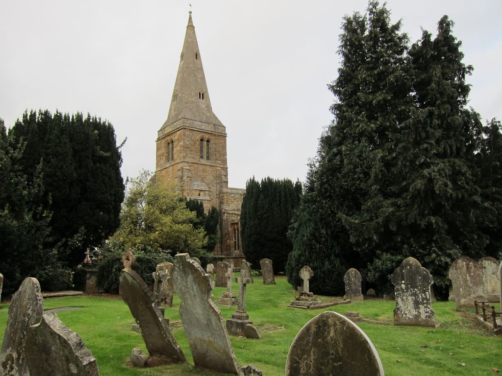
| Description | : | Guilsborough is a village between the towns of Rugby, Northampton, Daventry and Market Harborough. The Domesday Book records a church in Guilsborough, though it is not possible to give the date of the first church. However, above the south-facing belfry door there is a single, small stone aperture carved from a single block, which is likely to be Saxon. The church was originally dedicated to St Wilfred, but became St Etheldreda during the 14th century. The tower, which is early English, is the oldest part of the church and was built in the first half of the 13th century. It... Read More |
frequently asked questions (FAQ):
-
Where is St Etheldreda Churchyard?
St Etheldreda Churchyard is located at Coton Road Guilsborough, Daventry District ,Northamptonshire , NN6 8QAEngland.
-
St Etheldreda Churchyard cemetery's updated grave count on graveviews.com?
2 memorials
-
Where are the coordinates of the St Etheldreda Churchyard?
Latitude: 52.3480310
Longitude: -1.0089780
Nearby Cemetories:
1. St James Churchyard
Hollowell, Daventry District, England
Coordinate: 52.3404638, -0.9912752
2. St Denys' Church
Northampton Borough, England
Coordinate: 52.3271318, -1.0182438
3. All Saints Churchyard
Cottesbrooke, Daventry District, England
Coordinate: 52.3552260, -0.9588300
4. St. Denys' Churchyard
Cold Ashby, Daventry District, England
Coordinate: 52.3806000, -1.0372700
5. East Haddon Churchyard
East Haddon, Daventry District, England
Coordinate: 52.3076000, -1.0224800
6. All Saints Churchyard
West Haddon, Daventry District, England
Coordinate: 52.3409590, -1.0764700
7. St Andrew Churchyard
Spratton, Daventry District, England
Coordinate: 52.3243520, -0.9483460
8. St. Michael and All Angels Churchyard
Winwick, Daventry District, England
Coordinate: 52.3589063, -1.0820887
9. All Saints Churchyard
Holdenby, Daventry District, England
Coordinate: 52.3021000, -0.9868100
10. All Saints Churchyard
Naseby, Daventry District, England
Coordinate: 52.3968790, -0.9889740
11. Saint Michael's Churchyard
Haselbech, Daventry District, England
Coordinate: 52.3891890, -0.9556720
12. St. Lawrence Churchyard
Long Buckby, Daventry District, England
Coordinate: 52.3042680, -1.0815040
13. Long Buckby & Brington Baptist Church
Long Buckby, Daventry District, England
Coordinate: 52.3022756, -1.0804149
14. United Reformed Churchyard
Long Buckby, Daventry District, England
Coordinate: 52.3016430, -1.0793930
15. Spencer Estate Grounds
Althorp, Daventry District, England
Coordinate: 52.2839190, -0.9889520
16. St Mary the Virgin with St John Churchyard
Great Brington, Daventry District, England
Coordinate: 52.2810470, -1.0235660
17. Yelvertoft Cemetery
Yelvertoft, Daventry District, England
Coordinate: 52.3707000, -1.1153400
18. Watford Village Cemetery
Watford, Daventry District, England
Coordinate: 52.3168542, -1.1102416
19. All Saints Churchyard
Yelvertoft, Daventry District, England
Coordinate: 52.3717866, -1.1164310
20. St. Peter and St. Paul Churchyard
Watford, Daventry District, England
Coordinate: 52.3160210, -1.1163920
21. St Botolph Churchyard
Church Brampton, Daventry District, England
Coordinate: 52.2849866, -0.9486724
22. Yelvertoft Independent Chapel Churchyard
Yelvertoft, Daventry District, England
Coordinate: 52.3736980, -1.1225680
23. All Saints Churchyard
Lamport, Daventry District, England
Coordinate: 52.3637900, -0.8883600
24. St Mary the Virgin Churchyard
Welford, Daventry District, England
Coordinate: 52.4172618, -1.0587465