
| Memorials | : | 0 |
| Location | : | Chester, Cheshire West and Chester Unitary Authority, England |
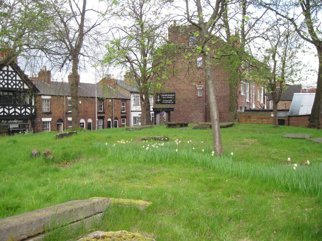
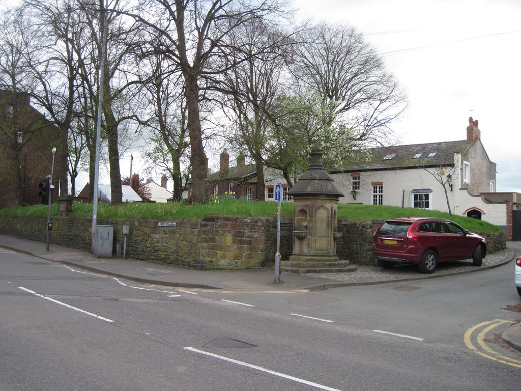
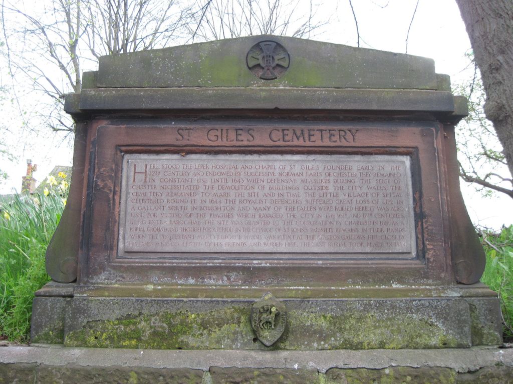
| Description | : | St Giles Cemetery ‘Here Stood The Leper Hospital And Chapel Of St Gile’s Founded Early In The 12th Century And Endowed By Successive Norman Earls Of Chester They Remained In Constant Use Until 1643 When Defensive Measures During The Siege Of Chester Necessitated The Demolition Of Buildings Outside The City Walls. The Cemetery Remained To Mark The Site And In Time The Little Village Of Spital Clustered Around It. In 1644 The Royalist Defenders Suffered Great Loss Of Life In A Gallant Sortie In Boughton And Many Of The Fallen Were Buried Here. It Was Also Used For Victims Of The... Read More |
frequently asked questions (FAQ):
-
Where is St Giles Cemetery?
St Giles Cemetery is located at Chester, Cheshire West and Chester Unitary Authority, England.
-
St Giles Cemetery cemetery's updated grave count on graveviews.com?
0 memorials
Nearby Cemetories:
1. St. John the Evangelist Churchyard
Ashton, Cheshire West and Chester Unitary Authority, England
Coordinate: 53.2613110, -2.7547240
2. St. Wenefredes Churchyard
Bickley, Cheshire West and Chester Unitary Authority, England
Coordinate: 53.2094380, -2.7957310
3. Helsby Cemetery
Helsby, Cheshire West and Chester Unitary Authority, England
Coordinate: 53.1035280, -2.7251110
4. St. Paul's Churchyard
Helsby, Cheshire West and Chester Unitary Authority, England
Coordinate: 53.2123300, -2.6602000
5. Birches Remembrance Park and Crematorium
Lach Dennis, Cheshire West and Chester Unitary Authority, England
Coordinate: 53.2861000, -2.8950800
6. St. Oswald's Churchyard
Lower Peover, Cheshire West and Chester Unitary Authority, England
Coordinate: 53.2881800, -2.9215590
7. Newton-near-Frodsham Quaker Burial Ground
Newton, Cheshire West and Chester Unitary Authority, England
8. All Saints Churchyard
Saughall, Cheshire West and Chester Unitary Authority, England
9. Ebenezer Primitive Methodist Churchyard
Saughall, Cheshire West and Chester Unitary Authority, England
Coordinate: 53.2900000, -2.8600000
10. Saughall Churches of Christ Grove Chapel
Saughall, Cheshire West and Chester Unitary Authority, England
Coordinate: 53.2971800, -2.9569700
11. St. Mary's Churchyard
Thornton-le-Moors, Cheshire West and Chester Unitary Authority, England
Coordinate: 53.2902200, -2.9511400
12. Saint Mary's Churchyard
Whitegate, Cheshire West and Chester Unitary Authority, England
Coordinate: 53.1838720, -2.6021830
13. St. John the Evangelist Churchyard
Alvanley, Cheshire West and Chester Unitary Authority, England
Coordinate: 53.2613110, -2.7547240
14. St. Bartholomew's Churchyard
Barrow, Cheshire West and Chester Unitary Authority, England
Coordinate: 53.2094380, -2.7957310
15. St. John the Divine Churchyard
Burwardsley, Cheshire West and Chester Unitary Authority, England
Coordinate: 53.1035280, -2.7251110
16. St Peter's Churchyard
Delamere, Cheshire West and Chester Unitary Authority, England
Coordinate: 53.2123300, -2.6602000
17. Christ Church Churchyard
Ellesmere Port, Cheshire West and Chester Unitary Authority, England
Coordinate: 53.2861000, -2.8950800
18. Overpool Cemetery
Ellesmere Port, Cheshire West and Chester Unitary Authority, England
Coordinate: 53.2881800, -2.9215590
19. Parischurch
Ellesmere Port, Cheshire West and Chester Unitary Authority, England
20. Rossmore Road
Ellesmere Port, Cheshire West and Chester Unitary Authority, England
21. Stanlow Abbey Ruins
Ellesmere Port, Cheshire West and Chester Unitary Authority, England
Coordinate: 53.2900000, -2.8600000
22. St Mary of the Angels Hooton
Hooton, Cheshire West and Chester Unitary Authority, England
Coordinate: 53.2971800, -2.9569700
23. St. Paul's Churchyard
Hooton, Cheshire West and Chester Unitary Authority, England
Coordinate: 53.2902200, -2.9511400
24. St. Peter's Churchyard
Little Budworth, Cheshire West and Chester Unitary Authority, England
Coordinate: 53.1838720, -2.6021830