
| Memorials | : | 1 |
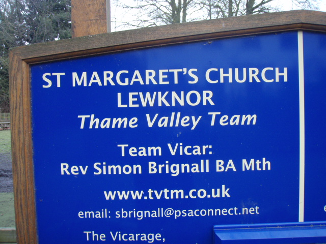
| Location | : | Lewknor, South Oxfordshire District, England |
| Coordinate | : | 51.6730340, -0.9663030 |
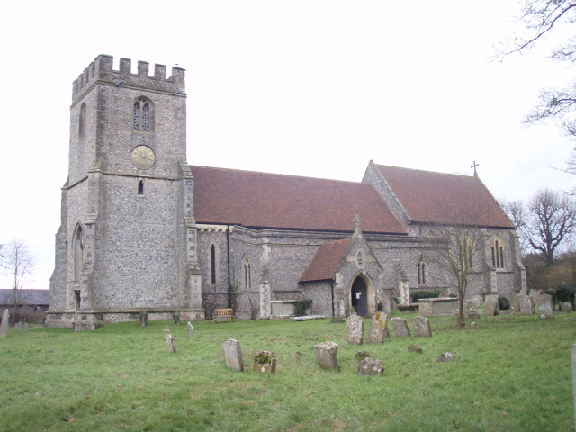
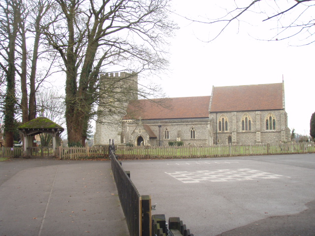
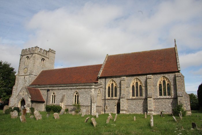
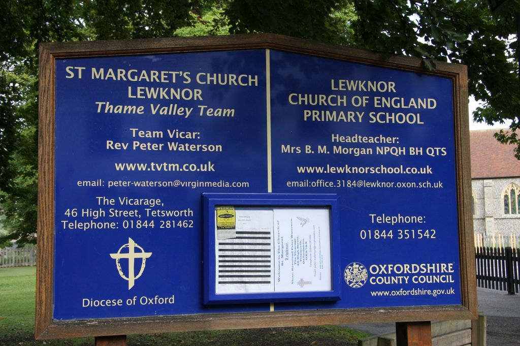
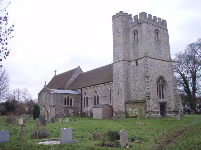
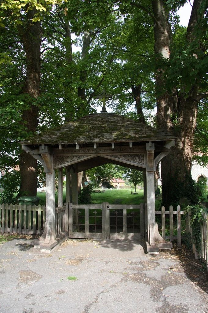
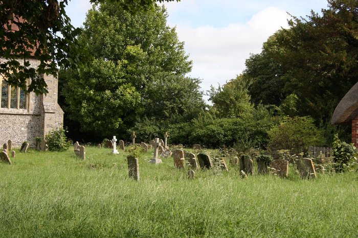
| Description | : | Lewknor is 5 miles (8.0 km) south of Thame in Oxfordshire.Documentary and architectural evidence indicates the Church of England parish church was built some time after 1146 and before 1200. It was dedicated to Saint Mary but at some date was rededicated to Saint Margaret. It was originally a cruciform building with a chancel, nave, north and south chapels and a west tower. The chancel arch, north chapel, two lancet windows in the nave, the font and some other features survive from this time. Early in the 14th century the building was enlarged in the Decorated Gothic style with a... Read More |
frequently asked questions (FAQ):
-
Where is St Margarets Churchyard?
St Margarets Churchyard is located at High Street Lewknor, South Oxfordshire District ,Oxfordshire , OX49 5THEngland.
-
St Margarets Churchyard cemetery's updated grave count on graveviews.com?
1 memorials
-
Where are the coordinates of the St Margarets Churchyard?
Latitude: 51.6730340
Longitude: -0.9663030
Nearby Cemetories:
1. St. Peter and St. Paul's Church Cemetery
Aston Rowant, South Oxfordshire District, England
Coordinate: 51.6851100, -0.9502900
2. All Saints Churchyard
Shirburn, South Oxfordshire District, England
Coordinate: 51.6577000, -0.9945000
3. St. Mary's Churchyard
Adwell, South Oxfordshire District, England
Coordinate: 51.6906560, -0.9938380
4. St. Andrew's Churchyard
Wheatfield, South Oxfordshire District, England
Coordinate: 51.6879720, -1.0050930
5. St Mary Churchyard
Pyrton, South Oxfordshire District, England
Coordinate: 51.6558520, -1.0076830
6. Nativity of the Blessed Virgin Mary Churchyard
Crowell, South Oxfordshire District, England
Coordinate: 51.6921610, -0.9268631
7. St. Mary Magdalene
Stoke Talmage, South Oxfordshire District, England
Coordinate: 51.6878240, -1.0183240
8. Getty Family Estate
Stokenchurch, Wycombe District, England
Coordinate: 51.6437360, -0.9334510
9. Watlington War Memorial
Watlington, South Oxfordshire District, England
Coordinate: 51.6456450, -1.0065781
10. St. Leonard's Churchyard
Watlington, South Oxfordshire District, England
Coordinate: 51.6474030, -1.0117420
11. St Peter and St Paul Churchyard
Stokenchurch, Wycombe District, England
Coordinate: 51.6615290, -0.9022940
12. St Mary's Churchyard
Sydenham, South Oxfordshire District, England
Coordinate: 51.7112360, -0.9398460
13. St Giles Churchyard
Tetsworth, South Oxfordshire District, England
Coordinate: 51.7085800, -1.0086700
14. Stokenchurch Church Cemetery
Stokenchurch, Wycombe District, England
Coordinate: 51.6572200, -0.8960300
15. St Andrew's Church
Chinnor, South Oxfordshire District, England
Coordinate: 51.7016400, -0.9062790
16. St Peter Churchyard
Easington, South Oxfordshire District, England
Coordinate: 51.6684300, -1.0443070
17. Holy Rood Churchyard
Cuxham, South Oxfordshire District, England
Coordinate: 51.6516250, -1.0376070
18. St Nicholas Churchyard
Britwell Salome, South Oxfordshire District, England
Coordinate: 51.6376983, -1.0262075
19. Thame Park Chapel
Thame, South Oxfordshire District, England
Coordinate: 51.7290130, -0.9650540
20. St Nicholas Churchyard
Ibstone, Wycombe District, England
Coordinate: 51.6247660, -0.9093120
21. Brightwell Baldwin St Bartholomews Churchyard
Brightwell Baldwin, South Oxfordshire District, England
Coordinate: 51.6500670, -1.0569610
22. St Mary Churchyard
Radnage, Wycombe District, England
Coordinate: 51.6747990, -0.8647210
23. Holy Trinity Churchyard
Bledlow, Wycombe District, England
Coordinate: 51.7127780, -0.8745720
24. Holy Trinity New Churchyard
Bledlow, Wycombe District, England
Coordinate: 51.7136400, -0.8737800