
| Memorials | : | 0 |
| Location | : | Darley Dale, Derbyshire Dales District, England |
| Coordinate | : | 53.1634910, -1.6020670 |
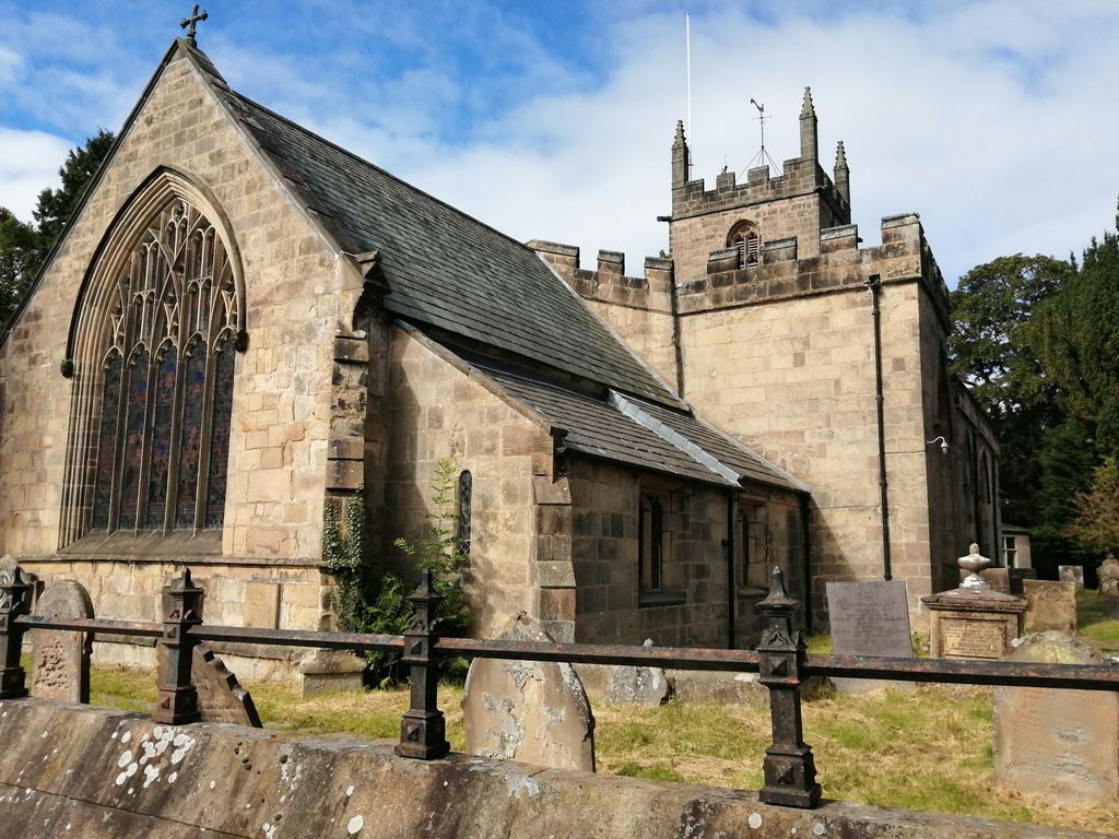
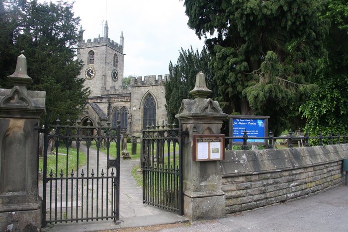
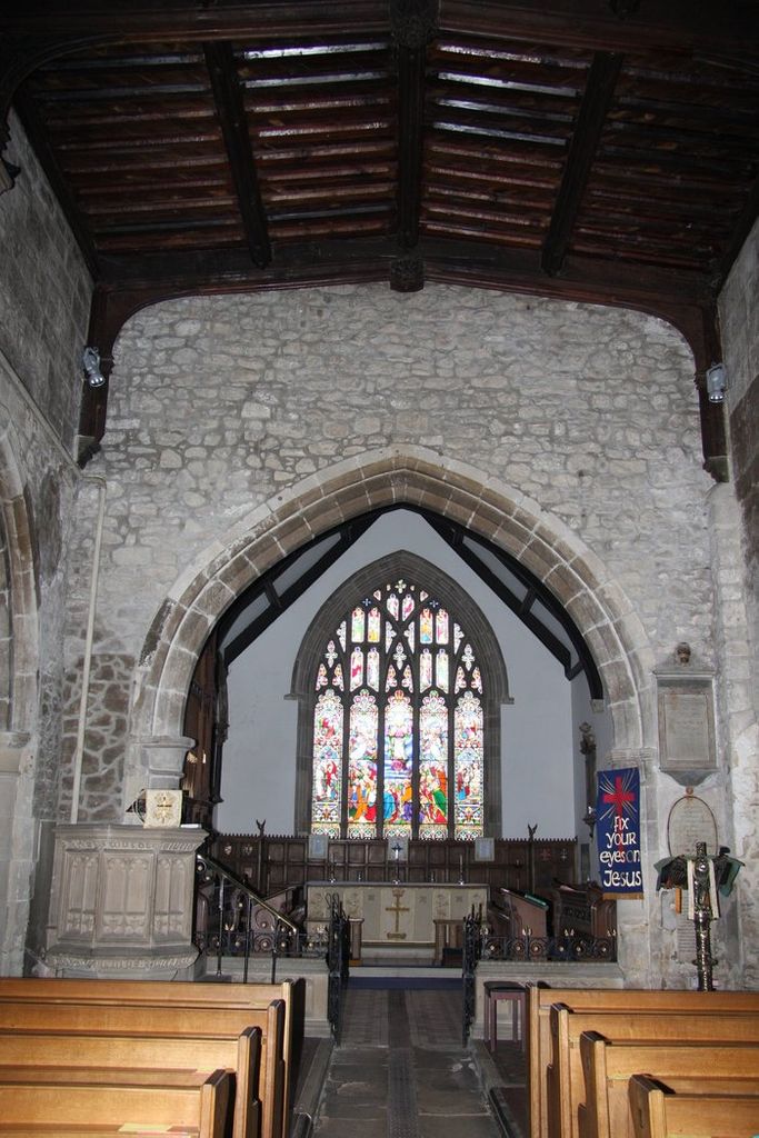
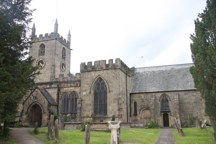
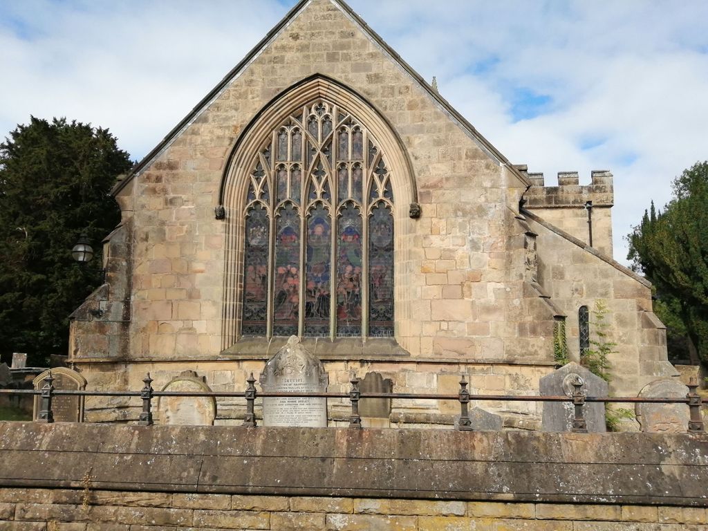
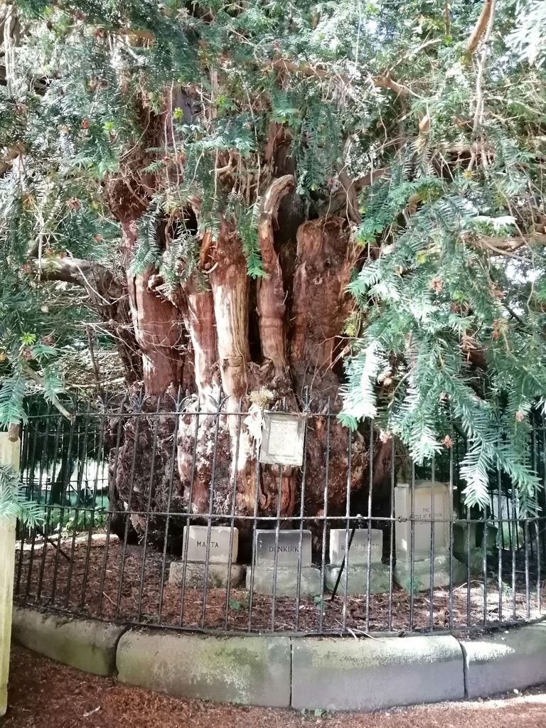
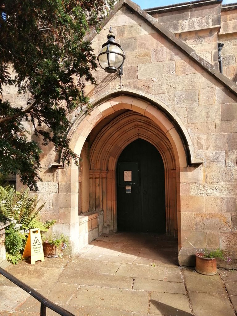
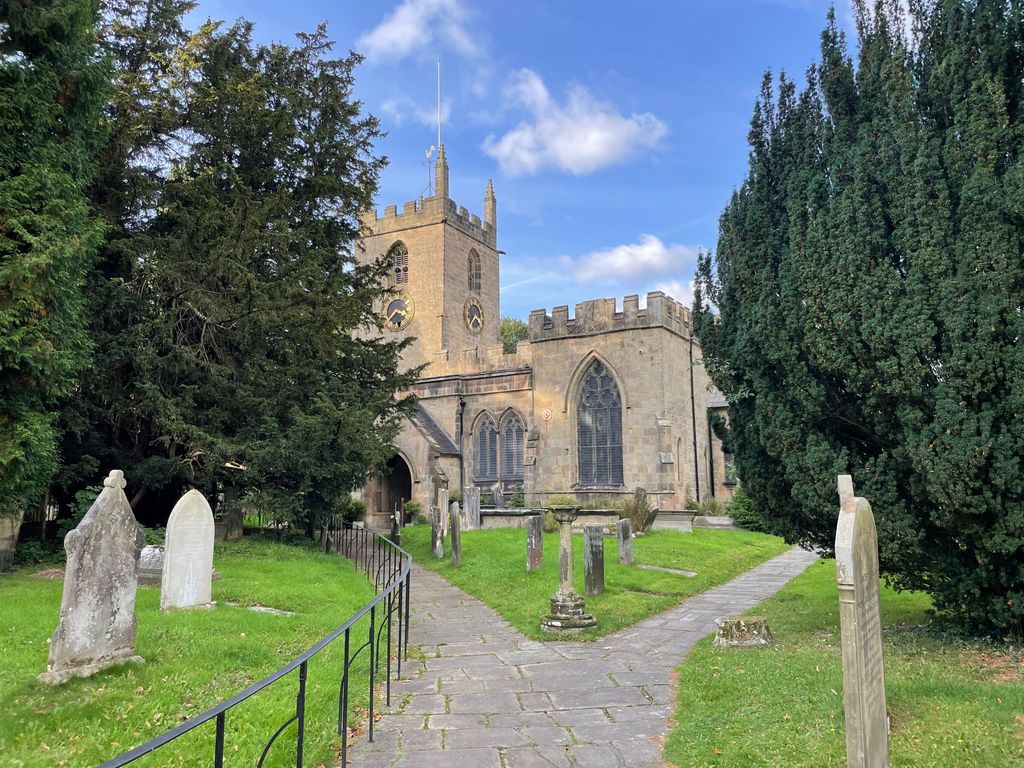
| Description | : | The Parish Church of St. Helen's dates from the 12th century and contains a 600 year old monument to Sir John de Darley, Lord of the Manor. St Helen's is dominated by an ancient and famous yew tree estimated to be 2000 years old. Another well known feature is the stone wall sundial, erected by Rev William Wray in the 18th century to encourage his parishioners to be on time to services. He felt they spent too much time gossiping under the famous yew tree. The Church also contains a "lepers window" which was left open so that those afflicted with... Read More |
frequently asked questions (FAQ):
-
Where is St. Helen's Churchyard?
St. Helen's Churchyard is located at Church Rd Darley Dale, Derbyshire Dales District ,Derbyshire , DE4 2GGEngland.
-
St. Helen's Churchyard cemetery's updated grave count on graveviews.com?
0 memorials
-
Where are the coordinates of the St. Helen's Churchyard?
Latitude: 53.1634910
Longitude: -1.6020670


Nearby Cemetories:
1. Darley Dale Cemetery
Darley Dale, Derbyshire Dales District, England
Coordinate: 53.1635670, -1.5926300
2. St. Mary the Virgin Churchyard
South Darley, Derbyshire Dales District, England
Coordinate: 53.1498000, -1.6015000
3. Holy Trinity Churchyard
Stanton in Peak, Derbyshire Dales District, England
Coordinate: 53.1750700, -1.6403760
4. St. John the Baptist Churchyard
Winster, Derbyshire Dales District, England
Coordinate: 53.1418016, -1.6434807
5. Harthill Chapel
Harthill, Derbyshire Dales District, England
Coordinate: 53.1784740, -1.6588870
6. St. Giles' Churchyard
Matlock, Derbyshire Dales District, England
Coordinate: 53.1343560, -1.5533960
7. St Anne Churchyard
Beeley, Derbyshire Dales District, England
Coordinate: 53.2052320, -1.6048640
8. All Saints Churchyard
Elton, Derbyshire Dales District, England
Coordinate: 53.1455078, -1.6700720
9. St. James the Apostle Churchyard
Bonsall, Derbyshire Dales District, England
Coordinate: 53.1196200, -1.5832110
10. All Saints Churchyard
Youlgreave, Derbyshire Dales District, England
Coordinate: 53.1760130, -1.6841700
11. Holy Trinity Churchyard
Matlock Bath, Derbyshire Dales District, England
Coordinate: 53.1172020, -1.5612230
12. Holy Trinity Churchyard
Tansley, Derbyshire Dales District, England
Coordinate: 53.1353920, -1.5194670
13. St. Mark's Churchyard
Cromford, Derbyshire Dales District, England
Coordinate: 53.1076550, -1.5647150
14. Middleton by Wirksworth Cemetery
Middleton by Wirksworth, Derbyshire Dales District, England
Coordinate: 53.1033860, -1.5919920
15. St. Mary's Churchyard
Cromford, Derbyshire Dales District, England
Coordinate: 53.1104260, -1.5538440
16. Bakewell Cemetery
Bakewell, Derbyshire Dales District, England
Coordinate: 53.2083710, -1.6773120
17. St. Peter's Churchyard
Edensor, Derbyshire Dales District, England
Coordinate: 53.2255530, -1.6260190
18. St Anne Churchyard
Over Haddon, Derbyshire Dales District, England
Coordinate: 53.1940230, -1.6968800
19. Bakewell Quaker Burial Ground
Bakewell, Derbyshire Dales District, England
Coordinate: 53.2108382, -1.6754294
20. Holy Trinity Churchyard
Middleton by Wirksworth, Derbyshire Dales District, England
Coordinate: 53.0979228, -1.5860175
21. All Saints Churchyard
Bakewell, Derbyshire Dales District, England
Coordinate: 53.2129170, -1.6784670
22. Steeple Arch Cemetery
Wirksworth, Derbyshire Dales District, England
Coordinate: 53.0969820, -1.5688340
23. All Saints Churchyard
Ashover, North East Derbyshire District, England
Coordinate: 53.1638900, -1.4800330
24. Dethick Lea and Holloway Cemetery
Holloway, Amber Valley Borough, England
Coordinate: 53.1075100, -1.5183800