
| Memorials | : | 0 |
| Location | : | Fittleworth, Chichester District, England |
| Coordinate | : | 50.9641190, -0.5641100 |
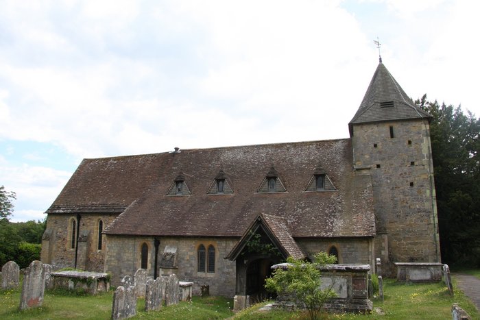
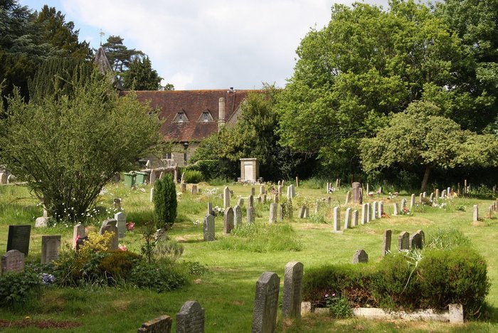
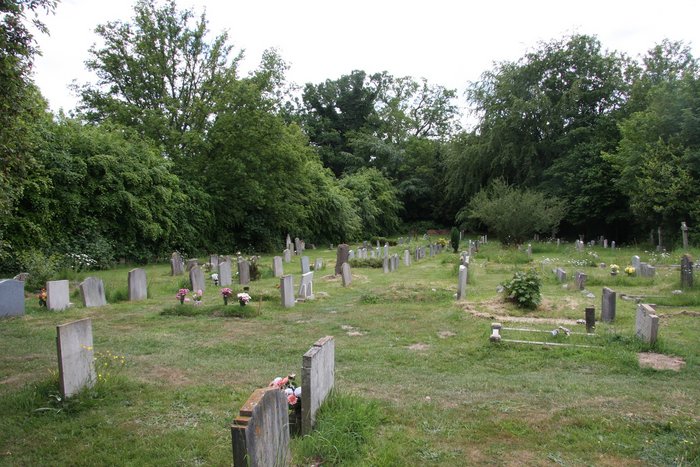
| Description | : | The cemetery lies between the Church and the road from Petworth to Pulborough. Fittleworth is a village and civil parish in the District of Chichester in West Sussex, England located seven kilometres (3 miles) west from Pulborough on the A283 road and three miles south east from Petworth. The village has an Anglican church, a primary school and one pub, the Swan |
frequently asked questions (FAQ):
-
Where is St Mary the Virgin Churchyard?
St Mary the Virgin Churchyard is located at Church Lane Fittleworth, Chichester District ,West Sussex , RH20 1HLEngland.
-
St Mary the Virgin Churchyard cemetery's updated grave count on graveviews.com?
0 memorials
-
Where are the coordinates of the St Mary the Virgin Churchyard?
Latitude: 50.9641190
Longitude: -0.5641100


Nearby Cemetories:
1. St Bartholomew Churchyard
Egdean, Chichester District, England
Coordinate: 50.9716740, -0.5819790
2. St Mary the Virgin Churchyard
Stopham, Chichester District, England
Coordinate: 50.9607210, -0.5397030
3. St. Botolph's Churchyard
Pulborough, Horsham District, England
Coordinate: 50.9486804, -0.5228765
4. St Botolph Churchyard
Hardham, Horsham District, England
Coordinate: 50.9485730, -0.5226740
5. St. Mary’s Churchyard
Pulborough, Horsham District, England
Coordinate: 50.9588300, -0.5101400
6. Bartons Lane Cemetery
Petworth, Chichester District, England
Coordinate: 50.9870920, -0.6073540
7. St Mary the Virgin Churchyard
Petworth, Chichester District, England
Coordinate: 50.9879345, -0.6096756
8. Horsham Road Cemetery
Petworth, Chichester District, England
Coordinate: 50.9920830, -0.6066060
9. St Richard's Church
Duncton, Chichester District, England
Coordinate: 50.9486600, -0.6230000
10. St. John The Baptist Churchyard Cemetery
Sutton, Chichester District, England
Coordinate: 50.9316638, -0.6080123
11. Greatham Parish Churchyard
Pulborough, Horsham District, England
Coordinate: 50.9339600, -0.5156300
12. Hampers Green Cemetery
Petworth, Chichester District, England
Coordinate: 50.9963280, -0.6101350
13. Holy Trinity Churchyard
Duncton, Chichester District, England
Coordinate: 50.9491400, -0.6337740
14. All Hallows Churchyard
Tillington, Chichester District, England
Coordinate: 50.9893180, -0.6291640
15. All Hallows Churchyard Extension
Tillington, Chichester District, England
Coordinate: 50.9893231, -0.6313783
16. Pitshill Garden of Rest
Tillington, Chichester District, England
Coordinate: 50.9893710, -0.6320950
17. Wiggonholt Churchyard
Parham, Horsham District, England
Coordinate: 50.9404490, -0.4924910
18. St. John the Evangelist Churchyard
Bury, Chichester District, England
Coordinate: 50.9084756, -0.5565667
19. St Peters Churchyard
East Lavington, Chichester District, England
Coordinate: 50.9379250, -0.6550920
20. St John The Baptist Churchyard
Kirdford, Chichester District, England
Coordinate: 51.0287710, -0.5494880
21. St. Peter ad Vincula Churchyard
Wisborough Green, Chichester District, England
Coordinate: 51.0223710, -0.5017390
22. St. Mary's Churchyard
West Chiltington, Horsham District, England
Coordinate: 50.9542360, -0.4492980
23. St Peter Churchyard
Lodsworth, Chichester District, England
Coordinate: 50.9968230, -0.6746850
24. St Mary the Virgin
Upwaltham, Chichester District, England
Coordinate: 50.9164000, -0.6600810