
| Memorials | : | 0 |
| Location | : | Stopham, Chichester District, England |
| Coordinate | : | 50.9607210, -0.5397030 |
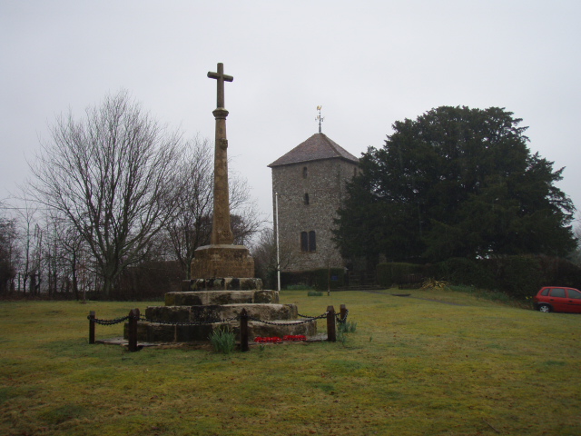
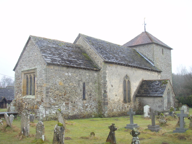
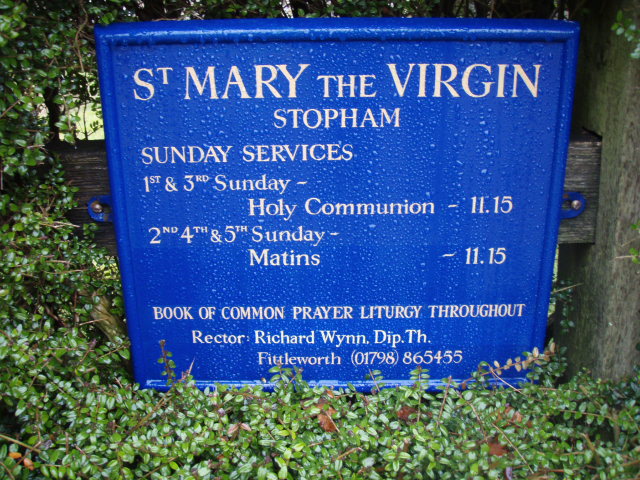
| Description | : | Stopham is a Saxon Anglican church, dedicated to St. Mary the Virgin, located a few hundred metres north of the A283 two kilometres west of Pulborough road together with an ancient Manor house. The parish is bounded to the east by the River Arun, crossed by Stopham bridge built in 1423. Stopham or Stopeham is recorded in the Domesday Book and has belonged to the same family, the Bartletts or Barttelots since the Norman Conquest. Since 1875 they have been baronets. Added by Wertypop |
frequently asked questions (FAQ):
-
Where is St Mary the Virgin Churchyard?
St Mary the Virgin Churchyard is located at Stopham, Chichester District ,West Sussex ,England.
-
St Mary the Virgin Churchyard cemetery's updated grave count on graveviews.com?
0 memorials
-
Where are the coordinates of the St Mary the Virgin Churchyard?
Latitude: 50.9607210
Longitude: -0.5397030

Nearby Cemetories:
1. St Mary the Virgin Churchyard
Fittleworth, Chichester District, England
Coordinate: 50.9641190, -0.5641100
2. St. Botolph's Churchyard
Pulborough, Horsham District, England
Coordinate: 50.9486804, -0.5228765
3. St Botolph Churchyard
Hardham, Horsham District, England
Coordinate: 50.9485730, -0.5226740
4. St. Mary’s Churchyard
Pulborough, Horsham District, England
Coordinate: 50.9588300, -0.5101400
5. St Bartholomew Churchyard
Egdean, Chichester District, England
Coordinate: 50.9716740, -0.5819790
6. Greatham Parish Churchyard
Pulborough, Horsham District, England
Coordinate: 50.9339600, -0.5156300
7. Wiggonholt Churchyard
Parham, Horsham District, England
Coordinate: 50.9404490, -0.4924910
8. Bartons Lane Cemetery
Petworth, Chichester District, England
Coordinate: 50.9870920, -0.6073540
9. St Mary the Virgin Churchyard
Petworth, Chichester District, England
Coordinate: 50.9879345, -0.6096756
10. St. John The Baptist Churchyard Cemetery
Sutton, Chichester District, England
Coordinate: 50.9316638, -0.6080123
11. Horsham Road Cemetery
Petworth, Chichester District, England
Coordinate: 50.9920830, -0.6066060
12. St. John the Evangelist Churchyard
Bury, Chichester District, England
Coordinate: 50.9084756, -0.5565667
13. St Richard's Church
Duncton, Chichester District, England
Coordinate: 50.9486600, -0.6230000
14. Hampers Green Cemetery
Petworth, Chichester District, England
Coordinate: 50.9963280, -0.6101350
15. St. Mary's Churchyard
West Chiltington, Horsham District, England
Coordinate: 50.9542360, -0.4492980
16. Holy Trinity Churchyard
Duncton, Chichester District, England
Coordinate: 50.9491400, -0.6337740
17. All Hallows Churchyard
Tillington, Chichester District, England
Coordinate: 50.9893180, -0.6291640
18. All Hallows Churchyard Extension
Tillington, Chichester District, England
Coordinate: 50.9893231, -0.6313783
19. Pitshill Garden of Rest
Tillington, Chichester District, England
Coordinate: 50.9893710, -0.6320950
20. St. Peter ad Vincula Churchyard
Wisborough Green, Chichester District, England
Coordinate: 51.0223710, -0.5017390
21. Our Lady of England Churchyard
Storrington, Horsham District, England
Coordinate: 50.9164980, -0.4599130
22. St John The Baptist Churchyard
Kirdford, Chichester District, England
Coordinate: 51.0287710, -0.5494880
23. St. Mary's Churchyard
Storrington, Horsham District, England
Coordinate: 50.9160360, -0.4566160
24. St Peters Churchyard
East Lavington, Chichester District, England
Coordinate: 50.9379250, -0.6550920