
| Memorials | : | 0 |
| Location | : | Duncton, Chichester District, England |
| Coordinate | : | 50.9491400, -0.6337740 |
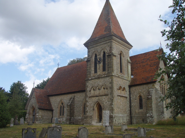
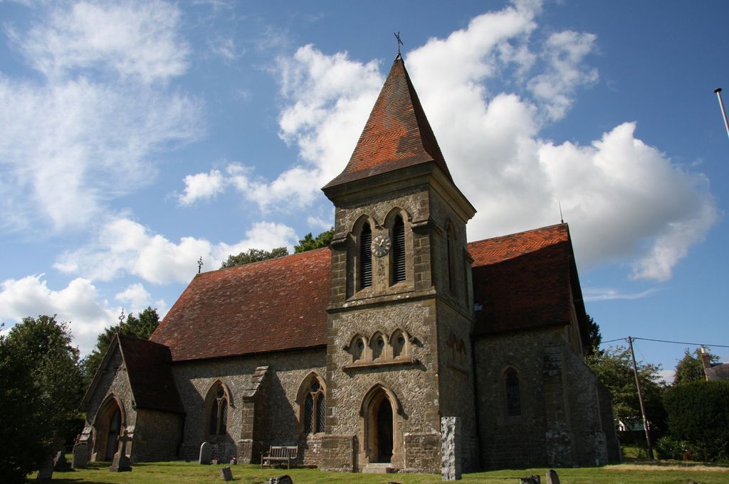
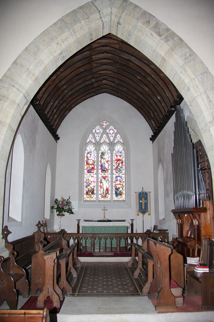
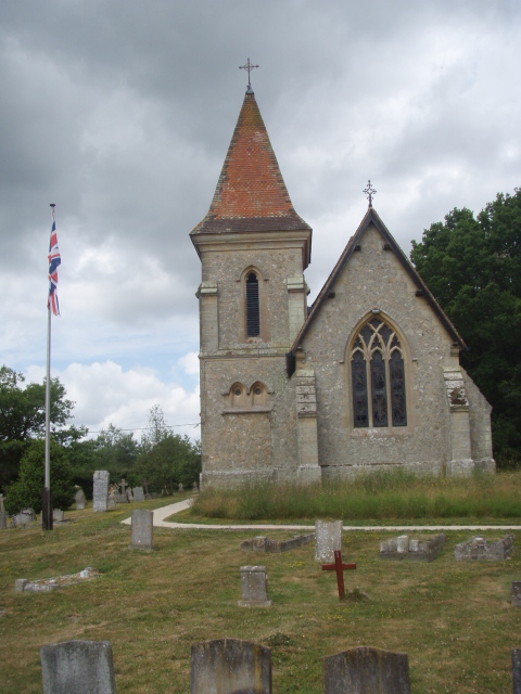
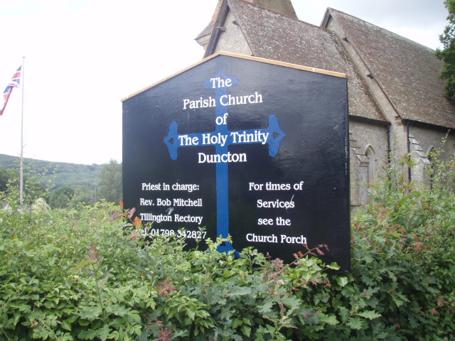
| Description | : | Holy Trinity Anglican church Duncton is a village and civil parish in the District of Chichester in West Sussex, England located one mile south of Petworth on the A285 road. The village has an Anglican church, a Roman catholic church and a pub named The Cricketers in honour of two past residents, Jemmy Dean and Jem Broadbridge, who played cricket for Sussex in the nineteenth century. There is a modern village hall and two croquet pitches. the east of the village on the border with Barlavington civil parish is Burton Park, a stately home now converted into a number of... Read More |
frequently asked questions (FAQ):
-
Where is Holy Trinity Churchyard?
Holy Trinity Churchyard is located at Duncton, Chichester District ,West Sussex ,England.
-
Holy Trinity Churchyard cemetery's updated grave count on graveviews.com?
0 memorials
-
Where are the coordinates of the Holy Trinity Churchyard?
Latitude: 50.9491400
Longitude: -0.6337740


Nearby Cemetories:
1. St Richard's Church
Duncton, Chichester District, England
Coordinate: 50.9486600, -0.6230000
2. St Peters Churchyard
East Lavington, Chichester District, England
Coordinate: 50.9379250, -0.6550920
3. St. John The Baptist Churchyard Cemetery
Sutton, Chichester District, England
Coordinate: 50.9316638, -0.6080123
4. St Mary the Virgin
Upwaltham, Chichester District, England
Coordinate: 50.9164000, -0.6600810
5. St Bartholomew Churchyard
Egdean, Chichester District, England
Coordinate: 50.9716740, -0.5819790
6. All Hallows Churchyard Extension
Tillington, Chichester District, England
Coordinate: 50.9893231, -0.6313783
7. Pitshill Garden of Rest
Tillington, Chichester District, England
Coordinate: 50.9893710, -0.6320950
8. All Hallows Churchyard
Tillington, Chichester District, England
Coordinate: 50.9893180, -0.6291640
9. Bartons Lane Cemetery
Petworth, Chichester District, England
Coordinate: 50.9870920, -0.6073540
10. St Mary the Virgin Churchyard
Petworth, Chichester District, England
Coordinate: 50.9879345, -0.6096756
11. Horsham Road Cemetery
Petworth, Chichester District, England
Coordinate: 50.9920830, -0.6066060
12. St Mary the Virgin Churchyard
Fittleworth, Chichester District, England
Coordinate: 50.9641190, -0.5641100
13. Hampers Green Cemetery
Petworth, Chichester District, England
Coordinate: 50.9963280, -0.6101350
14. St Peter Churchyard
Lodsworth, Chichester District, England
Coordinate: 50.9968230, -0.6746850
15. St James Churchyard
Heyshott, Chichester District, England
Coordinate: 50.9556210, -0.7238880
16. St Mary the Virgin Churchyard
Stopham, Chichester District, England
Coordinate: 50.9607210, -0.5397030
17. All Saints Churchyard
East Dean, Chichester District, England
Coordinate: 50.9111110, -0.7136340
18. St. John the Evangelist Churchyard
Bury, Chichester District, England
Coordinate: 50.9084756, -0.5565667
19. St Mary Magdelene Churchyard
West Lavington, Chichester District, England
Coordinate: 50.9773640, -0.7311840
20. St. Botolph's Churchyard
Pulborough, Horsham District, England
Coordinate: 50.9486804, -0.5228765
21. St Botolph Churchyard
Hardham, Horsham District, England
Coordinate: 50.9485730, -0.5226740
22. Easebourne Priory
Easebourne, Chichester District, England
Coordinate: 50.9950335, -0.7258487
23. Greatham Parish Churchyard
Pulborough, Horsham District, England
Coordinate: 50.9339600, -0.5156300
24. St. Mary’s Churchyard
Pulborough, Horsham District, England
Coordinate: 50.9588300, -0.5101400