| Memorials | : | 0 |
| Location | : | Chester, Cheshire West and Chester Unitary Authority, England |
| Website | : | discovery.nationalarchives.gov.uk/details/r/2f1aa848-9003-4ab0-95ef-95008318bd74 |
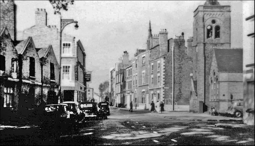
| Description | : | The ancient parish of Chester St. Martin had no dependent townships. The parish church stood in the angle formed by Nicholas Street, White Friars and Cuppin Street. In 1842 the parish was united with that of St. Bridget, the united benefice being known as St. Bridget with St. Martin. St. Martin's church was transferred to the Welsh residents of Chester. The church and church yard were removed in 1964 during the construction of the Inner Ring Road |
frequently asked questions (FAQ):
-
Where is St. Martin Parish Church Burial Ground?
St. Martin Parish Church Burial Ground is located at No GPS information available Add GPSThe parish church stood in the angle formed by Nicholas Street, White Friars and Cuppin Street. Chester, Cheshire West and Chester Unitary Authority ,Cheshire , CH1 2BNEngland.
-
St. Martin Parish Church Burial Ground cemetery's updated grave count on graveviews.com?
0 memorials
Nearby Cemetories:
1. St. John the Evangelist Churchyard
Ashton, Cheshire West and Chester Unitary Authority, England
Coordinate: 53.2613110, -2.7547240
2. St. Wenefredes Churchyard
Bickley, Cheshire West and Chester Unitary Authority, England
Coordinate: 53.2094380, -2.7957310
3. Helsby Cemetery
Helsby, Cheshire West and Chester Unitary Authority, England
Coordinate: 53.1035280, -2.7251110
4. St. Paul's Churchyard
Helsby, Cheshire West and Chester Unitary Authority, England
Coordinate: 53.2123300, -2.6602000
5. Birches Remembrance Park and Crematorium
Lach Dennis, Cheshire West and Chester Unitary Authority, England
Coordinate: 53.2861000, -2.8950800
6. St. Oswald's Churchyard
Lower Peover, Cheshire West and Chester Unitary Authority, England
Coordinate: 53.2881800, -2.9215590
7. Newton-near-Frodsham Quaker Burial Ground
Newton, Cheshire West and Chester Unitary Authority, England
8. All Saints Churchyard
Saughall, Cheshire West and Chester Unitary Authority, England
9. Ebenezer Primitive Methodist Churchyard
Saughall, Cheshire West and Chester Unitary Authority, England
Coordinate: 53.2900000, -2.8600000
10. Saughall Churches of Christ Grove Chapel
Saughall, Cheshire West and Chester Unitary Authority, England
Coordinate: 53.2971800, -2.9569700
11. St. Mary's Churchyard
Thornton-le-Moors, Cheshire West and Chester Unitary Authority, England
Coordinate: 53.2902200, -2.9511400
12. Saint Mary's Churchyard
Whitegate, Cheshire West and Chester Unitary Authority, England
Coordinate: 53.1838720, -2.6021830
13. St. John the Evangelist Churchyard
Alvanley, Cheshire West and Chester Unitary Authority, England
Coordinate: 53.2613110, -2.7547240
14. St. Bartholomew's Churchyard
Barrow, Cheshire West and Chester Unitary Authority, England
Coordinate: 53.2094380, -2.7957310
15. St. John the Divine Churchyard
Burwardsley, Cheshire West and Chester Unitary Authority, England
Coordinate: 53.1035280, -2.7251110
16. St Peter's Churchyard
Delamere, Cheshire West and Chester Unitary Authority, England
Coordinate: 53.2123300, -2.6602000
17. Christ Church Churchyard
Ellesmere Port, Cheshire West and Chester Unitary Authority, England
Coordinate: 53.2861000, -2.8950800
18. Overpool Cemetery
Ellesmere Port, Cheshire West and Chester Unitary Authority, England
Coordinate: 53.2881800, -2.9215590
19. Parischurch
Ellesmere Port, Cheshire West and Chester Unitary Authority, England
20. Rossmore Road
Ellesmere Port, Cheshire West and Chester Unitary Authority, England
21. Stanlow Abbey Ruins
Ellesmere Port, Cheshire West and Chester Unitary Authority, England
Coordinate: 53.2900000, -2.8600000
22. St Mary of the Angels Hooton
Hooton, Cheshire West and Chester Unitary Authority, England
Coordinate: 53.2971800, -2.9569700
23. St. Paul's Churchyard
Hooton, Cheshire West and Chester Unitary Authority, England
Coordinate: 53.2902200, -2.9511400
24. St. Peter's Churchyard
Little Budworth, Cheshire West and Chester Unitary Authority, England
Coordinate: 53.1838720, -2.6021830

