
| Memorials | : | 1 |
| Location | : | Leighton Linslade, Central Bedfordshire Unitary Authority, England |
| Coordinate | : | 51.9324420, -0.6776870 |
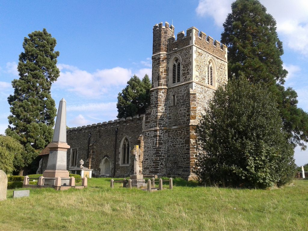
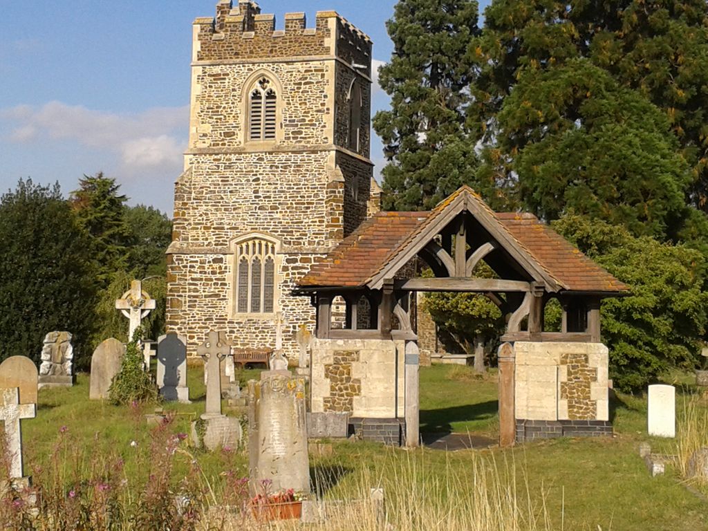
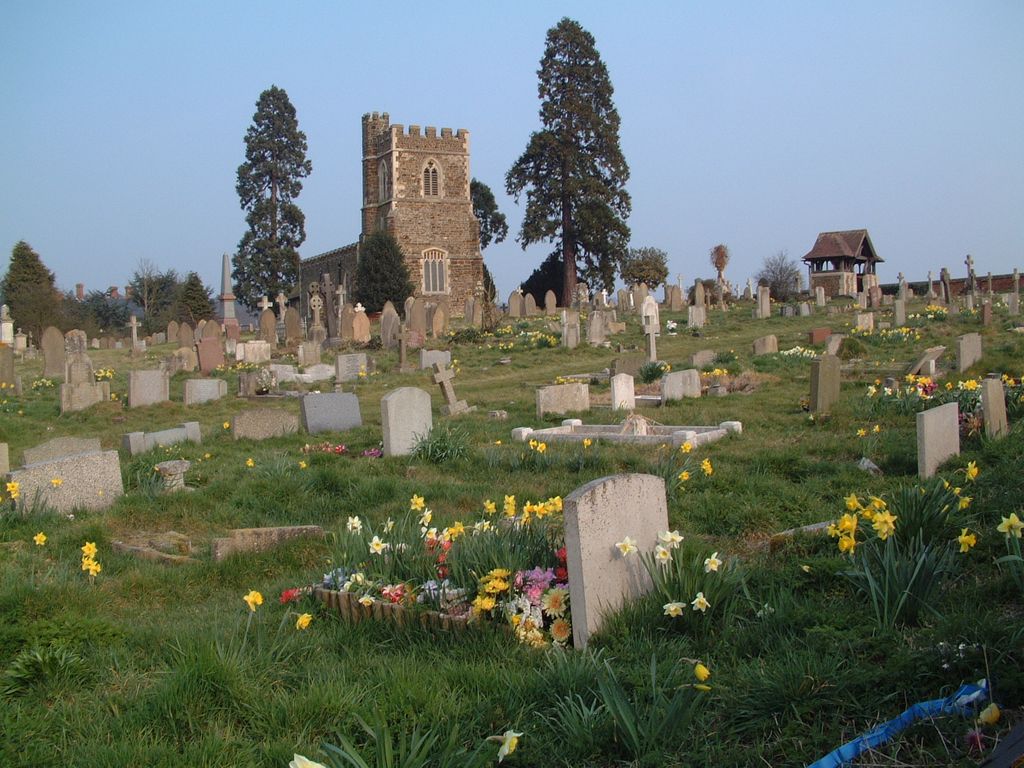
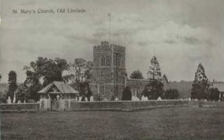
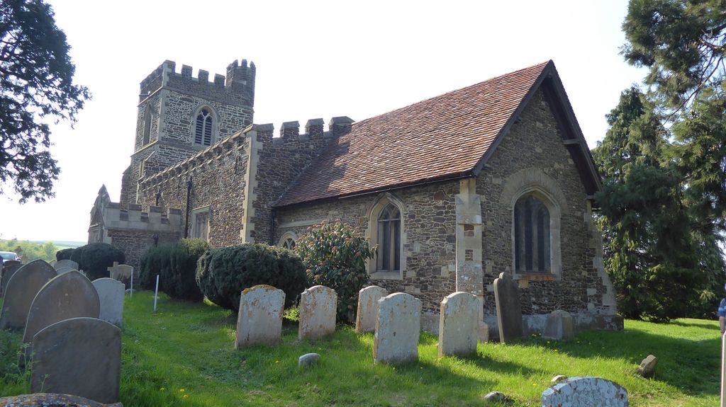
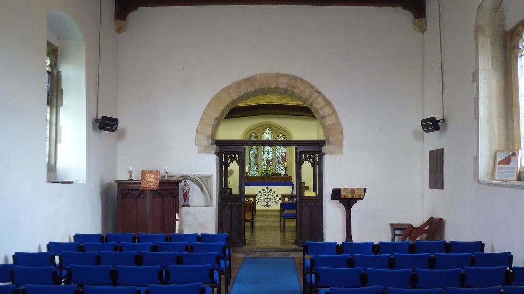
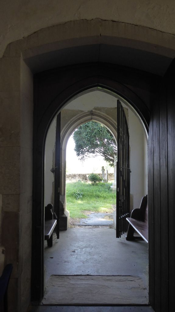
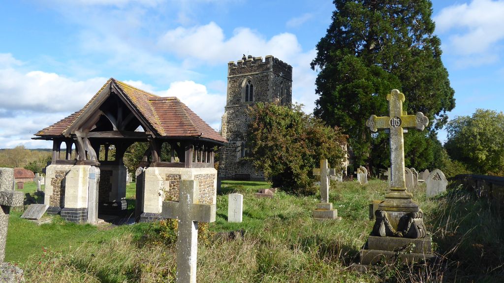
| Description | : | St. Mary's in Old Linslade is approx. 1000 years old. It is the mother Church of Linslade, but when the village centre moved to the new railway station, the church was abandoned. It was restored by the Victorians and is now used occasionally for Services, concerts and weddings. It remains much-loved and is usually open on the first Saturday of the month, and on Sunday afternoons between Easter and the end of September. It is part of the Parish of Linslade in the Ouzel Valley Team |
frequently asked questions (FAQ):
-
Where is St. Mary's Churchyard?
St. Mary's Churchyard is located at Old Linslade Road Leighton Linslade, Central Bedfordshire Unitary Authority ,Bedfordshire , LU7 0DUEngland.
-
St. Mary's Churchyard cemetery's updated grave count on graveviews.com?
1 memorials
-
Where are the coordinates of the St. Mary's Churchyard?
Latitude: 51.9324420
Longitude: -0.6776870
Nearby Cemetories:
1. Old Linslade Cemetery
Leighton Linslade, Central Bedfordshire Unitary Authority, England
Coordinate: 51.9319962, -0.6794293
2. Heath and Reach Cemetery
Heath and Reach, Central Bedfordshire Unitary Authority, England
Coordinate: 51.9405100, -0.6557170
3. Leighton Buzzard Friends Meeting House
Leighton Buzzard, Central Bedfordshire Unitary Authority, England
Coordinate: 51.9181543, -0.6608307
4. Vandyke Road Cemetery
Leighton Buzzard, Central Bedfordshire Unitary Authority, England
Coordinate: 51.9237190, -0.6503660
5. All Saints Churchyard
Leighton Buzzard, Central Bedfordshire Unitary Authority, England
Coordinate: 51.9148010, -0.6651860
6. Lake Street Baptist Chapel
Leighton Buzzard, Central Bedfordshire Unitary Authority, England
Coordinate: 51.9148400, -0.6593400
7. All Saints Churchyard
Soulbury, Aylesbury Vale District, England
Coordinate: 51.9347636, -0.7181225
8. St. John The Baptist Churchyard
Stanbridge, Central Bedfordshire Unitary Authority, England
Coordinate: 51.9219541, -0.6359898
9. All Saints Churchyard
Marsworth, Aylesbury Vale District, England
Coordinate: 51.9219473, -0.6359566
10. Great Brickhill Baptist Chapel
Great Brickhill, Aylesbury Vale District, England
Coordinate: 51.9666820, -0.6892350
11. Great Brickhill Cemetery
Great Brickhill, Aylesbury Vale District, England
Coordinate: 51.9667550, -0.6894140
12. Great Brickhill Churchyard Extension
Great Brickhill, Aylesbury Vale District, England
Coordinate: 51.9670890, -0.6898000
13. St Mary Churchyard
Great Brickhill, Aylesbury Vale District, England
Coordinate: 51.9682720, -0.6896390
14. St Lukes Churchyard
Stoke Hammond, Aylesbury Vale District, England
Coordinate: 51.9594850, -0.7214330
15. St Michael and all Angels Churchyard
Grove, Central Bedfordshire Unitary Authority, England
Coordinate: 51.8931000, -0.6628500
16. St Michael Churchyard
Eggington, Central Bedfordshire Unitary Authority, England
Coordinate: 51.9168460, -0.6103740
17. St Mary Churchyard
Potsgrove, Central Bedfordshire Unitary Authority, England
Coordinate: 51.9589970, -0.6166510
18. St. Michael and All Angels Churchyard
Billington, Central Bedfordshire Unitary Authority, England
Coordinate: 51.8936510, -0.6347710
19. All Saints Churchyard
Wing, Aylesbury Vale District, England
Coordinate: 51.8945984, -0.7227797
20. St Peter and All Saints Churchyard
Battlesden, Central Bedfordshire Unitary Authority, England
Coordinate: 51.9520610, -0.6059540
21. St. Nicholas Churchyard
Hockliffe, Central Bedfordshire Unitary Authority, England
Coordinate: 51.9328680, -0.5964160
22. St. Mary Magdalene Churchyard
Little Brickhill, Milton Keynes Borough, England
Coordinate: 51.9831000, -0.6763200
23. St. Michael & All Angels Churchyard
Stewkley, Aylesbury Vale District, England
Coordinate: 51.9269300, -0.7625700
24. Holy Cross
Slapton, Aylesbury Vale District, England
Coordinate: 51.8768800, -0.6401000