
| Memorials | : | 79 |
| Location | : | Stratfield Saye, Basingstoke and Deane Borough, England |
| Coordinate | : | 51.3474200, -1.0023700 |
| Description | : | Stratfield Saye is a village and civil parish in the Borough of Basingstoke and Deane and the English county of Hampshire. The parish includes the hamlets of West End Green, Fair Oak Green and Fair Cross. The name means 'Street-Field of the Saye family'. The street was the 'Devil's Highway', the Roman road from London to Silchester which forms the northern parish boundary. Stratfield Saye House was built around 1630 as the Pitt family home, from fortunes made by "Diamond Pitt". In the late 18th century the family were closely related with the famous Prime Ministers of Great Britain, William Pitt the Elder... Read More |
frequently asked questions (FAQ):
-
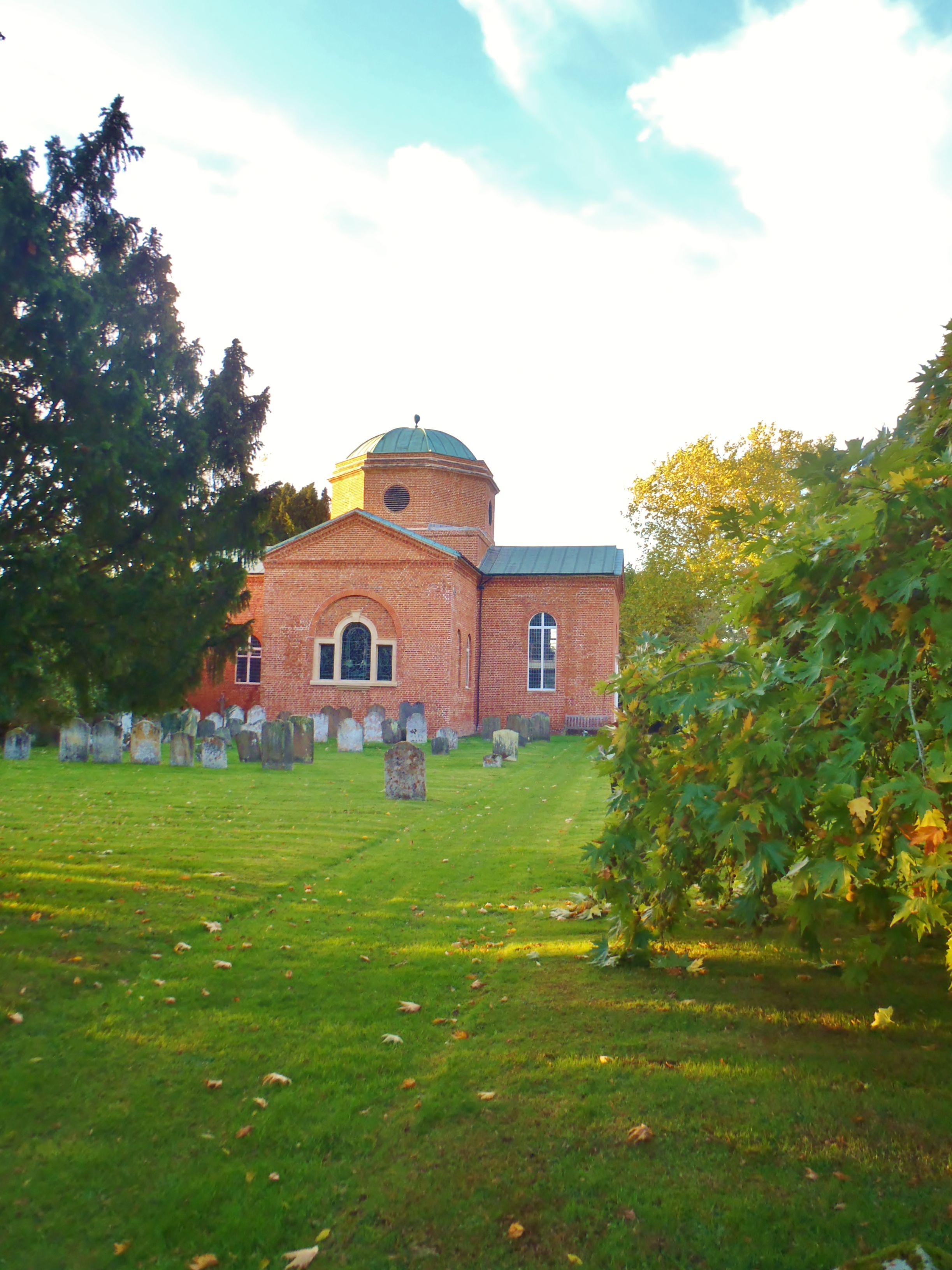
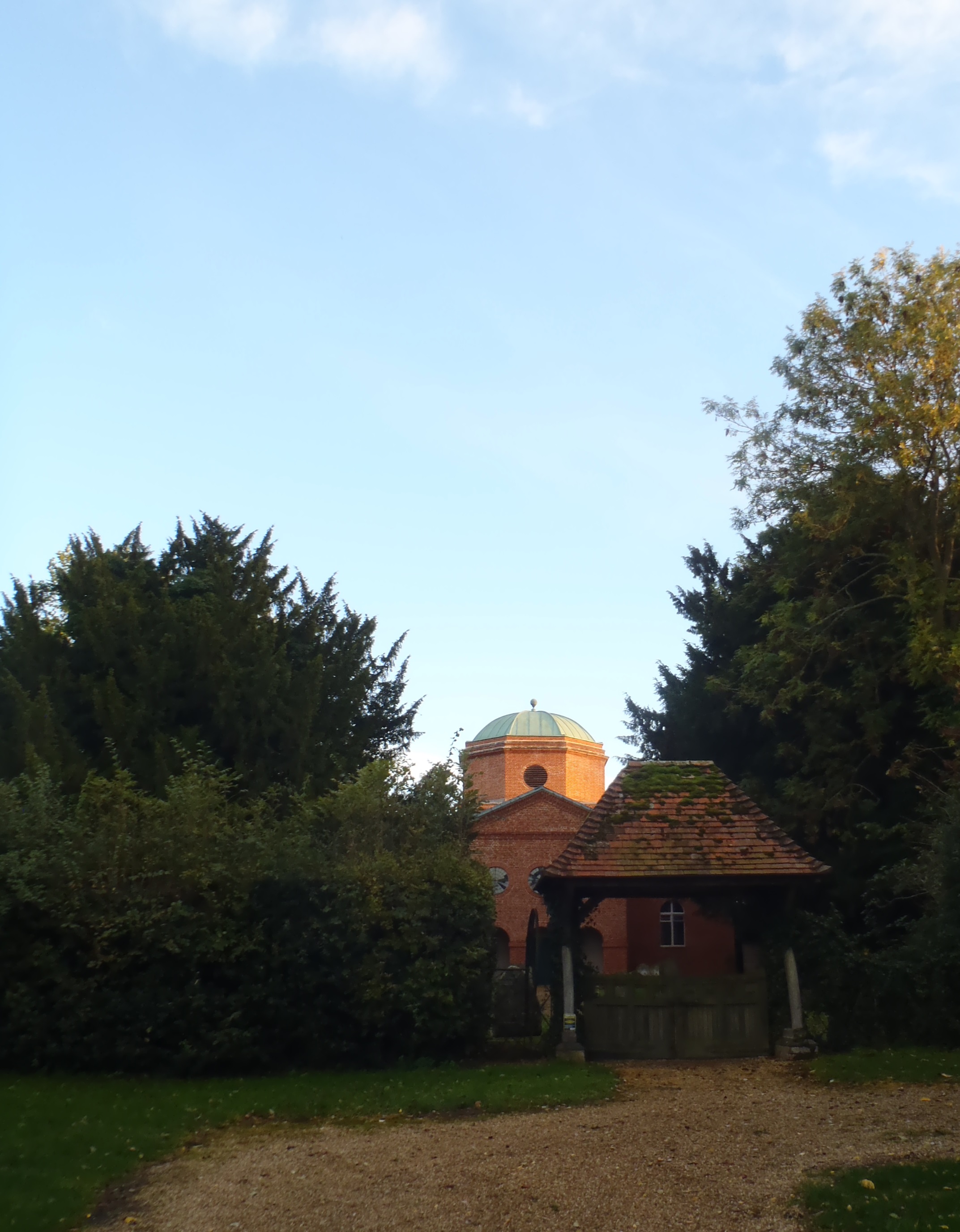
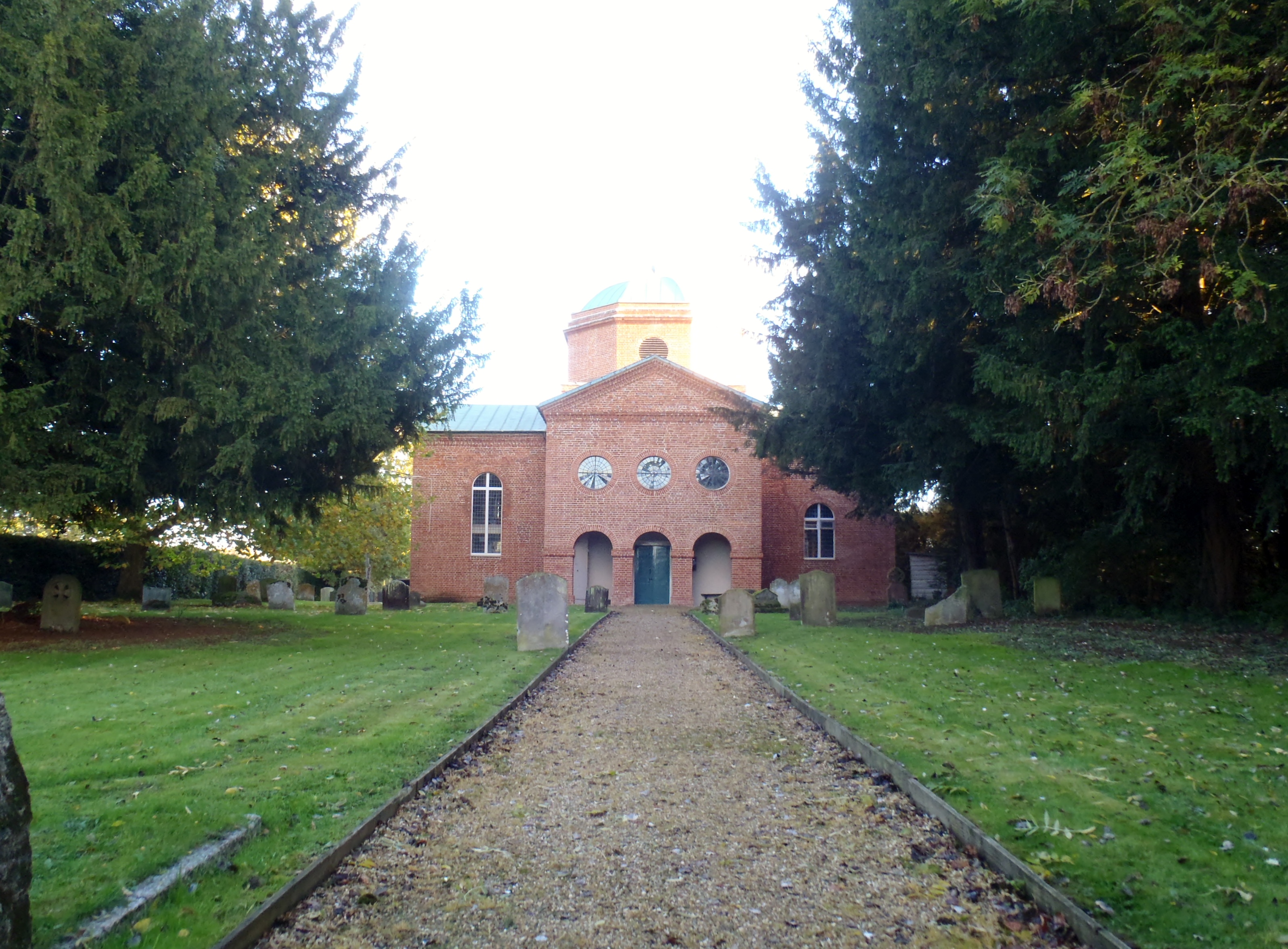
Where is St Mary Churchyard?
St Mary Churchyard is located at In the grounds of Stratfield Saye house Stratfield Saye, Basingstoke and Deane Borough ,Hampshire , RG7 2DAEngland.
-
St Mary Churchyard cemetery's updated grave count on graveviews.com?
79 memorials
-
Where are the coordinates of the St Mary Churchyard?
Latitude: 51.3474200
Longitude: -1.0023700
Nearby Cemetories:
1. Stratfield Saye House
Stratfield Saye, Basingstoke and Deane Borough, England
Coordinate: 51.3522220, -1.0058200
2. St Michael Churchyard
Heckfield, Hart District, England
Coordinate: 51.3389940, -0.9642430
3. St Mary Churchyard
Hartley Wespall, Basingstoke and Deane Borough, England
Coordinate: 51.3197500, -0.9996400
4. All Saints Churchyard
Swallowfield, Wokingham Borough, England
Coordinate: 51.3775140, -0.9500010
5. Nutbean Lane Cemetery
Swallowfield, Wokingham Borough, England
Coordinate: 51.3730630, -0.9430220
6. St. Leonard's Churchyard
Sherfield on Loddon, Basingstoke and Deane Borough, England
Coordinate: 51.3061100, -1.0376400
7. Mattingley Churchyard
Mattingley, Hart District, England
Coordinate: 51.3164700, -0.9447000
8. St Mary the Virgin Churchyard
Silchester, Basingstoke and Deane Borough, England
Coordinate: 51.3564000, -1.0775700
9. Rotherwick Churchyard
Rotherwick, Hart District, England
Coordinate: 51.3010190, -0.9806320
10. Holy Trinity Churchyard
Grazeley, Wokingham Borough, England
Coordinate: 51.3972008, -0.9965683
11. St James Churchyard
Bramley, Basingstoke and Deane Borough, England
Coordinate: 51.3263740, -1.0757240
12. St Saviour Churchyard
Mortimer West End, Basingstoke and Deane Borough, England
Coordinate: 51.3682600, -1.0912800
13. St Nicholas Churchyard
Newnham, Basingstoke and Deane Borough, England
Coordinate: 51.2806190, -0.9922190
14. St. Mary's Churchyard
Burghfield, West Berkshire Unitary Authority, England
Coordinate: 51.4110000, -1.0420000
15. St. Mary Churchyard
Shinfield, Wokingham Borough, England
Coordinate: 51.4081180, -0.9524620
16. Hook Cemetery
Hook, Hart District, England
Coordinate: 51.2840400, -0.9602700
17. St John the Evangelist Churchyard
Hook, Hart District, England
Coordinate: 51.2833900, -0.9601300
18. St Mary Churchyard
Eversley, Hart District, England
Coordinate: 51.3420150, -0.8827520
19. St. Swithun Churchyard
Nately Scures, Basingstoke and Deane Borough, England
Coordinate: 51.2719600, -1.0022200
20. Old Churchyard
Arborfield, Wokingham Borough, England
Coordinate: 51.4061530, -0.9231220
21. Old Basing Cemetery
Old Basing, Basingstoke and Deane Borough, England
Coordinate: 51.2736710, -1.0397679
22. All Souls Churchyard
Hartfordbridge, Hart District, England
Coordinate: 51.3141800, -0.8861300
23. St Bartholomew Churchyard
Arborfield, Wokingham Borough, England
Coordinate: 51.4043310, -0.9118300
24. St Mary Churchyard
Old Basing, Basingstoke and Deane Borough, England
Coordinate: 51.2715280, -1.0467700