
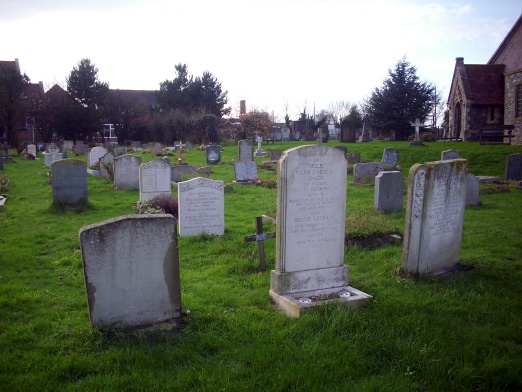
| Memorials | : | 55 |
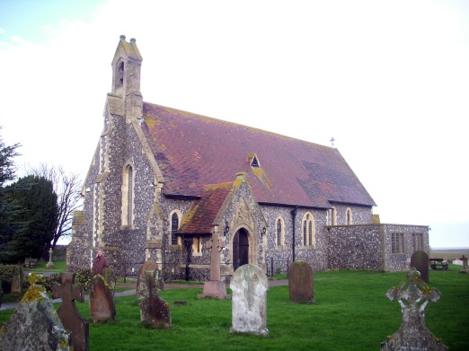
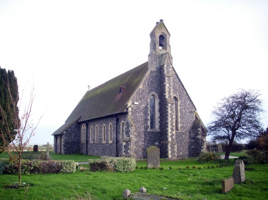
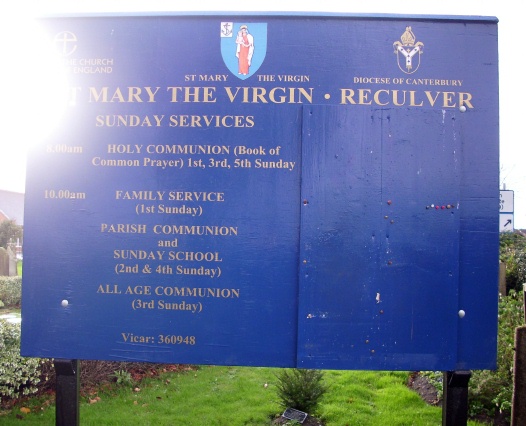
| Location | : | Reculver, City of Canterbury, England |
| Coordinate | : | 51.3684750, 1.1766050 |
frequently asked questions (FAQ):
-
Where is St Mary the Virgin Churchyard?
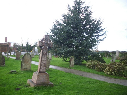
St Mary the Virgin Churchyard is located at Reculver Lane Reculver, City of Canterbury ,Kent , CT6 6TAEngland.
-
St Mary the Virgin Churchyard cemetery's updated grave count on graveviews.com?
55 memorials
-
Where are the coordinates of the St Mary the Virgin Churchyard?
Latitude: 51.3684750
Longitude: 1.1766050
Nearby Cemetories:
1. St Mary's Abbey
Reculver, City of Canterbury, England
Coordinate: 51.3795360, 1.1993770
2. Herne Bay Cemetery
Herne Bay, City of Canterbury, England
Coordinate: 51.3571810, 1.1304820
3. St Martins
Herne, City of Canterbury, England
Coordinate: 51.3500600, 1.1333200
4. St Martin's Churchyard
Herne, City of Canterbury, England
Coordinate: 51.3497060, 1.1334370
5. St Mary The Virgin Churchyard
Chislet, City of Canterbury, England
Coordinate: 51.3343610, 1.1921020
6. St. Nicholas' Churchyard
St Nicholas at Wade, Thanet District, England
Coordinate: 51.3542160, 1.2517980
7. St Nicholas-at-Wade Cemetery
St Nicholas at Wade, Thanet District, England
Coordinate: 51.3578344, 1.2534168
8. All Saints Churchyard
Stourmouth, Dover District, England
Coordinate: 51.3202600, 1.2365520
9. All Saints Churchyard
Westbere, City of Canterbury, England
Coordinate: 51.3065380, 1.1437670
10. Stodmarsh St Marys Churchyard
Wickhambreaux, City of Canterbury, England
Coordinate: 51.3009500, 1.1836900
11. St John the Baptist Churchyard
Swalecliffe, City of Canterbury, England
Coordinate: 51.3645500, 1.0667200
12. Sturry Cemetery
Sturry, City of Canterbury, England
Coordinate: 51.3058100, 1.1277700
13. St Mildred Churchyard
Preston, Dover District, England
Coordinate: 51.2985000, 1.2173980
14. St Nicholas Churchyard
Sturry, City of Canterbury, England
Coordinate: 51.2984830, 1.1201330
15. St Mary the Virgin Churchyard
Fordwich, City of Canterbury, England
Coordinate: 51.2958300, 1.1270530
16. All Saints Churchyard
Birchington, Thanet District, England
Coordinate: 51.3736580, 1.3059360
17. Elmstone Churchyard
Preston, Dover District, England
Coordinate: 51.2967160, 1.2424980
18. St Andrew Churchyard
Wickhambreaux, City of Canterbury, England
Coordinate: 51.2844400, 1.1822300
19. All Saints Churchyard
Whitstable, City of Canterbury, England
Coordinate: 51.3558090, 1.0396670
20. Whitstable Cemetery
Whitstable, City of Canterbury, England
Coordinate: 51.3529870, 1.0338530
21. Minster Cemetery
Minster-in-Thanet, Thanet District, England
Coordinate: 51.3423100, 1.3160550
22. St Mary the Virgin Church
Minster-in-Thanet, Thanet District, England
Coordinate: 51.3305810, 1.3156720
23. St Alphege Churchyard
Whitstable, City of Canterbury, England
Coordinate: 51.3576330, 1.0251080
24. St Mary the Virgin Churchyard
Wingham, Dover District, England
Coordinate: 51.2721220, 1.2128950