
| Memorials | : | 21 |
| Location | : | Stourmouth, Dover District, England |
| Coordinate | : | 51.3202600, 1.2365520 |
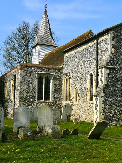
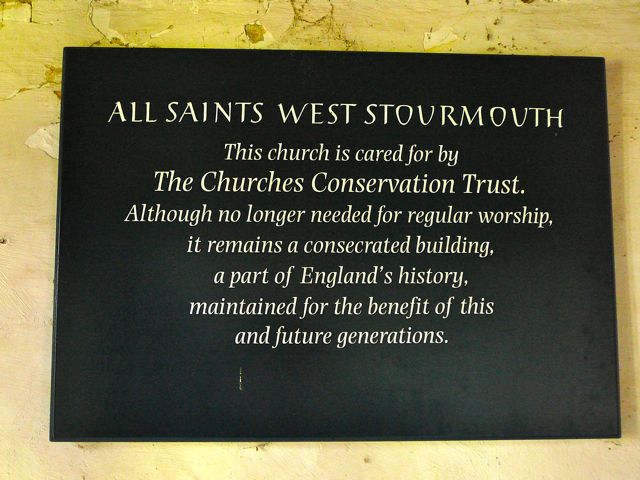
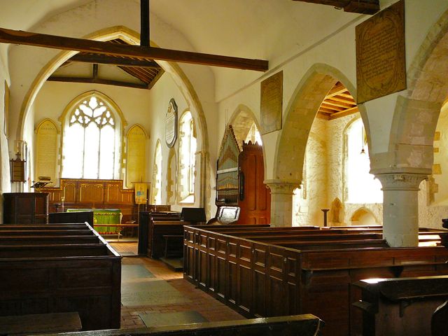
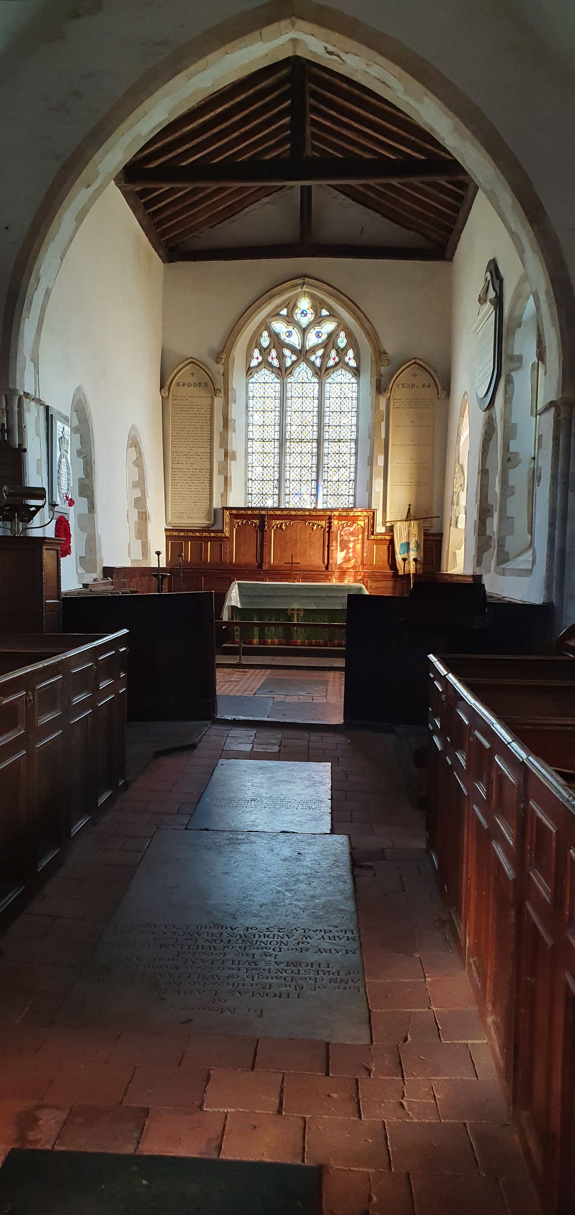
| Description | : | West Stourmouth, now long separated from the sea by the silting-up of the river Stour, is a small hamlet along a narrow country lane. All Saints is almost hidden among trees, a small building dating originally from Saxon times; the unstable ground has caused slippages over the centuries, and the west end of the church is supported by buttresses. On the north side the walls, built of a huge variety of materials, lean outwards, and the roof of the north aisle has been lowered to reduce the load. Inside, the Victorian tiled floor has some interesting ledger stones, and a... Read More |
frequently asked questions (FAQ):
-
Where is All Saints Churchyard?
All Saints Churchyard is located at Church Lane, West Stourmouth Stourmouth, Dover District ,Kent , CT3England.
-
All Saints Churchyard cemetery's updated grave count on graveviews.com?
21 memorials
-
Where are the coordinates of the All Saints Churchyard?
Latitude: 51.3202600
Longitude: 1.2365520

Nearby Cemetories:
1. Elmstone Churchyard
Preston, Dover District, England
Coordinate: 51.2967160, 1.2424980
2. St Mildred Churchyard
Preston, Dover District, England
Coordinate: 51.2985000, 1.2173980
3. St Mary The Virgin Churchyard
Chislet, City of Canterbury, England
Coordinate: 51.3343610, 1.1921020
4. St. Nicholas' Churchyard
St Nicholas at Wade, Thanet District, England
Coordinate: 51.3542160, 1.2517980
5. Stodmarsh St Marys Churchyard
Wickhambreaux, City of Canterbury, England
Coordinate: 51.3009500, 1.1836900
6. St Nicholas-at-Wade Cemetery
St Nicholas at Wade, Thanet District, England
Coordinate: 51.3578344, 1.2534168
7. St. Nicholas Churchyard
Ash, Dover District, England
Coordinate: 51.2786800, 1.2786400
8. St Andrew Churchyard
Wickhambreaux, City of Canterbury, England
Coordinate: 51.2844400, 1.1822300
9. St Mary the Virgin Churchyard
Wingham, Dover District, England
Coordinate: 51.2721220, 1.2128950
10. St Mary the Virgin Church
Minster-in-Thanet, Thanet District, England
Coordinate: 51.3305810, 1.3156720
11. Minster Cemetery
Minster-in-Thanet, Thanet District, England
Coordinate: 51.3423100, 1.3160550
12. St James the Great Churchyard
Staple, Dover District, England
Coordinate: 51.2636300, 1.2515200
13. All Saints Churchyard
Westbere, City of Canterbury, England
Coordinate: 51.3065380, 1.1437670
14. St Mary the Virgin Churchyard
Reculver, City of Canterbury, England
Coordinate: 51.3684750, 1.1766050
15. St Mary's Abbey
Reculver, City of Canterbury, England
Coordinate: 51.3795360, 1.1993770
16. All Saints Churchyard
Birchington, Thanet District, England
Coordinate: 51.3736580, 1.3059360
17. Sturry Cemetery
Sturry, City of Canterbury, England
Coordinate: 51.3058100, 1.1277700
18. St Martin's Churchyard
Herne, City of Canterbury, England
Coordinate: 51.3497060, 1.1334370
19. St Martins
Herne, City of Canterbury, England
Coordinate: 51.3500600, 1.1333200
20. Saint Mary The Virgin Churchyard
Woodnesborough, Dover District, England
Coordinate: 51.2628240, 1.3073810
21. St Mary the Virgin Churchyard
Fordwich, City of Canterbury, England
Coordinate: 51.2958300, 1.1270530
22. Holy Cross
Goodnestone, Dover District, England
Coordinate: 51.2457190, 1.2290550
23. Herne Bay Cemetery
Herne Bay, City of Canterbury, England
Coordinate: 51.3571810, 1.1304820
24. St Nicholas Churchyard
Sturry, City of Canterbury, England
Coordinate: 51.2984830, 1.1201330