
| Memorials | : | 10 |
| Location | : | Wickhambreaux, City of Canterbury, England |
| Coordinate | : | 51.3009500, 1.1836900 |
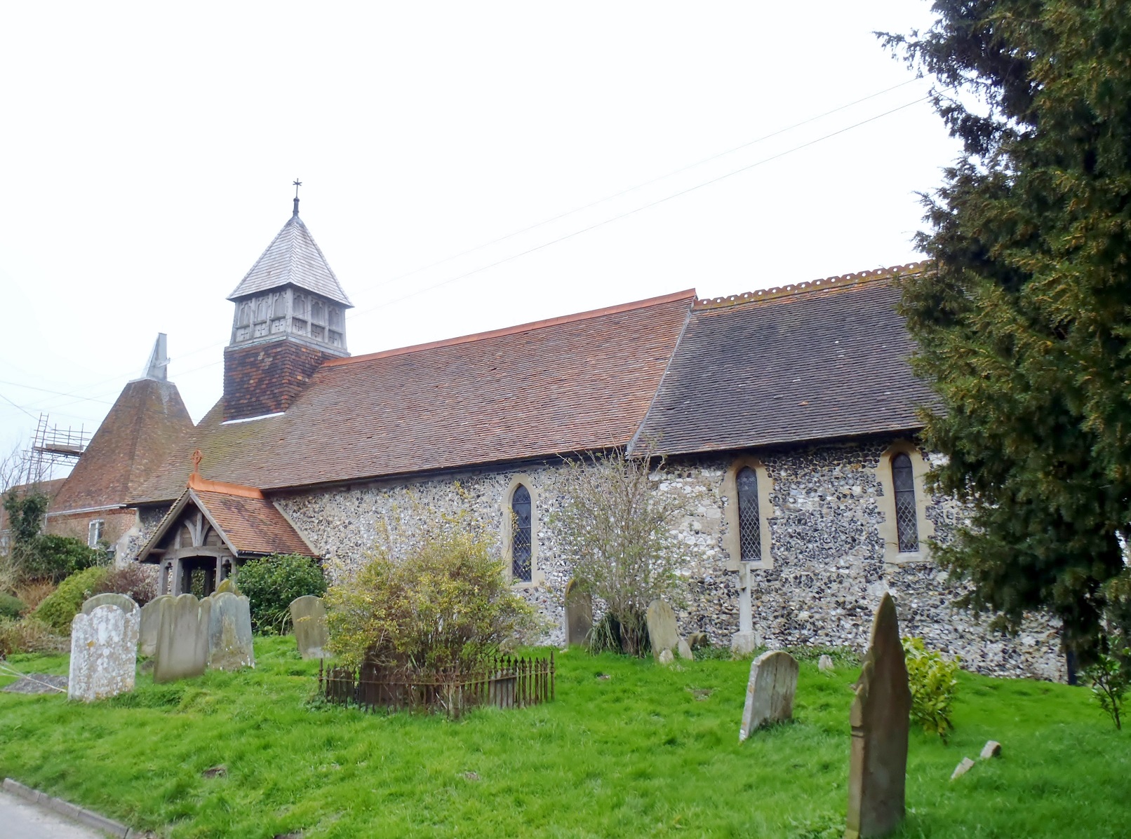
| Description | : | The church, dedicated to St Mary is small and consists of a single aisle and chancel. It has a low pointed turret at the western end containing two bells. This church was originally part of the possessions of the abbey at Canterbury, and remained so until 1243, when the abbot Robert, at the instance of archdeacon Simon de Langton, granted it to the hospital of poor priests in Canterbury, together with four acres of Stodmarsh, on the condition that they should not demand in future any tithes from the abbey. When the hospital was dissolved in 1575 Elizabeth I gave all... Read More |
frequently asked questions (FAQ):
-
Where is Stodmarsh St Marys Churchyard?
Stodmarsh St Marys Churchyard is located at Stodmarsh Road Wickhambreaux, City of Canterbury ,Kent , CT3 4BAEngland.
-
Stodmarsh St Marys Churchyard cemetery's updated grave count on graveviews.com?
10 memorials
-
Where are the coordinates of the Stodmarsh St Marys Churchyard?
Latitude: 51.3009500
Longitude: 1.1836900
Nearby Cemetories:
1. St Andrew Churchyard
Wickhambreaux, City of Canterbury, England
Coordinate: 51.2844400, 1.1822300
2. St Mildred Churchyard
Preston, Dover District, England
Coordinate: 51.2985000, 1.2173980
3. All Saints Churchyard
Westbere, City of Canterbury, England
Coordinate: 51.3065380, 1.1437670
4. St Mary The Virgin Churchyard
Chislet, City of Canterbury, England
Coordinate: 51.3343610, 1.1921020
5. St Mary the Virgin Churchyard
Wingham, Dover District, England
Coordinate: 51.2721220, 1.2128950
6. Sturry Cemetery
Sturry, City of Canterbury, England
Coordinate: 51.3058100, 1.1277700
7. St Mary the Virgin Churchyard
Fordwich, City of Canterbury, England
Coordinate: 51.2958300, 1.1270530
8. Elmstone Churchyard
Preston, Dover District, England
Coordinate: 51.2967160, 1.2424980
9. All Saints Churchyard
Stourmouth, Dover District, England
Coordinate: 51.3202600, 1.2365520
10. St Nicholas Churchyard
Sturry, City of Canterbury, England
Coordinate: 51.2984830, 1.1201330
11. St Peter Churchyard
Bekesbourne, City of Canterbury, England
Coordinate: 51.2563430, 1.1445750
12. St Mary Churchyard
Patrixbourne, City of Canterbury, England
Coordinate: 51.2534430, 1.1364840
13. St James the Great Churchyard
Staple, Dover District, England
Coordinate: 51.2636300, 1.2515200
14. Holy Innocents Churchyard
Adisham, City of Canterbury, England
Coordinate: 51.2440380, 1.1903320
15. St Martin's Churchyard
Herne, City of Canterbury, England
Coordinate: 51.3497060, 1.1334370
16. St Martins
Herne, City of Canterbury, England
Coordinate: 51.3500600, 1.1333200
17. St Martin Churchyard
Canterbury, City of Canterbury, England
Coordinate: 51.2780170, 1.0937160
18. Holy Cross
Goodnestone, Dover District, England
Coordinate: 51.2457190, 1.2290550
19. St Gregory Churchyard
Canterbury, City of Canterbury, England
Coordinate: 51.2816050, 1.0887840
20. St. Nicholas Churchyard
Ash, Dover District, England
Coordinate: 51.2786800, 1.2786400
21. St Gregory's Priory (defunct)
Canterbury, City of Canterbury, England
Coordinate: 51.2831127, 1.0855358
22. St Augustine Abbey Ruins
Canterbury, City of Canterbury, England
Coordinate: 51.2781280, 1.0882060
23. St Mary Northgate Cemetery
Canterbury, City of Canterbury, England
Coordinate: 51.2811320, 1.0859300
24. St. John the Baptist Hospital Chapelyard
Canterbury, City of Canterbury, England
Coordinate: 51.2832713, 1.0837677