
| Memorials | : | 89 |
| Location | : | Wingham, Dover District, England |
| Coordinate | : | 51.2721220, 1.2128950 |
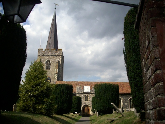
| Description | : | The distinctive needle spire of St Mary's Church can be seen for miles; it used to be bright green with verdigris, but the new copper applied in the restoration of a few years ago is still a sober brown. The tower it crowns is 14th century, and dates from soon after the building's origins as a collegiate church. The chancel is very large; the nave is divided from the north aisle by a row of huge wooden pillars (five chestnuts and one oak) placed there 400 years ago during an early restoration. The north chapel, which houses a handsome 17th... Read More |
frequently asked questions (FAQ):
-
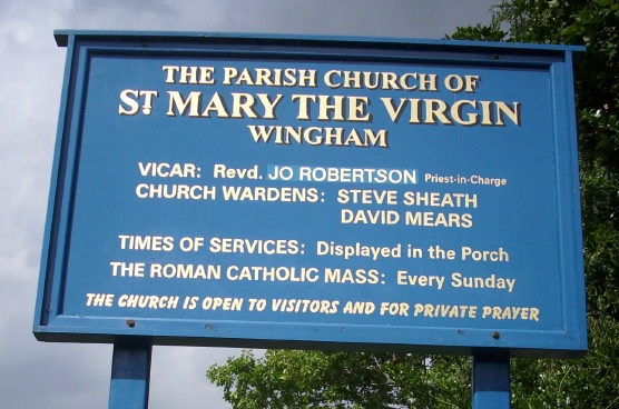
Where is St Mary the Virgin Churchyard?
St Mary the Virgin Churchyard is located at Canterbury Road Wingham, Dover District ,Kent , CT3 1BBEngland.
-
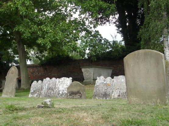
St Mary the Virgin Churchyard cemetery's updated grave count on graveviews.com?
89 memorials
-
Where are the coordinates of the St Mary the Virgin Churchyard?
Latitude: 51.2721220
Longitude: 1.2128950

Nearby Cemetories:
1. St Andrew Churchyard
Wickhambreaux, City of Canterbury, England
Coordinate: 51.2844400, 1.1822300
2. St James the Great Churchyard
Staple, Dover District, England
Coordinate: 51.2636300, 1.2515200
3. St Mildred Churchyard
Preston, Dover District, England
Coordinate: 51.2985000, 1.2173980
4. Holy Cross
Goodnestone, Dover District, England
Coordinate: 51.2457190, 1.2290550
5. Elmstone Churchyard
Preston, Dover District, England
Coordinate: 51.2967160, 1.2424980
6. Holy Innocents Churchyard
Adisham, City of Canterbury, England
Coordinate: 51.2440380, 1.1903320
7. Stodmarsh St Marys Churchyard
Wickhambreaux, City of Canterbury, England
Coordinate: 51.3009500, 1.1836900
8. St. Nicholas Churchyard
Ash, Dover District, England
Coordinate: 51.2786800, 1.2786400
9. St Peter Churchyard
Bekesbourne, City of Canterbury, England
Coordinate: 51.2563430, 1.1445750
10. St Mary the Virgin Churchyard
Nonington, Dover District, England
Coordinate: 51.2258300, 1.2253800
11. St Clement Church
Knowlton, Dover District, England
Coordinate: 51.2348930, 1.2652130
12. All Saints Churchyard
Stourmouth, Dover District, England
Coordinate: 51.3202600, 1.2365520
13. St Mary Churchyard
Patrixbourne, City of Canterbury, England
Coordinate: 51.2534430, 1.1364840
14. All Saints Churchyard
Westbere, City of Canterbury, England
Coordinate: 51.3065380, 1.1437670
15. St Mary the Virgin Churchyard
Fordwich, City of Canterbury, England
Coordinate: 51.2958300, 1.1270530
16. Saint Mary The Virgin Churchyard
Woodnesborough, Dover District, England
Coordinate: 51.2628240, 1.3073810
17. St Peter Churchyard
Bridge, City of Canterbury, England
Coordinate: 51.2443730, 1.1271000
18. Sturry Cemetery
Sturry, City of Canterbury, England
Coordinate: 51.3058100, 1.1277700
19. St Margaret of Antioch Churchyard
Womenswold, City of Canterbury, England
Coordinate: 51.2109850, 1.1878090
20. Aylesham Cemetery
Aylesham, Dover District, England
Coordinate: 51.2126910, 1.1781980
21. St Mary The Virgin Churchyard
Chislet, City of Canterbury, England
Coordinate: 51.3343610, 1.1921020
22. St Nicholas Churchyard
Sturry, City of Canterbury, England
Coordinate: 51.2984830, 1.1201330
23. St Mary Churchyard
Bishopsbourne, City of Canterbury, England
Coordinate: 51.2307620, 1.1323170
24. St Mary the Virgin Churchyard
Eastry, Dover District, England
Coordinate: 51.2453000, 1.3100000