
| Memorials | : | 0 |
| Location | : | Preston, Dover District, England |
| Coordinate | : | 51.2967160, 1.2424980 |
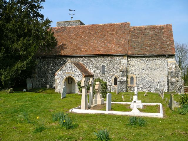
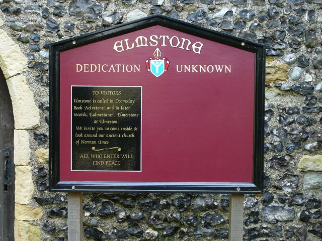
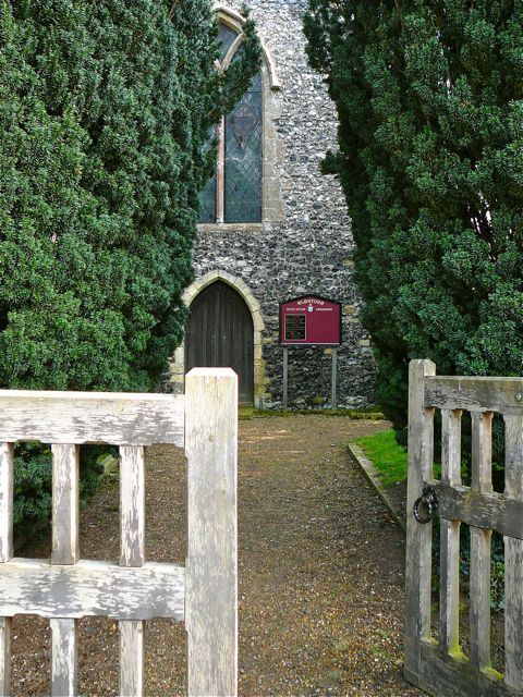
| Description | : | Elmstone is a tiny hamlet, that was nonetheless recorded in the Domesday Book. The church, whose dedication has been lost, stands at a quiet crossroads, surrounded by fields. It is early Norman in origin, with a low west tower with three bells, which originally carried inscriptions referring to William Gibbs, Churchwarden, in 1712. The flints of which the church is built unusually have no interior stone dressings around the windows. There is a fine Norman font, and some colourful glass, both mediaeval and Victorian, though the church is not often unlocked. The churchyard is still in use for burials. (Text by... Read More |
frequently asked questions (FAQ):
-
Where is Elmstone Churchyard?
Elmstone Churchyard is located at Sheerwater Road, Elmstone Preston, Dover District ,Kent , CT3 1HHEngland.
-
Elmstone Churchyard cemetery's updated grave count on graveviews.com?
0 memorials
-
Where are the coordinates of the Elmstone Churchyard?
Latitude: 51.2967160
Longitude: 1.2424980
Nearby Cemetories:
1. St Mildred Churchyard
Preston, Dover District, England
Coordinate: 51.2985000, 1.2173980
2. All Saints Churchyard
Stourmouth, Dover District, England
Coordinate: 51.3202600, 1.2365520
3. St. Nicholas Churchyard
Ash, Dover District, England
Coordinate: 51.2786800, 1.2786400
4. St Mary the Virgin Churchyard
Wingham, Dover District, England
Coordinate: 51.2721220, 1.2128950
5. St James the Great Churchyard
Staple, Dover District, England
Coordinate: 51.2636300, 1.2515200
6. Stodmarsh St Marys Churchyard
Wickhambreaux, City of Canterbury, England
Coordinate: 51.3009500, 1.1836900
7. St Andrew Churchyard
Wickhambreaux, City of Canterbury, England
Coordinate: 51.2844400, 1.1822300
8. St Mary The Virgin Churchyard
Chislet, City of Canterbury, England
Coordinate: 51.3343610, 1.1921020
9. Holy Cross
Goodnestone, Dover District, England
Coordinate: 51.2457190, 1.2290550
10. Saint Mary The Virgin Churchyard
Woodnesborough, Dover District, England
Coordinate: 51.2628240, 1.3073810
11. St Mary the Virgin Church
Minster-in-Thanet, Thanet District, England
Coordinate: 51.3305810, 1.3156720
12. St. Nicholas' Churchyard
St Nicholas at Wade, Thanet District, England
Coordinate: 51.3542160, 1.2517980
13. St Nicholas-at-Wade Cemetery
St Nicholas at Wade, Thanet District, England
Coordinate: 51.3578344, 1.2534168
14. Holy Innocents Churchyard
Adisham, City of Canterbury, England
Coordinate: 51.2440380, 1.1903320
15. All Saints Churchyard
Westbere, City of Canterbury, England
Coordinate: 51.3065380, 1.1437670
16. St .Mary's Churchyard
Sandwich, Dover District, England
Coordinate: 51.2771930, 1.3386580
17. St Clement Church
Knowlton, Dover District, England
Coordinate: 51.2348930, 1.2652130
18. Minster Cemetery
Minster-in-Thanet, Thanet District, England
Coordinate: 51.3423100, 1.3160550
19. St. Peter's Churchyard
Sandwich, Dover District, England
Coordinate: 51.2747680, 1.3405120
20. St Mary the Virgin Churchyard
Eastry, Dover District, England
Coordinate: 51.2453000, 1.3100000
21. St Clement's Church
Sandwich, Dover District, England
Coordinate: 51.2736510, 1.3427270
22. St Mary the Virgin Churchyard
Nonington, Dover District, England
Coordinate: 51.2258300, 1.2253800
23. St Mary the Virgin Churchyard
Fordwich, City of Canterbury, England
Coordinate: 51.2958300, 1.1270530
24. Sturry Cemetery
Sturry, City of Canterbury, England
Coordinate: 51.3058100, 1.1277700