
| Memorials | : | 0 |
| Location | : | Upper Heyford, Cherwell District, England |
| Coordinate | : | 51.9290710, -1.2819670 |
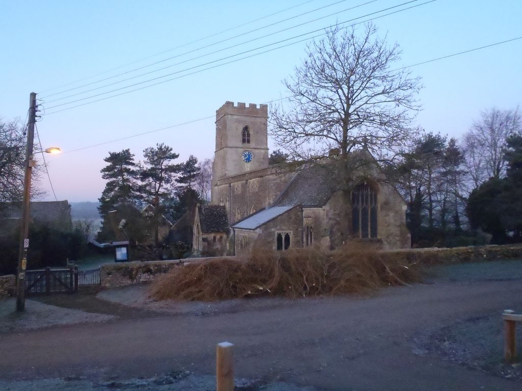
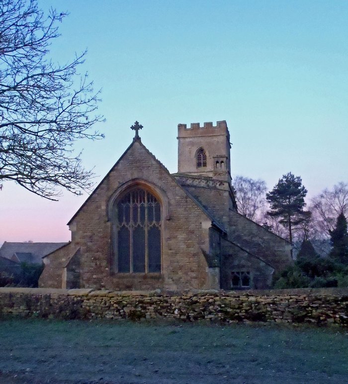
| Description | : | Upper Heyford is on the east bank of the River Cherwell. "Upper" distinguishes it from Lower Heyford which is about 1 mile (1.6 km) "lower", downstream along the Cherwell valley. Nearby is Upper Heyford Cemetery The village had a church by AD 1074.The current Church of England parish church of Saint Mary may have been rebuilt in the latter part of the 15th century, but only the Perpendicular Gothic tower survives from that time. Major repairs to the roof and south aisle were made in 1668 and 1769, but by the 1860s the nave and chancel were in a poor condition again.... Read More |
frequently asked questions (FAQ):
-
Where is St Marys Churchyard?
St Marys Churchyard is located at Church Walk Upper Heyford, Cherwell District ,Oxfordshire , OX25 5LQEngland.
-
St Marys Churchyard cemetery's updated grave count on graveviews.com?
0 memorials
-
Where are the coordinates of the St Marys Churchyard?
Latitude: 51.9290710
Longitude: -1.2819670
Nearby Cemetories:
1. Upper Heyford Cemetery
Upper Heyford, Cherwell District, England
Coordinate: 51.9294701, -1.2808000
2. St Mary Churchyard
Lower Heyford, Cherwell District, England
Coordinate: 51.9202580, -1.2960220
3. SS Peter and Paul Churchyard
Steeple Aston, Cherwell District, England
Coordinate: 51.9311350, -1.3091000
4. St Leonard and St James Churchyard
Rousham, West Oxfordshire District, England
Coordinate: 51.9139780, -1.3037790
5. St James Churchyard
Somerton, Cherwell District, England
Coordinate: 51.9539990, -1.2786200
6. St Marys Churchyard
North Aston, Cherwell District, England
Coordinate: 51.9562960, -1.3020350
7. All Saints Churchyard
Middleton Stoney, Cherwell District, England
Coordinate: 51.9053470, -1.2295300
8. St Olave Churchyard
Fritwell, Cherwell District, England
Coordinate: 51.9596980, -1.2381180
9. Fritwell Parish Council Cemetery
Fritwell, Cherwell District, England
Coordinate: 51.9599490, -1.2380650
10. St Mary Magdelene Churchyard
Duns Tew, Cherwell District, England
Coordinate: 51.9528350, -1.3363090
11. Steeple Barton Churchyard
Steeple Barton, West Oxfordshire District, England
Coordinate: 51.9207670, -1.3498060
12. Fewcott All Saints Churchyard
Albury, South Oxfordshire District, England
Coordinate: 51.9477100, -1.2170700
13. St. Mary's Churchyard
Ardley, Cherwell District, England
Coordinate: 51.9422140, -1.2122580
14. St. Nicholas Churchyard
Tackley, West Oxfordshire District, England
Coordinate: 51.8782400, -1.3102910
15. St. Edward the Confessor Churchyard
Westcot Barton, West Oxfordshire District, England
Coordinate: 51.9280100, -1.3747200
16. St Mary the Virgin Churchyard
Kirtlington, Cherwell District, England
Coordinate: 51.8718610, -1.2742740
17. Ss Peter and Paul Churchyard
Deddington, Cherwell District, England
Coordinate: 51.9817680, -1.3207470
18. St Mary the Virgin Churchyard
Souldern, Cherwell District, England
Coordinate: 51.9808600, -1.2399900
19. St Peter's Churchyard
Bucknell, Cherwell District, England
Coordinate: 51.9263400, -1.1861700
20. Deddington Cemetery
Deddington, Cherwell District, England
Coordinate: 51.9824490, -1.3338930
21. Holy Trinity Churchyard
Over Worton, West Oxfordshire District, England
Coordinate: 51.9598240, -1.3753620
22. St Michael Churchyard
Aynho, South Northamptonshire Borough, England
Coordinate: 51.9936080, -1.2522380
23. St Martins Churchyard
Sandford St Martin, West Oxfordshire District, England
Coordinate: 51.9371500, -1.3901400
24. St Peters Churchyard
Stoke Lyne, Cherwell District, England
Coordinate: 51.9505340, -1.1771680