
| Memorials | : | 6 |
| Location | : | Middleton Stoney, Cherwell District, England |
| Coordinate | : | 51.9053470, -1.2295300 |
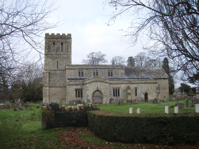
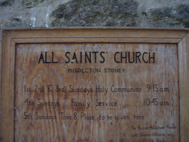
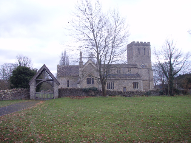
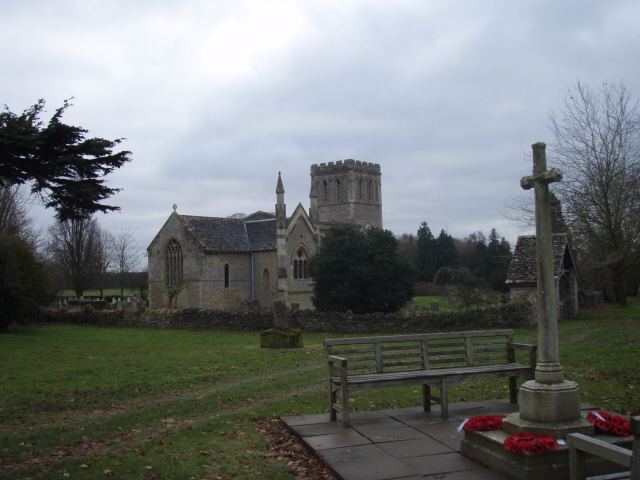
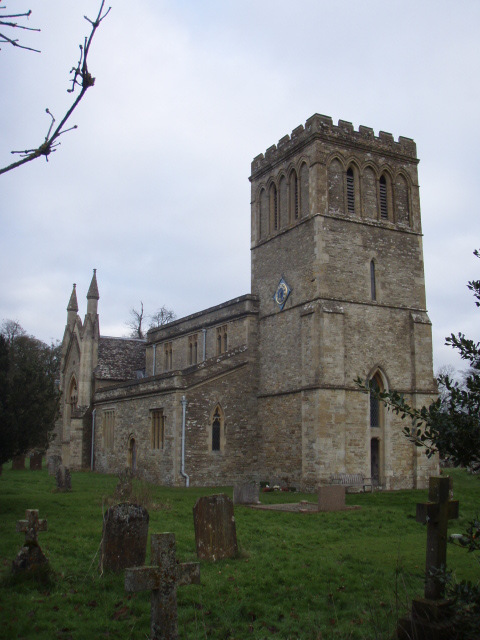
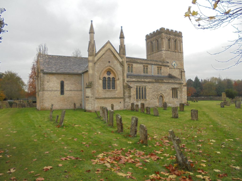
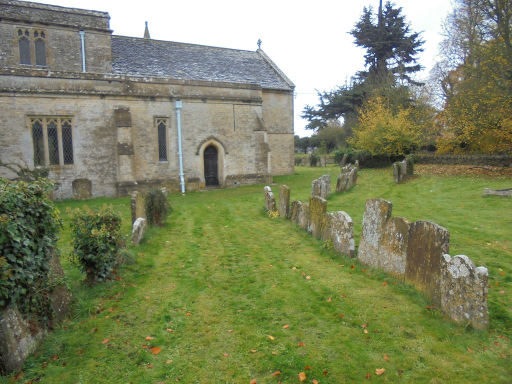
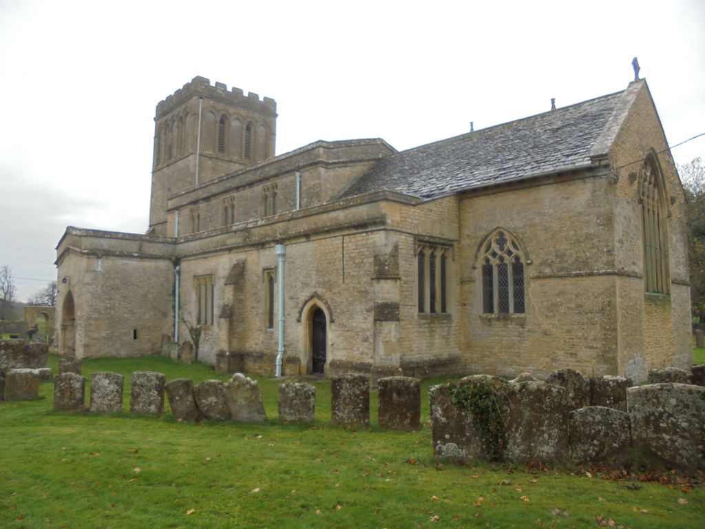
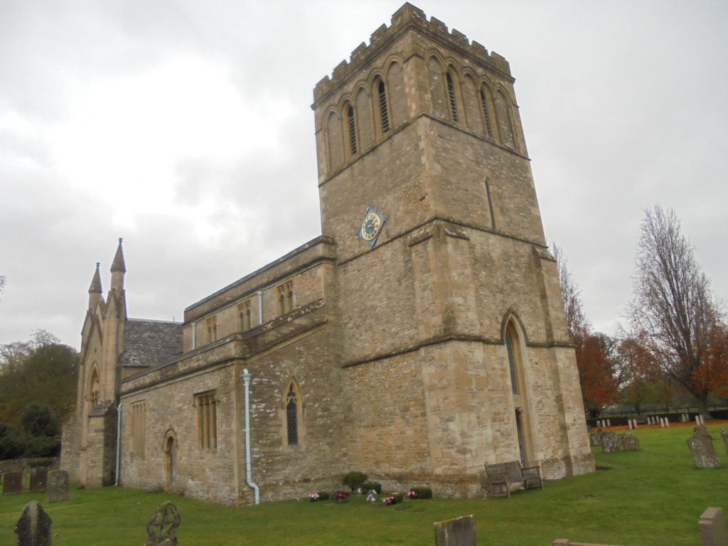
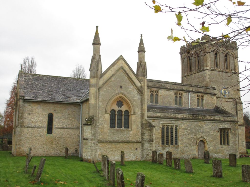
| Description | : | The earliest parts of the Church of England parish church of All Saints are Norman, dating from the middle of the 12th century. The bell tower has a ring of five bells, all cast in 1717 by Henry Bagley of Chacombe. The tenor bell was recast in 1883. Middleton Stoney had a motte-and-bailey castle, which was first recorded in 1215. Its remains are east of All Saints Church. The parish's common lands were enclosed at the end of the 17th century. In 1824-25 George Child Villiers, 5th Earl of Jersey demolished the original village and manor house... Read More |
frequently asked questions (FAQ):
-
Where is All Saints Churchyard?
All Saints Churchyard is located at Middleton Park Middleton Stoney, Cherwell District ,Oxfordshire ,England.
-
All Saints Churchyard cemetery's updated grave count on graveviews.com?
6 memorials
-
Where are the coordinates of the All Saints Churchyard?
Latitude: 51.9053470
Longitude: -1.2295300
Nearby Cemetories:
1. St Mary Churchyard
Chesterton, Cherwell District, England
Coordinate: 51.8879880, -1.1851540
2. St Peter's Churchyard
Bucknell, Cherwell District, England
Coordinate: 51.9263400, -1.1861700
3. St. Mary's Churchyard
Ardley, Cherwell District, England
Coordinate: 51.9422140, -1.2122580
4. Upper Heyford Cemetery
Upper Heyford, Cherwell District, England
Coordinate: 51.9294701, -1.2808000
5. St Marys Churchyard
Upper Heyford, Cherwell District, England
Coordinate: 51.9290710, -1.2819670
6. St Giles Churchyard
Wendlebury, Cherwell District, England
Coordinate: 51.8730580, -1.1901000
7. St Marys Churchyard
Weston-on-the-Green, Cherwell District, England
Coordinate: 51.8632420, -1.2302540
8. Fewcott All Saints Churchyard
Albury, South Oxfordshire District, England
Coordinate: 51.9477100, -1.2170700
9. St Mary the Virgin Churchyard
Kirtlington, Cherwell District, England
Coordinate: 51.8718610, -1.2742740
10. St Mary Churchyard
Lower Heyford, Cherwell District, England
Coordinate: 51.9202580, -1.2960220
11. St Leonard and St James Churchyard
Rousham, West Oxfordshire District, England
Coordinate: 51.9139780, -1.3037790
12. Bicester Town Cemetery
Bicester, Cherwell District, England
Coordinate: 51.8945880, -1.1553730
13. St Edburg Churchyard
Bicester, Cherwell District, England
Coordinate: 51.8960060, -1.1541930
14. St Laurence Churchyard
Caversfield, Cherwell District, England
Coordinate: 51.9223030, -1.1571690
15. Independent Chapel Cemetery
Bicester, Cherwell District, England
Coordinate: 51.8960550, -1.1514940
16. Bicester Priory
Bicester, Cherwell District, England
Coordinate: 51.9000000, -1.1500000
17. St Giles Churchyard and Extension
Bletchingdon, Cherwell District, England
Coordinate: 51.8582500, -1.2655500
18. St Olave Churchyard
Fritwell, Cherwell District, England
Coordinate: 51.9596980, -1.2381180
19. Fritwell Parish Council Cemetery
Fritwell, Cherwell District, England
Coordinate: 51.9599490, -1.2380650
20. SS Peter and Paul Churchyard
Steeple Aston, Cherwell District, England
Coordinate: 51.9311350, -1.3091000
21. St Peters Churchyard
Stoke Lyne, Cherwell District, England
Coordinate: 51.9505340, -1.1771680
22. St. Nicholas Churchyard
Tackley, West Oxfordshire District, England
Coordinate: 51.8782400, -1.3102910
23. St James Churchyard
Somerton, Cherwell District, England
Coordinate: 51.9539990, -1.2786200
24. St Swithuns Churchyard
Merton, Cherwell District, England
Coordinate: 51.8559670, -1.1633060