
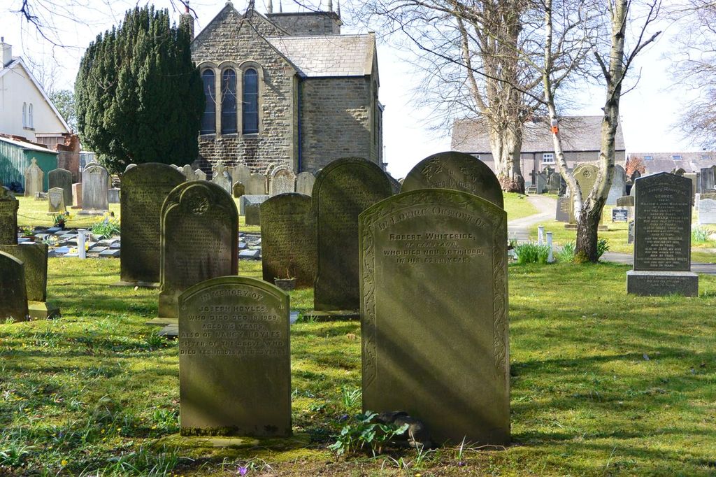
| Memorials | : | 94 |
| Location | : | Garstang, Wyre Borough, England |
| Coordinate | : | 53.8992300, -2.7764500 |
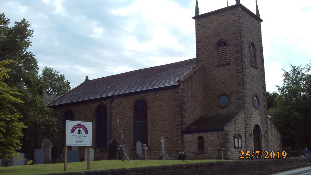
| Description | : | The church was founded in 1327. The first Chapel of Ease was erected in 1327 on a site to the rear of the High Sreet; this was demolished and replaced by a new chapel in 1770. It occupies a plot in present day Church Street, which until then had been known as Tythe Barn Lane. It was first known as "All Saints Chapel,of Ease" and became St Thomas' Church in 1848. The Parish was established in 1881 as a separate entity to St Helens Church at Churchtown, some two miles to the SW of the town, and the main Anglican... Read More |
frequently asked questions (FAQ):
-
Where is St. Thomas Churchyard?
St. Thomas Churchyard is located at Church Street Garstang, Wyre Borough ,Lancashire , PR3 1PAEngland.
-
St. Thomas Churchyard cemetery's updated grave count on graveviews.com?
94 memorials
-
Where are the coordinates of the St. Thomas Churchyard?
Latitude: 53.8992300
Longitude: -2.7764500
Nearby Cemetories:
1. Garstang United Reformed Churchyard
Garstang, Wyre Borough, England
Coordinate: 53.9026500, -2.7747400
2. St Mary and St Michael Catholic Churchyard
Garstang, Wyre Borough, England
Coordinate: 53.8975610, -2.7706170
3. All Saints Parish Churchyard
Barnacre with Bonds, Wyre Borough, England
Coordinate: 53.9079120, -2.7430580
4. St. Helen's Churchyard
Kirkland (Churchtown), Wyre Borough, England
Coordinate: 53.8790700, -2.7901000
5. Kirkland Strict and Particular Baptist Chapel
Nateby, Wyre Borough, England
Coordinate: 53.8961210, -2.8170130
6. St. Peter's Churchyard
Garstang, Wyre Borough, England
Coordinate: 53.9309510, -2.7591190
7. St Thomas Churchyard
Claughton-on-Brock, Wyre Borough, England
Coordinate: 53.8752030, -2.7199160
8. St. Michael’s Churchyard
St Michael's on Wyre, Wyre Borough, England
Coordinate: 53.8628050, -2.8195430
9. St. Hilda's Churchyard
Bilsborrow, Wyre Borough, England
Coordinate: 53.8522170, -2.7420090
10. Forton United Reform Church Cemetery
Forton, Wyre Borough, England
Coordinate: 53.9547940, -2.7813920
11. St Paul's Churchyard
Forton, Wyre Borough, England
Coordinate: 53.9543760, -2.7605890
12. Saint Michael's and All Angels Church Cemetery
Cockerham, City of Lancaster, England
Coordinate: 53.9602092, -2.8204877
13. St. Peters Churchyard
Inskip with Sowerby, Wyre Borough, England
Coordinate: 53.8347100, -2.8175200
14. Church of St James
Goosnargh, City of Preston, England
Coordinate: 53.8657750, -2.6719410
15. Inskip Baptist Churchyard
Inskip with Sowerby, Wyre Borough, England
Coordinate: 53.8353150, -2.8299610
16. St Mary Roman Catholic Churchyard
Great Eccleston, Wyre Borough, England
Coordinate: 53.8535420, -2.8710090
17. St William of York Church
Pilling, Wyre Borough, England
Coordinate: 53.9235047, -2.8934617
18. St. Lawrence Churchyard
Barton, City of Preston, England
Coordinate: 53.8289213, -2.7366654
19. St. Eadmer's Churchyard
Bleasdale, Wyre Borough, England
Coordinate: 53.9040530, -2.6504390
20. St. John’s Churchyard
Out Rawcliffe, Wyre Borough, England
Coordinate: 53.8741650, -2.8959310
21. St. Mary's Chapel Ellel Grange
Ellel, City of Lancaster, England
Coordinate: 53.9756944, -2.7918522
22. St Mark Churchyard
Dolphinholme, City of Lancaster, England
Coordinate: 53.9738730, -2.7378420
23. St Anne Churchyard
Great Eccleston, Wyre Borough, England
Coordinate: 53.8481413, -2.8835925
24. St Mary's Newhouse
Barton, City of Preston, England
Coordinate: 53.8205240, -2.7406500