
| Memorials | : | 83 |
| Location | : | Stonegrave, Ryedale District, England |
| Coordinate | : | 54.1925011, -0.9966000 |
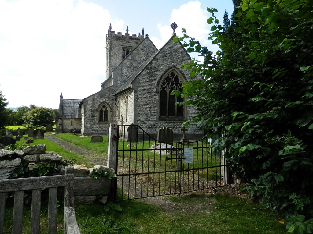
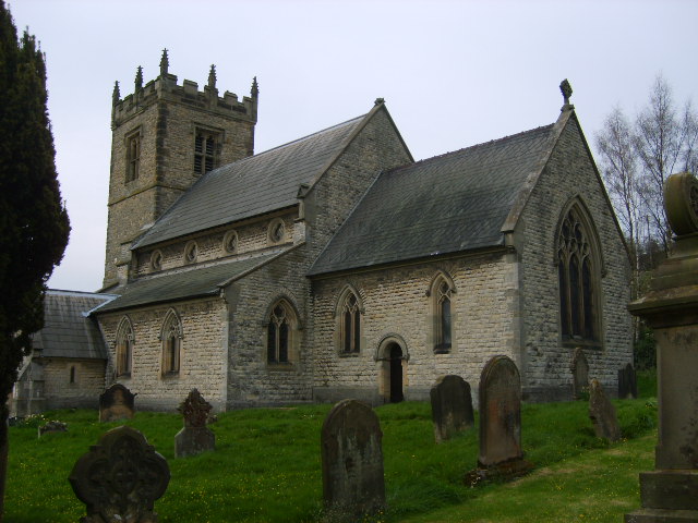
| Description | : | The Early Church: Stonegrave Minster had already been established by 757, when Pope Paul I wrote to Eadberht, King of Northumberland, about the appointment of an abbot. The minster had probably been founded by an earlier King of Northumberland and was staffed by priests of the tradition of Iona and Lindisfarne. The original church was a high and narrow rectangular structure. Today's west wall may be a remaining feature of this; its early date is shown by the proportions of the tall, narrow doorway, still centrally placed, which has a very roughly constructed arch above two irregular jambs. Such a high, narrow... Read More |
frequently asked questions (FAQ):
-
Where is Stonegrave Minster Churchyard?
Stonegrave Minster Churchyard is located at Stonegrave, Ryedale District ,North Yorkshire ,England.
-
Stonegrave Minster Churchyard cemetery's updated grave count on graveviews.com?
83 memorials
-
Where are the coordinates of the Stonegrave Minster Churchyard?
Latitude: 54.1925011
Longitude: -0.9966000

Nearby Cemetories:
1. All Saints and St James Church
Nunnington, Ryedale District, England
Coordinate: 54.2031000, -0.9806000
2. Hovingham Cemetery
Hovingham, Ryedale District, England
Coordinate: 54.1753500, -0.9808900
3. All Saints Churchyard
Hovingham, Ryedale District, England
Coordinate: 54.1728980, -0.9801260
4. St Oswald Churchyard
Oswaldkirk, Ryedale District, England
Coordinate: 54.2022340, -1.0495510
5. Gilling New Churchyard
Gilling East, Ryedale District, England
Coordinate: 54.1856070, -1.0559535
6. Holy Cross Churchyard
Gilling East, Ryedale District, England
Coordinate: 54.1841290, -1.0580460
7. St Saviour Churchyard
Harome, Ryedale District, England
Coordinate: 54.2302000, -1.0088000
8. Harome Village Cemetery
Harome, Ryedale District, England
Coordinate: 54.2308650, -1.0096380
9. All Saints Churchyard
Slingsby, Ryedale District, England
Coordinate: 54.1655800, -0.9342900
10. St George the Martyr Churchyard
Scackleton, Ryedale District, England
Coordinate: 54.1457520, -1.0066750
11. Slingsby Cemetery
Slingsby, Ryedale District, England
Coordinate: 54.1650600, -0.9256700
12. Ampleforth Abbey
Ampleforth, Ryedale District, England
Coordinate: 54.2019630, -1.0838000
13. Ampleforth Abbey - Monk's Wood
Ampleforth, Ryedale District, England
Coordinate: 54.2028689, -1.0841344
14. St. John of Beverley Parish Churchyard
Salton, Ryedale District, England
Coordinate: 54.2105680, -0.9028560
15. St Peter Churchyard
Dalby, Hambleton District, England
Coordinate: 54.1329290, -1.0262920
16. Our Lady & St Benedict RC Churchyard
Ampleforth, Ryedale District, England
Coordinate: 54.2009700, -1.1055400
17. St Hilda Churchyard
Ampleforth, Ryedale District, England
Coordinate: 54.2000630, -1.1075590
18. Rievaulx Abbey
Helmsley, Ryedale District, England
Coordinate: 54.2449170, -1.0639570
19. All Saints Churchyard
Terrington, Ryedale District, England
Coordinate: 54.1282770, -0.9735330
20. All Saints Churchyard
Helmsley, Ryedale District, England
Coordinate: 54.2469000, -1.0625000
21. St Michael Churchyard
Barton-le-Street, Ryedale District, England
Coordinate: 54.1587100, -0.8969600
22. Helmsley Town Cemetery
Helmsley, Ryedale District, England
Coordinate: 54.2483300, -1.0620300
23. Holy Trinity Churchyard
Yearsley, Hambleton District, England
Coordinate: 54.1619100, -1.1052300
24. Terrington Burial Ground
Terrington, Ryedale District, England
Coordinate: 54.1231640, -0.9717280