
| Memorials | : | 0 |
| Location | : | Brownfield, Oxford County, USA |
| Coordinate | : | 43.9546000, -70.9561500 |
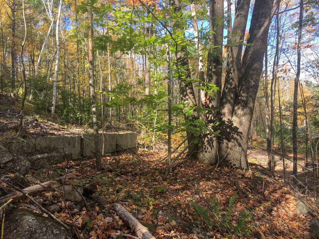
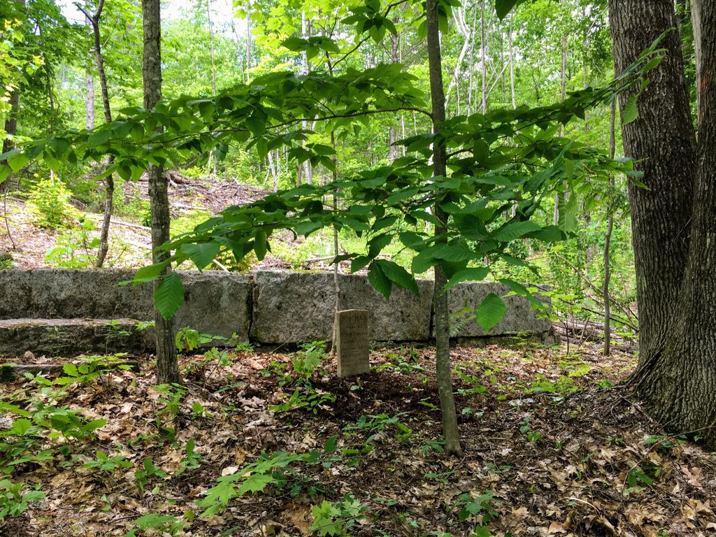
| Description | : | From its intersection with Tibbetts Mountain Road, drive south on Haley Town Road less than 0.1 miles. Granite walls of the cemetery can be seen on the right (west) side of the road about 100' in. Recent logging makes it visible, though one large oak tree still stands in the middle. Thomas Cotton lived on the southwest corner of Haleytown Road and Tibbetts Mountain Road, which was near the cemetery. Old records list that his wife Sarah and son Thomas Jr. are buried here. They also state that a child of a Mr. White who lived with the Cotton family (1812... Read More |
frequently asked questions (FAQ):
-
Where is Thomas Cotton Cemetery?
Thomas Cotton Cemetery is located at Brownfield, Oxford County ,Maine ,USA.
-
Thomas Cotton Cemetery cemetery's updated grave count on graveviews.com?
0 memorials
-
Where are the coordinates of the Thomas Cotton Cemetery?
Latitude: 43.9546000
Longitude: -70.9561500
Nearby Cemetories:
1. Marston Cemetery
Brownfield, Oxford County, USA
Coordinate: 43.9664001, -70.9539032
2. Edwin Hill Cemetery
Brownfield, Oxford County, USA
Coordinate: 43.9372900, -70.9454100
3. Wentworth-Brown Cemetery
Brownfield, Oxford County, USA
Coordinate: 43.9317200, -70.9555100
4. Isaac Johnson Cemetery
Brownfield, Oxford County, USA
Coordinate: 43.9321500, -70.9356200
5. Merrill Cemetery
Brownfield, Oxford County, USA
Coordinate: 43.9284000, -70.9423100
6. Greenlaw Cemetery
Brownfield, Oxford County, USA
Coordinate: 43.9263992, -70.9677963
7. Dennett Cemetery
Brownfield, Oxford County, USA
Coordinate: 43.9289700, -70.9931000
8. Brown-Johnson Cemetery
Brownfield, Oxford County, USA
Coordinate: 43.9163710, -70.9617450
9. Pine Grove Cemetery
Brownfield, Oxford County, USA
Coordinate: 43.9375000, -70.9041977
10. George Hart Cemetery
Eaton Center, Carroll County, USA
Coordinate: 43.9161600, -70.9950900
11. Gray Gravesite
Eaton Center, Carroll County, USA
Coordinate: 43.9227780, -71.0058330
12. Blake Cemetery
Brownfield, Oxford County, USA
Coordinate: 43.9063988, -70.9514008
13. Joseph Meserve Cemetery
Brownfield, Oxford County, USA
Coordinate: 43.9104300, -70.9854200
14. Sterling Cemetery
Conway, Carroll County, USA
Coordinate: 43.9563000, -71.0242000
15. Ricker Cemetery
Brownfield, Oxford County, USA
Coordinate: 43.9061540, -70.9425500
16. Davis Hill Cemetery
Conway, Carroll County, USA
Coordinate: 43.9727700, -71.0214000
17. Bean-West Cemetery
Wentworth Location, Coos County, USA
Coordinate: 43.9472220, -71.0280560
18. Burnt Meadow Cemetery
Brownfield, Oxford County, USA
Coordinate: 43.9458008, -70.8843994
19. Frank Hart Cemetery
Eaton Center, Carroll County, USA
Coordinate: 43.9145100, -71.0039600
20. Thurston-Meserve Cemetery
Eaton, Carroll County, USA
Coordinate: 43.9105100, -71.0027800
21. Hatch Perkins Cemetery
Eaton Center, Carroll County, USA
Coordinate: 43.9181000, -71.0170000
22. Quint Cemetery
Brownfield, Oxford County, USA
Coordinate: 43.8984700, -70.9408400
23. Thom Cemetery
Conway, Carroll County, USA
Coordinate: 43.9998660, -71.0105810
24. Osgood Cemetery
Conway, Carroll County, USA
Coordinate: 43.9999000, -71.0106000