
| Memorials | : | 15 |
| Location | : | Monk Fryston, Selby District, England |
| Coordinate | : | 53.7618300, -1.2349700 |
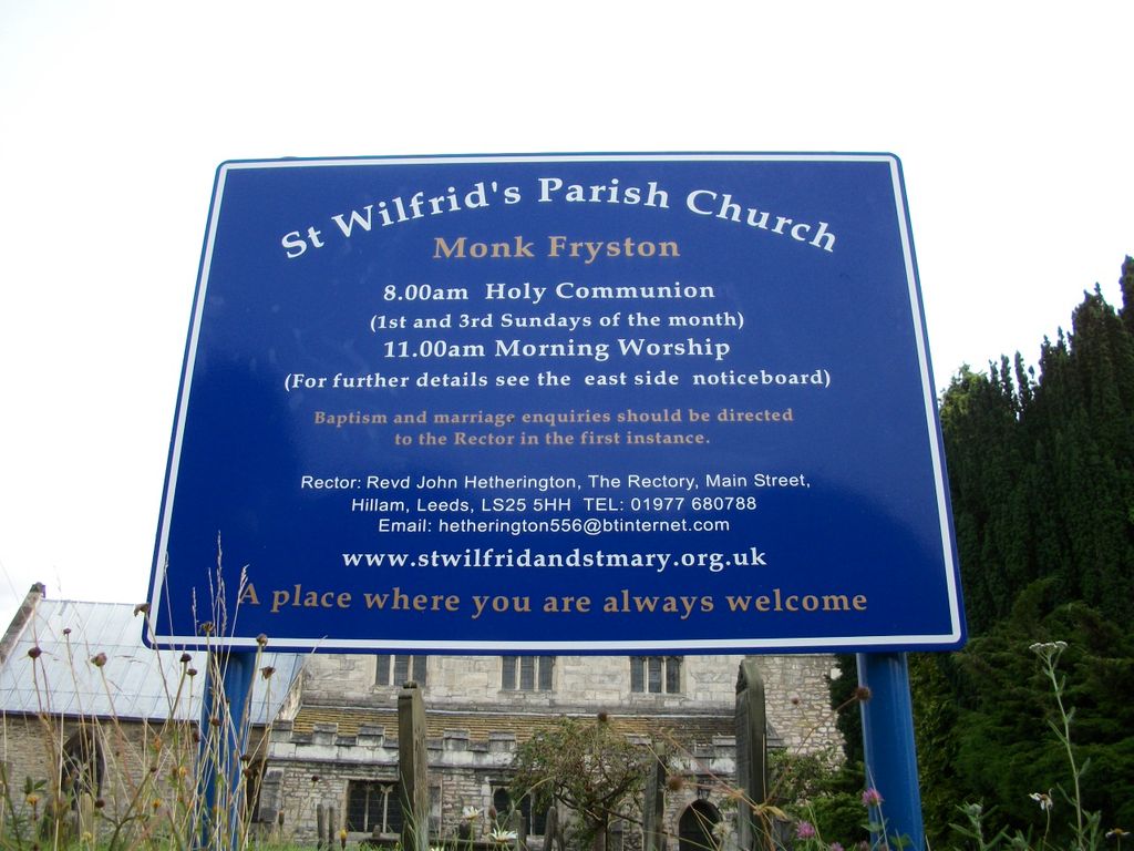
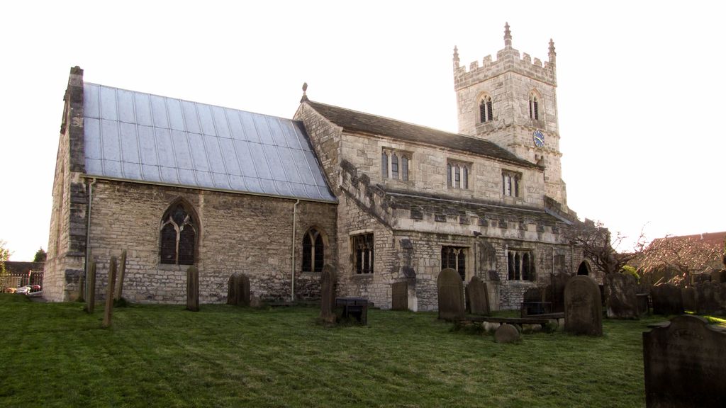
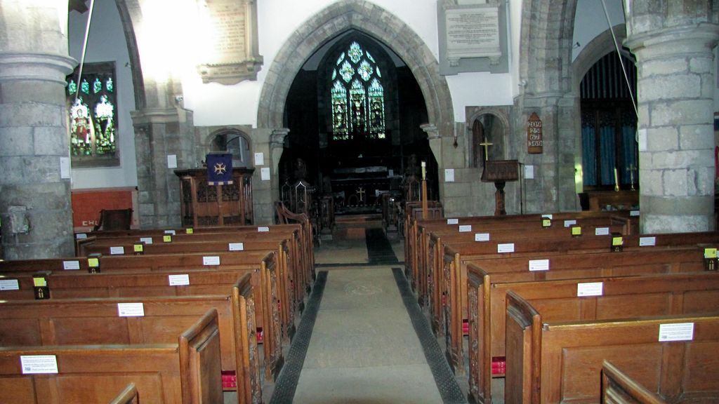
| Description | : | The Anglican parish church of St. Wilfrid, on Main Street, Monk Fryston stands centrally in the village, looking across to Monk Fryston Hall, former home of the Hemsworth family, through whose generosity the church was restored in the late 19th century. There is evidence that a pre-conquest (1066) church existed on the present site. There is documentary proof suggesting the church was originally dedicated to St. Mary. The current church dates from the 13th century with building work across the ages. A major restoration took place in 1889-91 by J. Hall Thorp & Son of Leeds under the... Read More |
frequently asked questions (FAQ):
-
Where is St Wilfrid’s Churchyard?
St Wilfrid’s Churchyard is located at Church Lane Monk Fryston, Selby District ,North Yorkshire , LS25 5DUEngland.
-
St Wilfrid’s Churchyard cemetery's updated grave count on graveviews.com?
15 memorials
-
Where are the coordinates of the St Wilfrid’s Churchyard?
Latitude: 53.7618300
Longitude: -1.2349700
Nearby Cemetories:
1. Monk Fryston Cemetery
Monk Fryston, Selby District, England
Coordinate: 53.7604400, -1.2291700
2. St Mary the Virgin Churchyard
South Milford, Selby District, England
Coordinate: 53.7771700, -1.2547300
3. St James Churchyard
Fairburn, Selby District, England
Coordinate: 53.7426700, -1.2841000
4. St Mary Churchyard
Birkin, Selby District, England
Coordinate: 53.7325000, -1.1979000
5. All Saints Churchyard
Sherburn-in-Elmet, Selby District, England
Coordinate: 53.7956000, -1.2605740
6. Brotherton United Reformed Church
Brotherton, Selby District, England
Coordinate: 53.7277104, -1.2698131
7. St Edward the Confessor Churchyard
Brotherton, Selby District, England
Coordinate: 53.7259200, -1.2709600
8. All Saints Churchyard
Ledsham, Metropolitan Borough of Leeds, England
Coordinate: 53.7622160, -1.3091920
9. Hambleton Cemetery
Hambleton, Selby District, England
Coordinate: 53.7715910, -1.1624600
10. St Mary Churchyard
Hambleton, Selby District, England
Coordinate: 53.7715910, -1.1624600
11. St. Andrew's Old Churchyard
Ferrybridge, Metropolitan Borough of Wakefield, England
Coordinate: 53.7193380, -1.2748540
12. St. Botolph Churchyard
Knottingley, Metropolitan Borough of Wakefield, England
Coordinate: 53.7108080, -1.2441680
13. United Reformed Churchyard
Knottingley, Metropolitan Borough of Wakefield, England
Coordinate: 53.7104820, -1.2397270
14. Ropewalk Methodist Church Burial Ground
Knottingley, Metropolitan Borough of Wakefield, England
Coordinate: 53.7092850, -1.2408320
15. St. Peter's Churchyard
Fryston, Metropolitan Borough of Wakefield, England
Coordinate: 53.7355400, -1.3151100
16. Ferrybridge Cemetery
Ferrybridge, Metropolitan Borough of Wakefield, England
Coordinate: 53.7102530, -1.2795200
17. Holy Trinity Churchyard
Barkston Ash, Selby District, England
Coordinate: 53.8189530, -1.2547620
18. Knottingley Cemetery
Knottingley, Metropolitan Borough of Wakefield, England
Coordinate: 53.7018600, -1.2363390
19. St. Edmund's Churchyard
Kellington, Selby District, England
Coordinate: 53.7142600, -1.1710500
20. St Mary the Virgin Churchyard
Church Fenton, Selby District, England
Coordinate: 53.8243100, -1.2203500
21. St. Mary the Virgin Churchyard
Micklefield, Metropolitan Borough of Leeds, England
Coordinate: 53.7971300, -1.3313700
22. All Saints Churchyard
Saxton, Selby District, England
Coordinate: 53.8261760, -1.2787060
23. Castleford New Extension Cemetery
Castleford, Metropolitan Borough of Wakefield, England
Coordinate: 53.7277600, -1.3391000
24. Castleford New Cemetery
Castleford, Metropolitan Borough of Wakefield, England
Coordinate: 53.7259920, -1.3380580