
| Memorials | : | 1 |
| Location | : | Ford City, Armstrong County, USA |
| Phone | : | 724-763-7071 |
| Coordinate | : | 40.7305260, -79.4382095 |
| Description | : | Driving Directions: In Kittanning, Armstrong County, Pennsylvania, at the intersection of the of the route 422/66/28 bypass, with U.S. Route 422, take U. S. Route 422 East and drive 3.77 miles to the intersection at Adams Road. (This intersection is a fork, at the bottom of the hill, just past Rinker Hollow Rd.) Bear Right onto Adams Road (State Route 2014) and proceed 0.7 miles, past Coffee Hollow Rd (T569), to the intersection of Schall Rd. Stay left on Schall Rd (T608)and drive 0.24 miles to the intersection of Boyer Road. Turn Right onto Boyer Road (T606) and drive 0.88... Read More |
frequently asked questions (FAQ):
-
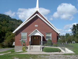
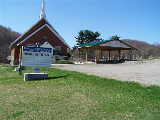
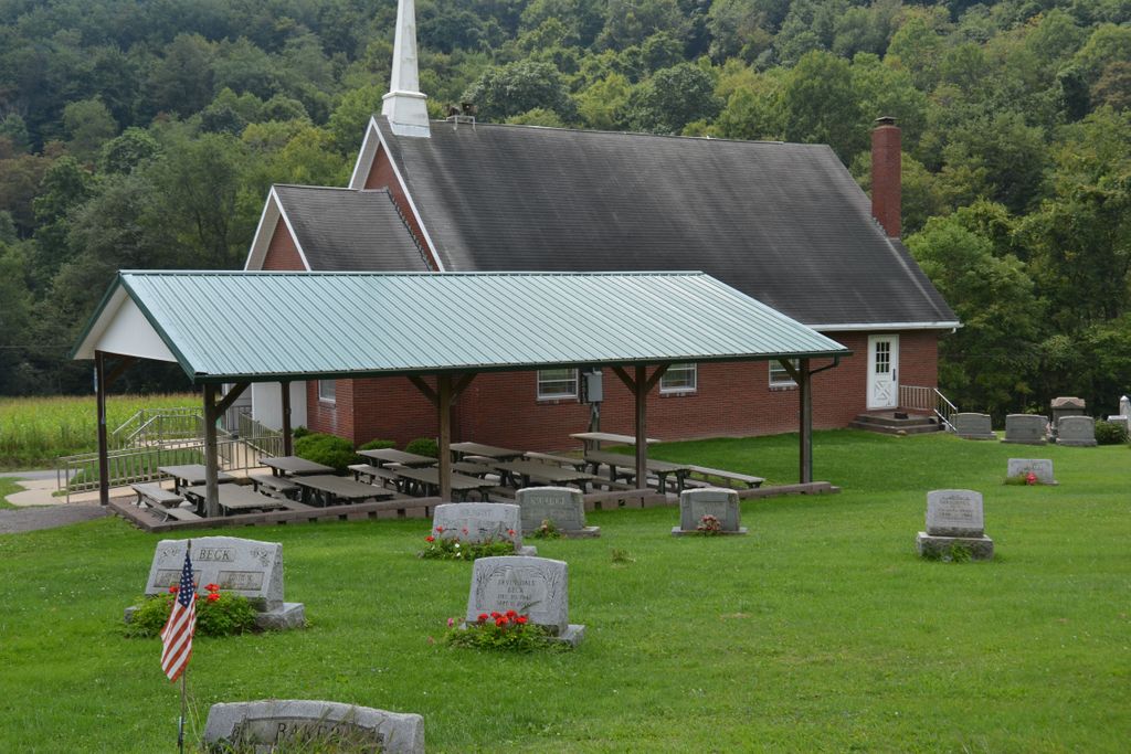
Where is United Rockville Lutheran Cemetery?
United Rockville Lutheran Cemetery is located at 720 State Route 2020 Ford City, Armstrong County ,Pennsylvania , 16226USA.
-
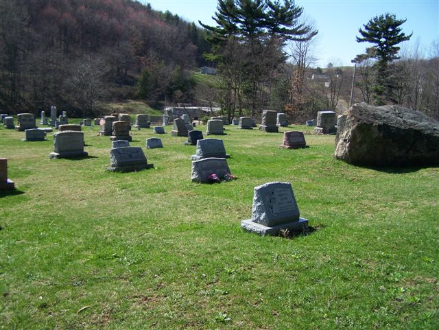
United Rockville Lutheran Cemetery cemetery's updated grave count on graveviews.com?
1 memorials
-
Where are the coordinates of the United Rockville Lutheran Cemetery?
Latitude: 40.7305260
Longitude: -79.4382095
Nearby Cemetories:
1. Saint John's Lutheran Church Cemetery
Ford City, Armstrong County, USA
Coordinate: 40.7197037, -79.4614410
2. Pettigrew Cemetery
Elderton, Armstrong County, USA
Coordinate: 40.7330560, -79.3991670
3. Shotts Cemetery
Armstrong County, USA
Coordinate: 40.7186012, -79.4753036
4. Whitesburg United Methodist Church Cemetery
Whitesburg, Armstrong County, USA
Coordinate: 40.7384000, -79.3964000
5. Whitesburg Presbyterian Cemetery
Armstrong County, USA
Coordinate: 40.7371000, -79.3959000
6. Heilman Emmanuel Evangelical Lutheran Cemetery
Heilman, Armstrong County, USA
Coordinate: 40.7588959, -79.4687347
7. Shaeffer Cemetery
Brick Church, Armstrong County, USA
Coordinate: 40.6927986, -79.4441986
8. Saint Michael's Lutheran Church Cemetery
Brick Church, Armstrong County, USA
Coordinate: 40.6831360, -79.4557114
9. Rowley Cemetery
Elderton, Armstrong County, USA
Coordinate: 40.6889750, -79.4027500
10. Rupp Lutheran Church Cemetery
Kittanning, Armstrong County, USA
Coordinate: 40.7866516, -79.4561920
11. Black Cemetery
Kittanning, Armstrong County, USA
Coordinate: 40.7764060, -79.4860300
12. Mount Union Lutheran Church Cemetery
Elderton, Armstrong County, USA
Coordinate: 40.6876678, -79.3781967
13. Simpson Church Cemetery
Kittanning, Armstrong County, USA
Coordinate: 40.7899000, -79.4083640
14. Saint Paul's Cemetery
Rural Valley, Armstrong County, USA
Coordinate: 40.7620583, -79.3640823
15. Saint Mary's Ukrainian Catholic Cemetery
Ford City, Armstrong County, USA
Coordinate: 40.7467003, -79.5205994
16. Cochrans Mill United Methodist Church Cemetery
Cochrans Mills, Armstrong County, USA
Coordinate: 40.6706000, -79.4700000
17. Crooked Creek Presbyterian Cemetery
Ford City, Armstrong County, USA
Coordinate: 40.7104000, -79.5197000
18. Dunkard Baptist Christian Bretheren Cemetery
Cochrans Mills, Armstrong County, USA
Coordinate: 40.6697655, -79.4726105
19. Saint Mary's Roman Catholic Cemetery
Ford City, Armstrong County, USA
Coordinate: 40.7599983, -79.5180969
20. Holy Trinity Cemetery
Ford City, Armstrong County, USA
Coordinate: 40.7571983, -79.5216980
21. Ford City Cemetery
Ford City, Armstrong County, USA
Coordinate: 40.7528570, -79.5239460
22. Sowers Cemetery
Rural Valley, Armstrong County, USA
Coordinate: 40.7775993, -79.3703003
23. Shoemaker Family Cemetery
Cochrans Mills, Armstrong County, USA
Coordinate: 40.6639400, -79.4665790
24. McDonald Cemetery
Burrell Township, Armstrong County, USA
Coordinate: 40.6603012, -79.4464035