
| Memorials | : | 0 |
| Location | : | Brick Church, Armstrong County, USA |
| Coordinate | : | 40.6927986, -79.4441986 |
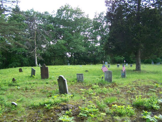
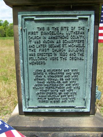
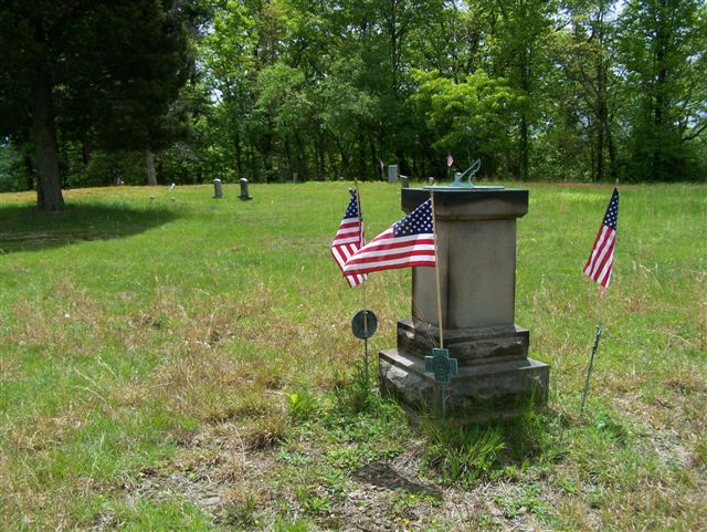
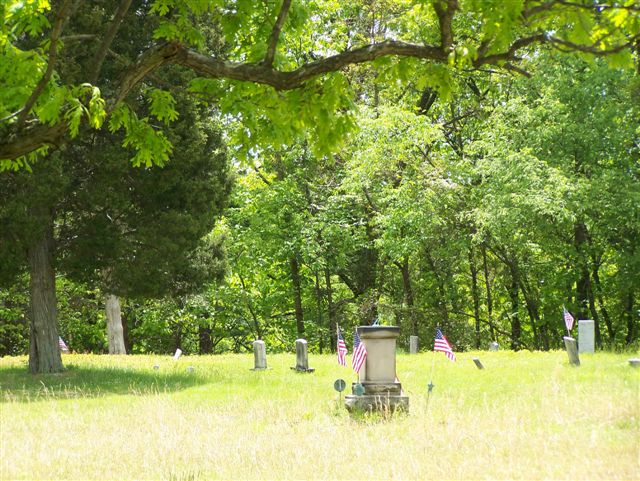
| Description | : | This Old Church Cemetery was founded sometime between 1795 and 1810 and it was next to the First St. Michael's Evangelical Lutheran Church. It sits atop a hill on what was once the Old Shaeffer Farm and was donated by the Shaeffer Family for the site of a Church and Cemetery. Sometime after 1880, the old church was torn down and all that was left was the Sundial and pedestal to mark the location...The old cemetery also remained. A new church was built on the intersection of Campbell Hollow Rd., Cherry Run Rd. and Garrett's Run... Read More |
frequently asked questions (FAQ):
-
Where is Shaeffer Cemetery?
Shaeffer Cemetery is located at Brick Church, Armstrong County ,Pennsylvania ,USA.
-
Shaeffer Cemetery cemetery's updated grave count on graveviews.com?
0 memorials
-
Where are the coordinates of the Shaeffer Cemetery?
Latitude: 40.6927986
Longitude: -79.4441986
Nearby Cemetories:
1. Saint Michael's Lutheran Church Cemetery
Brick Church, Armstrong County, USA
Coordinate: 40.6831360, -79.4557114
2. Cochrans Mill United Methodist Church Cemetery
Cochrans Mills, Armstrong County, USA
Coordinate: 40.6706000, -79.4700000
3. Saint John's Lutheran Church Cemetery
Ford City, Armstrong County, USA
Coordinate: 40.7197037, -79.4614410
4. Dunkard Baptist Christian Bretheren Cemetery
Cochrans Mills, Armstrong County, USA
Coordinate: 40.6697655, -79.4726105
5. Rowley Cemetery
Elderton, Armstrong County, USA
Coordinate: 40.6889750, -79.4027500
6. McDonald Cemetery
Burrell Township, Armstrong County, USA
Coordinate: 40.6603012, -79.4464035
7. Shoemaker Family Cemetery
Cochrans Mills, Armstrong County, USA
Coordinate: 40.6639400, -79.4665790
8. Shotts Cemetery
Armstrong County, USA
Coordinate: 40.7186012, -79.4753036
9. Ramaley Family Cemetery
Cochrans Mills, Armstrong County, USA
Coordinate: 40.6574780, -79.4585220
10. United Rockville Lutheran Cemetery
Ford City, Armstrong County, USA
Coordinate: 40.7305260, -79.4382095
11. Mount Zion United Methodist Church Cemetery
Girty, Armstrong County, USA
Coordinate: 40.6555710, -79.4134674
12. Rupert Cemetery
Girty, Armstrong County, USA
Coordinate: 40.6596550, -79.4020500
13. Mount Union Lutheran Church Cemetery
Elderton, Armstrong County, USA
Coordinate: 40.6876678, -79.3781967
14. Pettigrew Cemetery
Elderton, Armstrong County, USA
Coordinate: 40.7330560, -79.3991670
15. Whitesburg Presbyterian Cemetery
Armstrong County, USA
Coordinate: 40.7371000, -79.3959000
16. Whitesburg United Methodist Church Cemetery
Whitesburg, Armstrong County, USA
Coordinate: 40.7384000, -79.3964000
17. Shellhammer-Beck Cemetery
Mateer, Armstrong County, USA
Coordinate: 40.6394230, -79.4799040
18. Crooked Creek Presbyterian Cemetery
Ford City, Armstrong County, USA
Coordinate: 40.7104000, -79.5197000
19. Shellhammer Cemetery
Mateer, Armstrong County, USA
Coordinate: 40.6420000, -79.4887000
20. Porter Cemetery
Armstrong County, USA
Coordinate: 40.6618996, -79.5147018
21. Montgomery Family Cemetery
South Bend, Armstrong County, USA
Coordinate: 40.6597000, -79.3714000
22. Shellhammer Cemetery
Mateer, Armstrong County, USA
Coordinate: 40.6404860, -79.4944850
23. Bethel Lutheran Church Cemetery
Ford City, Armstrong County, USA
Coordinate: 40.6969290, -79.5336720
24. Heilman Emmanuel Evangelical Lutheran Cemetery
Heilman, Armstrong County, USA
Coordinate: 40.7588959, -79.4687347