
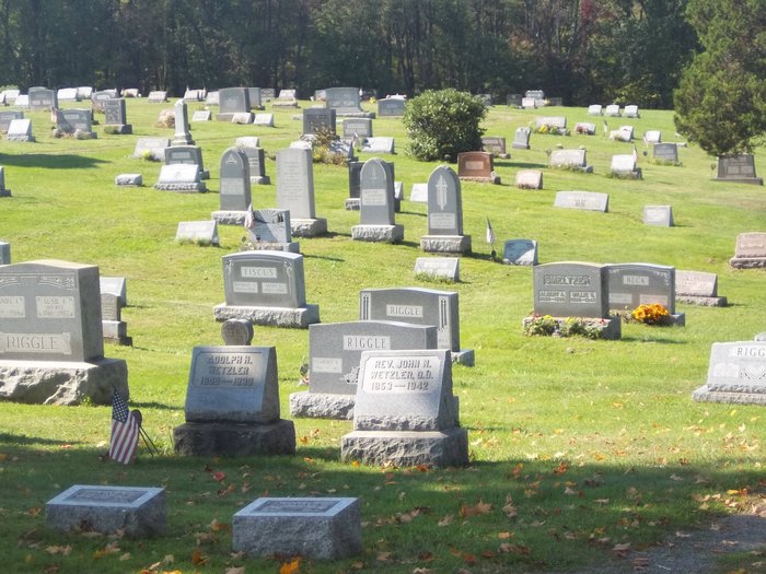
| Memorials | : | 8 |
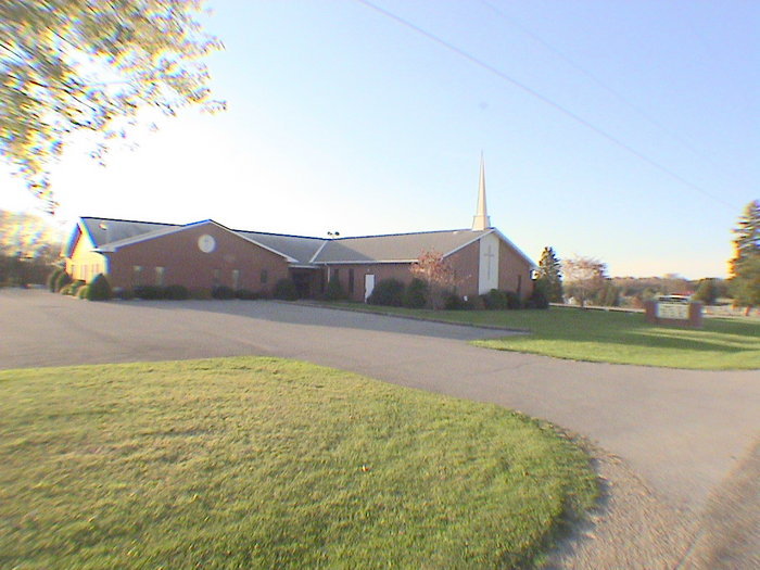
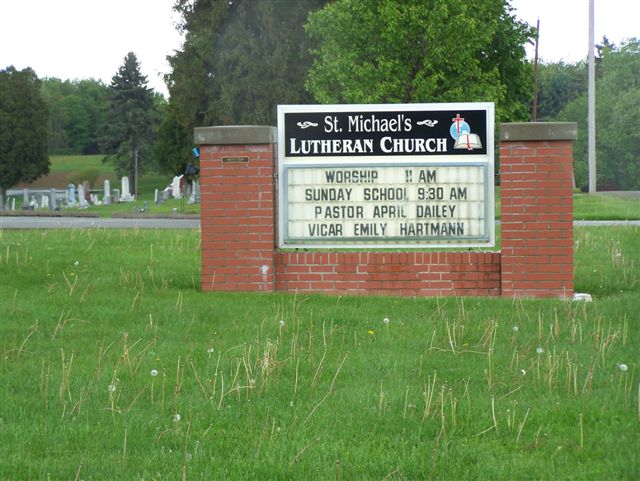
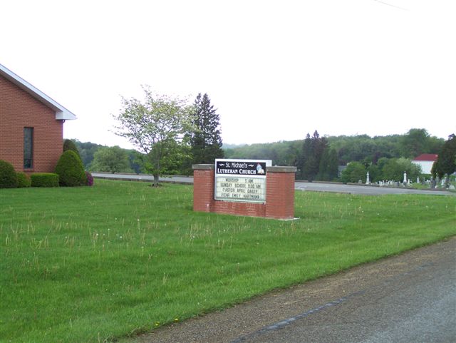
| Location | : | Brick Church, Armstrong County, USA |
| Coordinate | : | 40.6831360, -79.4557114 |
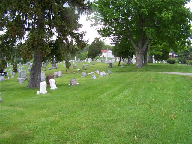
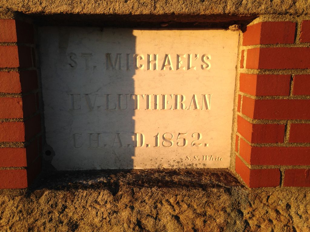
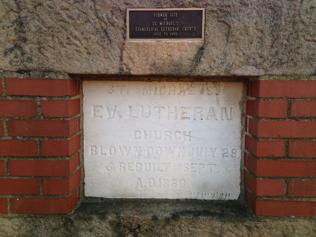
| Description | : | Driving Directions: This Church Cemetery is located in the village of Brick Church and is in Burrell Township, Armstrong County, PA., and it is right alongside State Route 2025. (Often called Garrett's Run Road) This Village is in the Ford City, PA zip code of 16226 and the Church has a Ford City mailing address. From the stop light and bridge, in North Vandergrift, Armstrong County, PA., drive 5.87 miles north, on State Route Alternate 66, toward Ford City, to the crossroads intersection at Cochrans Mill Road, on the right and Grantz Hollow Road on... Read More |
frequently asked questions (FAQ):
-
Where is Saint Michael's Lutheran Church Cemetery?
Saint Michael's Lutheran Church Cemetery is located at Brick Church, Armstrong County ,Pennsylvania ,USA.
-
Saint Michael's Lutheran Church Cemetery cemetery's updated grave count on graveviews.com?
3 memorials
-
Where are the coordinates of the Saint Michael's Lutheran Church Cemetery?
Latitude: 40.6831360
Longitude: -79.4557114

Nearby Cemetories:
1. Shaeffer Cemetery
Brick Church, Armstrong County, USA
Coordinate: 40.6927986, -79.4441986
2. Cochrans Mill United Methodist Church Cemetery
Cochrans Mills, Armstrong County, USA
Coordinate: 40.6706000, -79.4700000
3. Dunkard Baptist Christian Bretheren Cemetery
Cochrans Mills, Armstrong County, USA
Coordinate: 40.6697655, -79.4726105
4. Shoemaker Family Cemetery
Cochrans Mills, Armstrong County, USA
Coordinate: 40.6639400, -79.4665790
5. McDonald Cemetery
Burrell Township, Armstrong County, USA
Coordinate: 40.6603012, -79.4464035
6. Ramaley Family Cemetery
Cochrans Mills, Armstrong County, USA
Coordinate: 40.6574780, -79.4585220
7. Saint John's Lutheran Church Cemetery
Ford City, Armstrong County, USA
Coordinate: 40.7197037, -79.4614410
8. Shotts Cemetery
Armstrong County, USA
Coordinate: 40.7186012, -79.4753036
9. Rowley Cemetery
Elderton, Armstrong County, USA
Coordinate: 40.6889750, -79.4027500
10. Mount Zion United Methodist Church Cemetery
Girty, Armstrong County, USA
Coordinate: 40.6555710, -79.4134674
11. Rupert Cemetery
Girty, Armstrong County, USA
Coordinate: 40.6596550, -79.4020500
12. Shellhammer-Beck Cemetery
Mateer, Armstrong County, USA
Coordinate: 40.6394230, -79.4799040
13. Shellhammer Cemetery
Mateer, Armstrong County, USA
Coordinate: 40.6420000, -79.4887000
14. United Rockville Lutheran Cemetery
Ford City, Armstrong County, USA
Coordinate: 40.7305260, -79.4382095
15. Porter Cemetery
Armstrong County, USA
Coordinate: 40.6618996, -79.5147018
16. Shellhammer Cemetery
Mateer, Armstrong County, USA
Coordinate: 40.6404860, -79.4944850
17. Crooked Creek Presbyterian Cemetery
Ford City, Armstrong County, USA
Coordinate: 40.7104000, -79.5197000
18. Mount Union Lutheran Church Cemetery
Elderton, Armstrong County, USA
Coordinate: 40.6876678, -79.3781967
19. Bethel Lutheran Church Cemetery
Ford City, Armstrong County, USA
Coordinate: 40.6969290, -79.5336720
20. Pettigrew Cemetery
Elderton, Armstrong County, USA
Coordinate: 40.7330560, -79.3991670
21. Montgomery Family Cemetery
South Bend, Armstrong County, USA
Coordinate: 40.6597000, -79.3714000
22. Highfield Lutheran Church Cemetery
North Vandergrift, Armstrong County, USA
Coordinate: 40.6392441, -79.5245590
23. Smail Family Cemetery
North Vandergrift, Armstrong County, USA
Coordinate: 40.6781730, -79.5466050
24. Whitesburg Presbyterian Cemetery
Armstrong County, USA
Coordinate: 40.7371000, -79.3959000