
| Memorials | : | 0 |
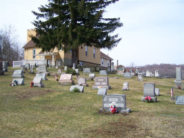
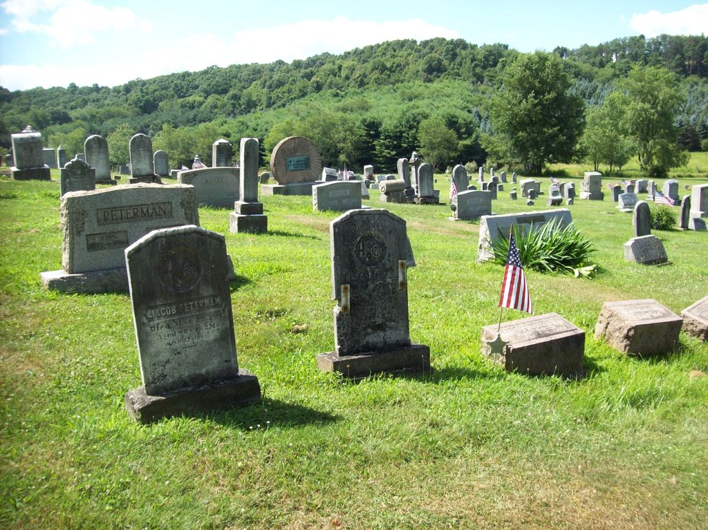
| Location | : | Rural Valley, Armstrong County, USA |
| Coordinate | : | 40.7620583, -79.3640823 |
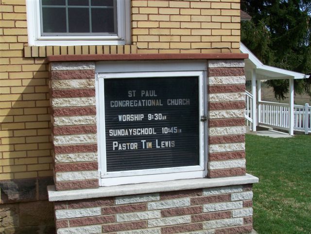
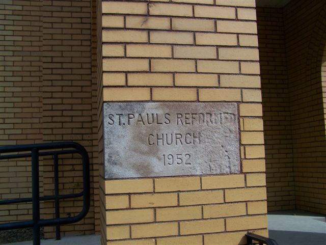
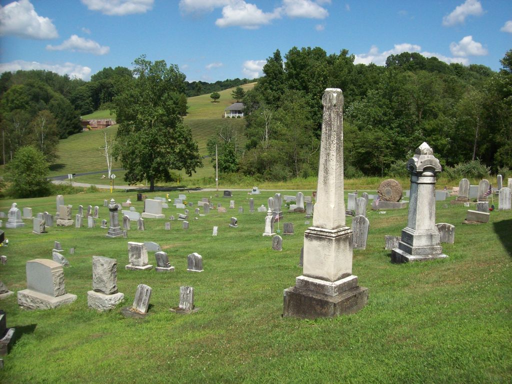
| Description | : | Driving Directions: This Church and Cemetery are known by Two names: The St. Paul's Reformed Church and the St. Paul's Congregational Church. It is located at the intersection of Church Road and St. Paul's Rd., in Cowanshannock Township, Armstrong County, PA. This Church and Cemetery are much closer to Rural Valley, PA. However, the church has a Kittanning, PA mailing address and is in zip code 16201. (The Rural Valley zip code is across the road intersection, on each side of the church.) In Rural Valley, Cowanshannock Township, Armstrong County, PA, at the intersection of Water Street and... Read More |
frequently asked questions (FAQ):
-
Where is Saint Paul's Cemetery?
Saint Paul's Cemetery is located at Rural Valley, Armstrong County ,Pennsylvania ,USA.
-
Saint Paul's Cemetery cemetery's updated grave count on graveviews.com?
0 memorials
-
Where are the coordinates of the Saint Paul's Cemetery?
Latitude: 40.7620583
Longitude: -79.3640823
Nearby Cemetories:
1. Sowers Cemetery
Rural Valley, Armstrong County, USA
Coordinate: 40.7775993, -79.3703003
2. Harkleroad Cemetery
Rural Valley, Armstrong County, USA
Coordinate: 40.7718964, -79.3289719
3. Whitesburg United Methodist Church Cemetery
Whitesburg, Armstrong County, USA
Coordinate: 40.7384000, -79.3964000
4. Whitesburg Presbyterian Cemetery
Armstrong County, USA
Coordinate: 40.7371000, -79.3959000
5. Pettigrew Cemetery
Elderton, Armstrong County, USA
Coordinate: 40.7330560, -79.3991670
6. Elgin-Old Presbyterian Cemetery
Rural Valley, Armstrong County, USA
Coordinate: 40.8046646, -79.3662949
7. Simpson Church Cemetery
Kittanning, Armstrong County, USA
Coordinate: 40.7899000, -79.4083640
8. Rural Valley Cemetery
Rural Valley, Armstrong County, USA
Coordinate: 40.8019714, -79.3118515
9. Salem United Church of Christ Cemetery
Kittanning, Armstrong County, USA
Coordinate: 40.8244130, -79.3559970
10. Gastown Cemetery
Gastown, Armstrong County, USA
Coordinate: 40.7081000, -79.3180000
11. United Rockville Lutheran Cemetery
Ford City, Armstrong County, USA
Coordinate: 40.7305260, -79.4382095
12. Elderton Presbyterian Church Cemetery
Elderton, Armstrong County, USA
Coordinate: 40.6972520, -79.3432240
13. Elderton United Methodist Church Cemetery
Elderton, Armstrong County, USA
Coordinate: 40.6941681, -79.3455887
14. Elderton Cemetery
Elderton, Armstrong County, USA
Coordinate: 40.6918000, -79.3436000
15. Pleasant Union Cemetery
Cowanshannock Township, Armstrong County, USA
Coordinate: 40.8314018, -79.3350449
16. Atwood Cemetery
Atwood, Armstrong County, USA
Coordinate: 40.7527504, -79.2682037
17. Rupp Lutheran Church Cemetery
Kittanning, Armstrong County, USA
Coordinate: 40.7866516, -79.4561920
18. Kimmel Cemetery
Elderton, Armstrong County, USA
Coordinate: 40.6910190, -79.3346140
19. Mount Union Lutheran Church Cemetery
Elderton, Armstrong County, USA
Coordinate: 40.6876678, -79.3781967
20. Schrecengost Farm Cemetery
Armstrong County, USA
Coordinate: 40.8288070, -79.3177450
21. Rowley Cemetery
Elderton, Armstrong County, USA
Coordinate: 40.6889750, -79.4027500
22. Heilman Emmanuel Evangelical Lutheran Cemetery
Heilman, Armstrong County, USA
Coordinate: 40.7588959, -79.4687347
23. Fisher Cemetery
Elderton, Armstrong County, USA
Coordinate: 40.7110610, -79.2780520
24. Mount Union Davis Cemetery
Armstrong County, USA
Coordinate: 40.8323850, -79.4236530