
| Memorials | : | 0 |
| Location | : | Ellijay, Gilmer County, USA |
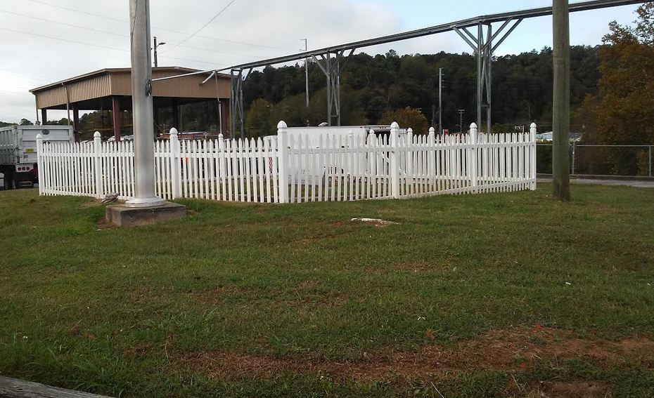
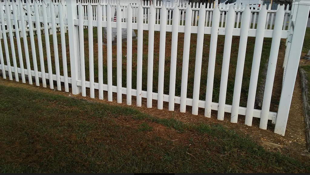
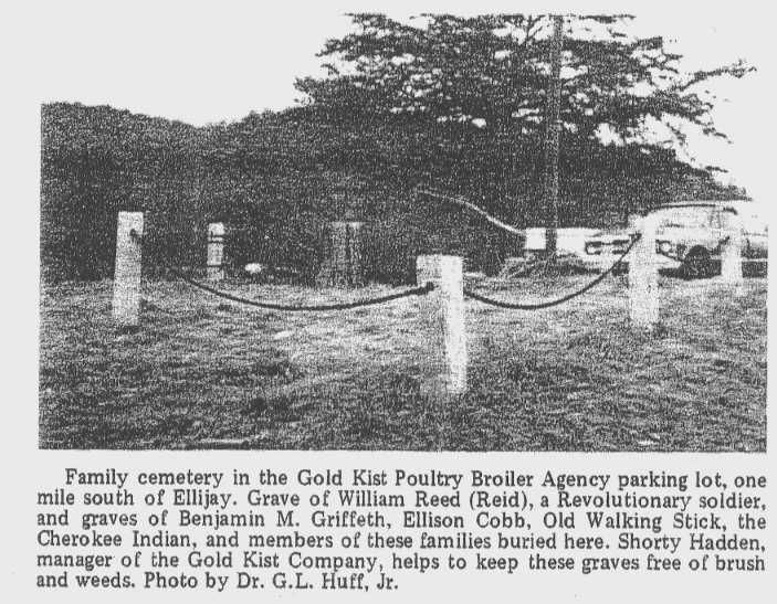
| Description | : | Walkingstick along with a son are buried in the old family cemetery one mile south of Ellijay. The grave plot today is in the Gold Kist Poultry Company parking lot. There are no stones to mark their graves. Only some old cedar trees are left to mark where the old warrior and statesman lies. |
frequently asked questions (FAQ):
-
Where is Walkingstick Old Family Cemetery?
Walkingstick Old Family Cemetery is located at No GPS information available Add GPSParkinglot of Gold Kist Poultry Processing plant Ellijay, Gilmer County ,Georgia , 30540USA.
-
Walkingstick Old Family Cemetery cemetery's updated grave count on graveviews.com?
0 memorials
Nearby Cemetories:
1. Baxter Cemetery
Gilmer County, USA
Coordinate: 34.7901000, -84.3842000
2. Boardtown Church of Christ Cemetery
Gilmer County, USA
Coordinate: 34.8156440, -84.3640240
3. Cartecay United Methodist Church Cemetery
Cartecay, Gilmer County, USA
Coordinate: 34.8147415, -84.3675650
4. Old Faith Baptist Church Cemetery
Gilmer County, USA
Coordinate: 34.7777220, -84.3896390
5. Pleasant Hill Baptist Church Cemetery
Gilmer County, USA
Coordinate: 34.7811800, -84.3976480
6. Pleasant Valley Baptist Church Cemetery
Gilmer County, USA
Coordinate: 34.8271590, -84.3768400
7. East New Hope Baptist Church Cemetery
Roy, Gilmer County, USA
Coordinate: 34.7362034, -84.2863043
8. Mount Pleasant Baptist Church Cemetery #1
Gilmer County, USA
Coordinate: 34.7672220, -84.4134720
9. Mount Pleasant Baptist Church Cemetery #2
Gilmer County, USA
Coordinate: 34.7026157, -84.4757971
10. Cohutta Cemetery
Mountaintown, Gilmer County, USA
Coordinate: 34.5625250, -84.5125920
11. Gates Chapel UMC Cemetery
Mountaintown, Gilmer County, USA
Coordinate: 34.6505090, -84.3885000
12. Chapman Cemetery
Gilmer County, USA
Coordinate: 34.5992012, -84.4199982
13. Cherry Hill Cemetery
Cherry Log, Gilmer County, USA
Coordinate: 34.7901000, -84.3842000
14. Cherry Log Baptist Church Cemetery
Cherry Log, Gilmer County, USA
Coordinate: 34.8156440, -84.3640240
15. Cherry Log Baptist Church Old Cemetery
Cherry Log, Gilmer County, USA
Coordinate: 34.8147415, -84.3675650
16. Rock Creek Baptist Church Cemetery
Cherry Log, Gilmer County, USA
Coordinate: 34.7777220, -84.3896390
17. Rogers Family Cemetery
Cherry Log, Gilmer County, USA
Coordinate: 34.7811800, -84.3976480
18. Sisson Cemetery
Cherry Log, Gilmer County, USA
Coordinate: 34.8271590, -84.3768400
19. Stanley Family Cemetery
Cherry Log, Gilmer County, USA
Coordinate: 34.7362034, -84.2863043
20. Whitaker Cemetery
Cherry Log, Gilmer County, USA
Coordinate: 34.7672220, -84.4134720
21. Unidentified Cemetery
Gilmer County, USA
Coordinate: 34.7026157, -84.4757971
22. Whitestone Baptist Church Cemetery
Gilmer County, USA
Coordinate: 34.5625250, -84.5125920
23. Cartecay United Methodist Church Cemetery Old
Gilmer County, USA
Coordinate: 34.6505090, -84.3885000
24. Clear Creek Baptist Church Cemetery
Gilmer County, USA
Coordinate: 34.5992012, -84.4199982