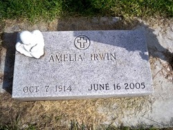
Amelia Czarnik Irwin
| Birth | : | 7 Oct 1914 Krakow, Nance County, Nebraska, USA |
| Death | : | 16 Jun 2005 Columbus, Platte County, Nebraska, USA |
| Burial | : | Aldershot Military Cemetery, Aldershot, Rushmoor Borough, England |
| Coordinate | : | 51.2554779, -0.7449350 |
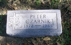
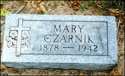
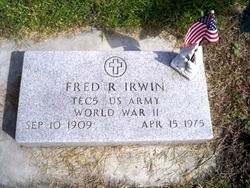
| Description | : | Daughter of Peter & Mary (Jarecki) Czarnik. She grew up in Fullerton and Columbus where she attended St. Anthony School. On June 1, 1935 Amelia was united in marriage to Fred Irwin in Columbus. The couple made their home in Columbus where she worked for Dr. Ronald Anderson, Godfather's Pizza and the Columbus Telegram. Amelia had many friends and enjoyed helping people. She loved going to church where she had an adoration hour for over 20 years. She was a member of St. Bonaventure Church, St. Bonaventure Guild and the Eagles Auxiliary. Amelia enjoyed dancing, playing cards, bingo and an occasional... Read More |
frequently asked questions (FAQ):
-
Where is Amelia Czarnik Irwin's memorial?
Amelia Czarnik Irwin's memorial is located at: Aldershot Military Cemetery, Aldershot, Rushmoor Borough, England.
-
When did Amelia Czarnik Irwin death?
Amelia Czarnik Irwin death on 16 Jun 2005 in Columbus, Platte County, Nebraska, USA
-
Where are the coordinates of the Amelia Czarnik Irwin's memorial?
Latitude: 51.2554779
Longitude: -0.7449350
Family Members:
Parent
Spouse
Siblings
Children
Flowers:
Nearby Cemetories:
1. Aldershot Military Cemetery
Aldershot, Rushmoor Borough, England
Coordinate: 51.2554779, -0.7449350
2. Aldershot Jewish Cemetery
Aldershot, Rushmoor Borough, England
Coordinate: 51.2508900, -0.7463000
3. Redan Road Cemetery
Aldershot, Rushmoor Borough, England
Coordinate: 51.2495610, -0.7488900
4. St Michael the Archangel Churchyard
Aldershot, Rushmoor Borough, England
Coordinate: 51.2414300, -0.7558900
5. Ash War Memorial
Ash, Guildford Borough, England
Coordinate: 51.2546746, -0.7157783
6. Emery Gates Cemetery
Ash, Guildford Borough, England
Coordinate: 51.2500370, -0.7163210
7. St Peter Churchyard
Ash, Guildford Borough, England
Coordinate: 51.2490760, -0.7155380
8. Aldershot Crematorium
Aldershot, Rushmoor Borough, England
Coordinate: 51.2325970, -0.7443200
9. St Lawrence Churchyard
Seale, Guildford Borough, England
Coordinate: 51.2231840, -0.7170140
10. St. Peter's Churchyard
Farnborough, Rushmoor Borough, England
Coordinate: 51.2924100, -0.7499300
11. Saint John the Evangelist Churchyard
Hale, Waverley Borough, England
Coordinate: 51.2280880, -0.7849360
12. Victoria Road Cemetery
Farnborough, Rushmoor Borough, England
Coordinate: 51.2941300, -0.7593900
13. St. Mark's Churchyard
Pirbright, Guildford Borough, England
Coordinate: 51.2549050, -0.6812810
14. Upper Hale Cemetery
Farnham, Waverley Borough, England
Coordinate: 51.2352700, -0.8001800
15. St Michael's Abbey
Farnborough, Rushmoor Borough, England
Coordinate: 51.2971140, -0.7497110
16. St. John the Baptist Churchyard
Farnborough, Rushmoor Borough, England
Coordinate: 51.2973050, -0.7819310
17. Ship Lane Cemetery
Farnborough, Rushmoor Borough, England
Coordinate: 51.3057800, -0.7488900
18. St Andrew Churchyard
Farnham, Waverley Borough, England
Coordinate: 51.2131350, -0.8007400
19. St Mary Churchyard
Ewshot, Hart District, England
Coordinate: 51.2416700, -0.8322800
20. Deepcut Military Cemetery
Deepcut, Surrey Heath Borough, England
Coordinate: 51.3062170, -0.7049060
21. St. Bartholomew's Churchyard
Wanborough, Guildford Borough, England
Coordinate: 51.2317700, -0.6625100
22. St Peter's Churchyard
Frimley, Surrey Heath Borough, England
Coordinate: 51.3149770, -0.7393330
23. St. John the Baptist Churchyard
Puttenham, Guildford Borough, England
Coordinate: 51.2222610, -0.6650440
24. West Street Cemetery
Farnham, Waverley Borough, England
Coordinate: 51.2109000, -0.8093900

