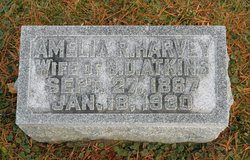
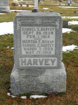
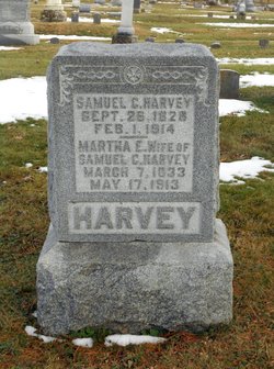
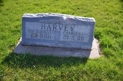
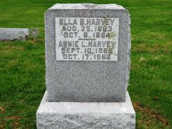
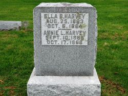
Amelia Rowena “Minnie” Harvey Atkins
| Birth | : | 27 Sep 1867 Letts, Louisa County, Iowa, USA |
| Death | : | 18 Jan 1930 Seward, Seward County, Nebraska, USA |
| Burial | : | St. John the Evangalist Churchyard, Stoke Row, South Oxfordshire District, England |
| Coordinate | : | 51.5510570, -1.0226630 |
| Inscription | : | Wife of S.D. Atkins |
| Description | : | 62y 4m 21d Mrs. Smith D. Atkins, well known to Seward people among whom she had lived for forty-three years, passed away at her home here at an early hour Saturday morning. The direct cause of her death was an attack of influenza, although she had been in poor health for several years. She is survived by her husband and one son, Smith D. Atkins, Jr. of St. Louis,, Mo., and one daughter, Mrs. William A. Reynolds of Friend, Nebr. The son was summoned from St. Louis, but did not reach Seward until after his mother had passed away. |
frequently asked questions (FAQ):
-
Where is Amelia Rowena “Minnie” Harvey Atkins's memorial?
Amelia Rowena “Minnie” Harvey Atkins's memorial is located at: St. John the Evangalist Churchyard, Stoke Row, South Oxfordshire District, England.
-
When did Amelia Rowena “Minnie” Harvey Atkins death?
Amelia Rowena “Minnie” Harvey Atkins death on 18 Jan 1930 in Seward, Seward County, Nebraska, USA
-
Where are the coordinates of the Amelia Rowena “Minnie” Harvey Atkins's memorial?
Latitude: 51.5510570
Longitude: -1.0226630
Family Members:
Parent
Spouse
Siblings
Children
Flowers:
Nearby Cemetories:
1. St. John the Evangalist Churchyard
Stoke Row, South Oxfordshire District, England
Coordinate: 51.5510570, -1.0226630
2. Stoke Row Independant Chapel
Stoke Row, South Oxfordshire District, England
Coordinate: 51.5510570, -1.0226630
3. Stoke Row Independent Chapel Cemetery
Stoke Row, South Oxfordshire District, England
Coordinate: 51.5510570, -1.0226630
4. Checkendon Churchyard
Checkendon, South Oxfordshire District, England
Coordinate: 51.5424461, -1.0449720
5. St. Pauls Highmoor Cross
Highmoor, South Oxfordshire District, England
Coordinate: 51.5532740, -0.9910110
6. St. Bartholomew's Churchyard
Nettlebed, South Oxfordshire District, England
Coordinate: 51.5752360, -0.9936230
7. Holy Trinity Churchyard
Nuffield, South Oxfordshire District, England
Coordinate: 51.5810040, -1.0378960
8. St. Leonard's Churchyard
Woodcote, South Oxfordshire District, England
Coordinate: 51.5348117, -1.0731299
9. All Saints Churchyard
Rotherfield Peppard, South Oxfordshire District, England
Coordinate: 51.5280531, -0.9725009
10. St. Mary the Virgin Cemetery
Ipsden, South Oxfordshire District, England
Coordinate: 51.5674164, -1.0866686
11. Saint Bartholomew Chapelyard
Goring Heath, South Oxfordshire District, England
Coordinate: 51.5102184, -1.0545583
12. St. Nicholas' Churchyard
Rotherfield Greys, South Oxfordshire District, England
Coordinate: 51.5351017, -0.9541395
13. St. James's Churchyard
Bix and Assendon, South Oxfordshire District, England
Coordinate: 51.5610070, -0.9511270
14. St. John the Baptist Churchyard
Kidmore End, South Oxfordshire District, England
Coordinate: 51.5085170, -0.9951240
15. Kidmore End Cemetery
Kidmore End, South Oxfordshire District, England
Coordinate: 51.5071600, -0.9942160
16. St. James' Old Churchyard
South Oxfordshire District, England
Coordinate: 51.5769360, -0.9532550
17. St. Botolph's New Graveyard
Swyncombe, South Oxfordshire District, England
Coordinate: 51.6064829, -1.0167999
18. St. Botolph Old Cemetery
Swyncombe, South Oxfordshire District, England
Coordinate: 51.6065347, -1.0157358
19. St. John the Baptist Churchyard
Whitchurch Hill, South Oxfordshire District, England
Coordinate: 51.5050469, -1.0824315
20. Henley-on-Thames Cemetery
Henley-on-Thames, South Oxfordshire District, England
Coordinate: 51.5543570, -0.9271320
21. St. Mary's Churchyard
North Stoke, South Oxfordshire District, England
Coordinate: 51.5714910, -1.1228080
22. Whitehill Burial Ground
Goring, South Oxfordshire District, England
Coordinate: 51.5214730, -1.1180180
23. St. Margaret's Churchyard
Mapledurham, South Oxfordshire District, England
Coordinate: 51.4850830, -1.0364690
24. Chapel of St Michael the Archangel
Mapledurham, South Oxfordshire District, England
Coordinate: 51.4849140, -1.0355910

