
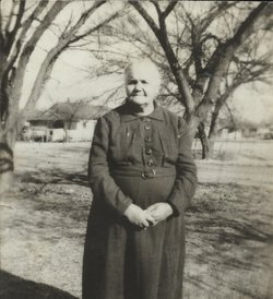

Anna Belle Critchfield Eacret
| Birth | : | 17 May 1879 Indiana, USA |
| Death | : | 2 Apr 1950 Whitman County, Washington, USA |
| Burial | : | St. Michael and All Angels Churchyard, Edstone, Ryedale District, England |
| Coordinate | : | 54.2469000, -0.9188000 |
frequently asked questions (FAQ):
-
Where is Anna Belle Critchfield Eacret's memorial?
Anna Belle Critchfield Eacret's memorial is located at: St. Michael and All Angels Churchyard, Edstone, Ryedale District, England.
-
When did Anna Belle Critchfield Eacret death?
Anna Belle Critchfield Eacret death on 2 Apr 1950 in Whitman County, Washington, USA
-
Where are the coordinates of the Anna Belle Critchfield Eacret's memorial?
Latitude: 54.2469000
Longitude: -0.9188000
Family Members:
Parent
Spouse
Siblings

Children

Flowers:


Nearby Cemetories:
1. St. Michael and All Angels Churchyard
Edstone, Ryedale District, England
Coordinate: 54.2469000, -0.9188000
2. All Saints Churchyard
Kirkbymoorside, Ryedale District, England
Coordinate: 54.2703470, -0.9310110
3. St Gregory Minster Churchyard
Nawton, Ryedale District, England
Coordinate: 54.2627570, -0.9621910
4. St. Gregory's Minster Churchyard
Kirkdale, Ryedale District, England
Coordinate: 54.2628300, -0.9622613
5. St Gregory Minster Churchyard Extension
Nawton, Ryedale District, England
Coordinate: 54.2628100, -0.9629100
6. St. Andrew's Churchyard
Normanby, Ryedale District, England
Coordinate: 54.2253710, -0.8744810
7. St. John of Beverley Parish Churchyard
Salton, Ryedale District, England
Coordinate: 54.2105680, -0.9028560
8. All Saints Churchyard
Sinnington, Ryedale District, England
Coordinate: 54.2647920, -0.8556060
9. Christ Church Churchyard
Appleton-le-Moors, Ryedale District, England
Coordinate: 54.2832030, -0.8729120
10. St Chad Churchyard
Hutton-le-Hole, Ryedale District, England
Coordinate: 54.3000700, -0.9167300
11. St Saviour Churchyard
Harome, Ryedale District, England
Coordinate: 54.2302000, -1.0088000
12. Harome Village Cemetery
Harome, Ryedale District, England
Coordinate: 54.2308650, -1.0096380
13. All Saints and St James Church
Nunnington, Ryedale District, England
Coordinate: 54.2031000, -0.9806000
14. St Aidan Churchyard
Gillamoor, Ryedale District, England
Coordinate: 54.3023510, -0.9502880
15. St Mary Churchyard
Lastingham, Ryedale District, England
Coordinate: 54.3046870, -0.8827260
16. St. Gregory Churchyard
Cropton, Ryedale District, England
Coordinate: 54.2935460, -0.8394850
17. St Andrew Churchyard
Middleton, Ryedale District, England
Coordinate: 54.2587500, -0.8011900
18. St Andrews Churchyard
Middleton, Ryedale District, England
Coordinate: 54.2587270, -0.8009640
19. Stonegrave Minster Churchyard
Stonegrave, Ryedale District, England
Coordinate: 54.1925011, -0.9966000
20. St Laurence Churchyard
Kirby Misperton, Ryedale District, England
Coordinate: 54.2057120, -0.8070710
21. Hovingham Cemetery
Hovingham, Ryedale District, England
Coordinate: 54.1753500, -0.9808900
22. All Saints Churchyard
Slingsby, Ryedale District, England
Coordinate: 54.1655800, -0.9342900
23. Slingsby Cemetery
Slingsby, Ryedale District, England
Coordinate: 54.1650600, -0.9256700
24. All Saints Churchyard
Hovingham, Ryedale District, England
Coordinate: 54.1728980, -0.9801260