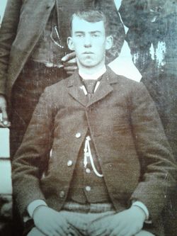
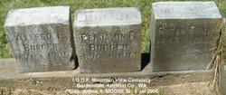
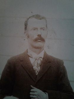
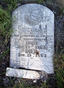
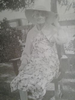
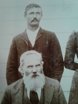
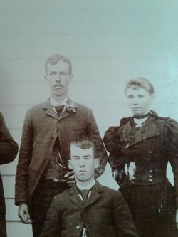
Benjamin Franklin Burgen
| Birth | : | 1879 Washington, USA |
| Death | : | 5 Jan 1914 Goldendale, Klickitat County, Washington, USA |
| Burial | : | St. Swithin's Churchyard, Ganarew, Herefordshire Unitary Authority, England |
| Coordinate | : | 51.8433258, -2.6850994 |
| Description | : | 1910 US Census Record Name: Benjamin F. Burgen Age in 1910: 31 Estimated birth year: abt 1879 Birthplace: Washington Relation to Head of House: Head Father's Birth Place: Virginia Mother's Name: Susan J. (Mother) Mother's Birth Place: Missouri Home in 1910: Sand Springs, Klickitat Co., Washington Marital Status: Single Race: White Gender: Male Household Members: Name Age Benjamin F. Burgen 31 Susan J. Burgen 67 ____________________________________________________ Washington State Archives Digital Archives HomeSearch Name: Benjamin Franklin Burgen Date Of Death: 5 Jan 1914 Age: 34 Gender: Male Father Name: Thomas Burgen Mother Name: Susan... Read More |
frequently asked questions (FAQ):
-
Where is Benjamin Franklin Burgen's memorial?
Benjamin Franklin Burgen's memorial is located at: St. Swithin's Churchyard, Ganarew, Herefordshire Unitary Authority, England.
-
When did Benjamin Franklin Burgen death?
Benjamin Franklin Burgen death on 5 Jan 1914 in Goldendale, Klickitat County, Washington, USA
-
Where are the coordinates of the Benjamin Franklin Burgen's memorial?
Latitude: 51.8433258
Longitude: -2.6850994
Family Members:
Parent
Siblings
Flowers:
Nearby Cemetories:
1. St. Swithin's Churchyard
Ganarew, Herefordshire Unitary Authority, England
Coordinate: 51.8433258, -2.6850994
2. Christ Church Cemetery
Llangarron, Herefordshire Unitary Authority, England
Coordinate: 51.8699460, -2.6889130
3. All Saints Churchyard
Staunton (Coleford), Forest of Dean District, England
Coordinate: 51.8101900, -2.6533900
4. St Mary Churchyard
English Bicknor, Forest of Dean District, England
Coordinate: 51.8390300, -2.6082000
5. Christchurch Churchyard
Coleford, Forest of Dean District, England
Coordinate: 51.8135470, -2.6229980
6. Coleford Cemetery
Coleford, Forest of Dean District, England
Coordinate: 51.7933080, -2.6245110
7. All Saints Churchyard
Newland, Forest of Dean District, England
Coordinate: 51.7825990, -2.6499310
8. All Saints Churchyard
Bishopswood, Herefordshire Unitary Authority, England
Coordinate: 51.8635318, -2.5852627
9. The Parish Church of the Holy Jesus
Lydbrook, Forest of Dean District, England
Coordinate: 51.8376080, -2.5774900
10. St. John the Baptist Churchyard
Ruardean, Forest of Dean District, England
Coordinate: 51.8564500, -2.5515220
11. Clearwell Cemetery Chapel
Clearwell, Forest of Dean District, England
Coordinate: 51.7685400, -2.6167800
12. St Michael churchyard
Garway, Herefordshire Unitary Authority, England
Coordinate: 51.8982110, -2.7934460
13. St Bridget Churchyard
Bridstow, Herefordshire Unitary Authority, England
Coordinate: 51.9204600, -2.6055410
14. St. Dubricius Churchyard
Hentland, Herefordshire Unitary Authority, England
Coordinate: 51.9342080, -2.6660250
15. Forest of Dean Crematorium
Cinderford, Forest of Dean District, England
Coordinate: 51.8098440, -2.5259280
16. Holy Trinity Churchyard
Drybrook, Forest of Dean District, England
Coordinate: 51.8460500, -2.5125400
17. St. Mary the Virgin Churchyard
St Briavels, Forest of Dean District, England
Coordinate: 51.7388290, -2.6405550
18. St. John the Baptist Churchyard
Llanwarne, Herefordshire Unitary Authority, England
Coordinate: 51.9501676, -2.7203512
19. St. Michael and All Angels Churchyard
Brampton Abbots, Herefordshire Unitary Authority, England
Coordinate: 51.9347980, -2.5817590
20. St Paul's Churchyard
Parkend, Forest of Dean District, England
Coordinate: 51.7659090, -2.5521630
21. St John The Evangelist Churchyard
Cinderford, Forest of Dean District, England
Coordinate: 51.8125630, -2.5050510
22. St John The Baptist Churchyard
Kings Caple, Herefordshire Unitary Authority, England
Coordinate: 51.9562740, -2.6433720
23. St. James' Churchyard
Bream, Forest of Dean District, England
Coordinate: 51.7468630, -2.5795910
24. Hoarwithy Church of England
Hentland, Herefordshire Unitary Authority, England
Coordinate: 51.9612740, -2.6625310

