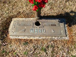
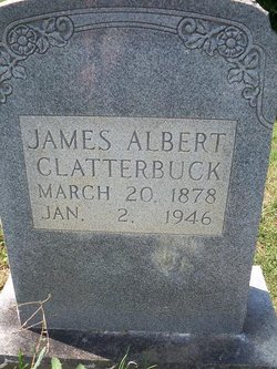
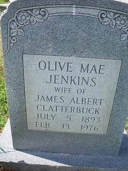
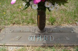
Beulah Margaret Clatterbuck Ward
| Birth | : | 27 Sep 1912 Sperryville, Rappahannock County, Virginia, USA |
| Death | : | 1 Jul 2010 Sperryville, Rappahannock County, Virginia, USA |
| Burial | : | Saint Mary The Virgin Churchyard, Thame, South Oxfordshire District, England |
| Coordinate | : | 51.7511750, -0.9819190 |
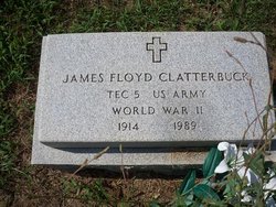
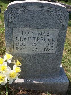
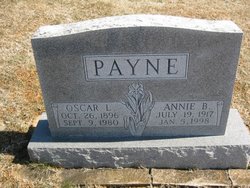
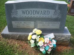
| Description | : | Beulah Margaret Clatterbuck Ward, 97 passed away July 1, 2010 at her residence in Sperryville, VA. She was born September 27, 1912 in Sperryville, VA in Rappahannock County. She was preceded in death by her husband, Orrin Provin Ward, Sr. and son-in-law Robert Gordon (Bob) Corbin, Sr.; parents James Albert Clatterbuck and Olive May Jenkins Clatterbuck; brother James Floyd Clatterbuck; sisters Annie Payne, Emma Woodward, Lois Clatterbuck, and a special aunt Ella Clatterbuck. Survivors include daughters Beatrice Corbin of Culpeper and Colleen Glascock and husband Kenneth of Amissville; sons Orrin Provin (Buddy) Ward, Jr., and wife JoAnn of Culpeper and James... Read More |
frequently asked questions (FAQ):
-
Where is Beulah Margaret Clatterbuck Ward's memorial?
Beulah Margaret Clatterbuck Ward's memorial is located at: Saint Mary The Virgin Churchyard, Thame, South Oxfordshire District, England.
-
When did Beulah Margaret Clatterbuck Ward death?
Beulah Margaret Clatterbuck Ward death on 1 Jul 2010 in Sperryville, Rappahannock County, Virginia, USA
-
Where are the coordinates of the Beulah Margaret Clatterbuck Ward's memorial?
Latitude: 51.7511750
Longitude: -0.9819190
Family Members:
Parent
Spouse
Siblings
Flowers:
Nearby Cemetories:
1. Saint Mary The Virgin Churchyard
Thame, South Oxfordshire District, England
Coordinate: 51.7511750, -0.9819190
2. Thame War Memorial
Thame, South Oxfordshire District, England
Coordinate: 51.7452570, -0.9743330
3. North Weston Chapel
Thame, South Oxfordshire District, England
Coordinate: 51.7433420, -1.0153490
4. Baptist Chapel Burial Ground
Long Crendon, Aylesbury Vale District, England
Coordinate: 51.7730713, -0.9929426
5. Thame Park Chapel
Thame, South Oxfordshire District, England
Coordinate: 51.7290130, -0.9650540
6. St Mary the Virgin Churchyard
Long Crendon, Aylesbury Vale District, England
Coordinate: 51.7758380, -0.9890670
7. St. Catherine Churchyard
Towersey, South Oxfordshire District, England
Coordinate: 51.7411700, -0.9360300
8. St. Mary Magdalene Churchyard
Shabbington, Aylesbury Vale District, England
Coordinate: 51.7554420, -1.0357510
9. St Nicholas Churchyard
Kingsey, Aylesbury Vale District, England
Coordinate: 51.7545190, -0.9246110
10. Rycote Chapel
Great Haseley, South Oxfordshire District, England
Coordinate: 51.7366100, -1.0355370
11. St. Mary the Virgin Churchyard
Haddenham, Aylesbury Vale District, England
Coordinate: 51.7658180, -0.9266980
12. White Friar's Church
Oxford, City of Oxford, England
Coordinate: 51.7710000, -0.9288600
13. St Nicholas Churchyard
Chearsley, Aylesbury Vale District, England
Coordinate: 51.7868900, -0.9571600
14. Haddenham Baptist Church Graveyard
Haddenham, Aylesbury Vale District, England
Coordinate: 51.7706830, -0.9274900
15. St Helen Churchyard
Albury, South Oxfordshire District, England
Coordinate: 51.7406280, -1.0519520
16. St Giles Churchyard
Tetsworth, South Oxfordshire District, England
Coordinate: 51.7085800, -1.0086700
17. St Mary's Churchyard
Sydenham, South Oxfordshire District, England
Coordinate: 51.7112360, -0.9398460
18. St. Mary's Churchyard
Chilton, Aylesbury Vale District, England
Coordinate: 51.7988760, -1.0055490
19. Aston Sandford St Michael and all Angels
Aston Sandford, Aylesbury Vale District, England
Coordinate: 51.7651962, -0.9024482
20. St. Nicholas' Churchyard
Ickford, Aylesbury Vale District, England
Coordinate: 51.7614648, -1.0656459
21. St. Nicholas Churchyard
Cuddington, Aylesbury Vale District, England
Coordinate: 51.7944300, -0.9320400
22. St. Peter's Churchyard
Ilmer, Wycombe District, England
Coordinate: 51.7428914, -0.8873946
23. St. Nicholas' Churchyard
Nether Winchendon, Aylesbury Vale District, England
Coordinate: 51.8041000, -0.9388000
24. St. Mary's Churchyard
Adwell, South Oxfordshire District, England
Coordinate: 51.6906560, -0.9938380

