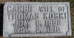
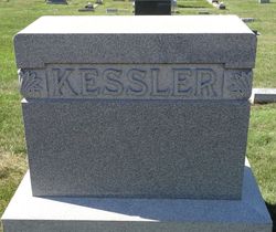
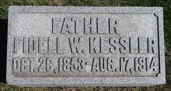
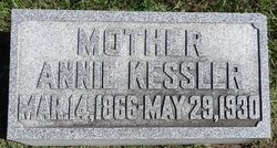
Carrie Kessler Koski
| Birth | : | 8 Jul 1888 Dunlap, Harrison County, Iowa, USA |
| Death | : | 2 Nov 1918 Dunlap, Harrison County, Iowa, USA |
| Burial | : | Saint Mary the Virgin Churchyard, Uttoxeter, East Staffordshire Borough, England |
| Coordinate | : | 52.8987700, -1.8624100 |
| Plot | : | Block 7, Row 2 |
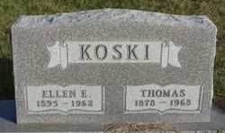
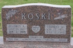
| Description | : | In 1908 Thomas Koski was married to Carrie Kessler. 3 boys and 2 girls were born to them. During the flu epidemic of 1918, Carrie died, leaving a family of small children. Grandmother, Annie Kessler, cam to care for the family. In 1919 the family moved to the farm south of Dunlap....Tom was married to Ella Crom in 1926, and they had a family of 2 boys and 2 girls. (Source: Dunlap Pioneers and Progress Centennial book ) |
frequently asked questions (FAQ):
-
Where is Carrie Kessler Koski's memorial?
Carrie Kessler Koski's memorial is located at: Saint Mary the Virgin Churchyard, Uttoxeter, East Staffordshire Borough, England.
-
When did Carrie Kessler Koski death?
Carrie Kessler Koski death on 2 Nov 1918 in Dunlap, Harrison County, Iowa, USA
-
Where are the coordinates of the Carrie Kessler Koski's memorial?
Latitude: 52.8987700
Longitude: -1.8624100
Family Members:
Parent
Spouse
Siblings
Children
Flowers:
Nearby Cemetories:
1. Saint Mary the Virgin Churchyard
Uttoxeter, East Staffordshire Borough, England
Coordinate: 52.8987700, -1.8624100
2. St. Cuthbert's Churchyard
Doveridge, Derbyshire Dales District, England
Coordinate: 52.9042368, -1.8317361
3. St Michael and All Angels Churchyard
Stramshall, East Staffordshire Borough, England
Coordinate: 52.9201040, -1.8836100
4. St Lawrence Churchyard
Bramshall, East Staffordshire Borough, England
Coordinate: 52.8963900, -1.9106400
5. Dove Evangelical Free Church, Somersal Herbert
Doveridge, Derbyshire Dales District, England
Coordinate: 52.9109200, -1.7905560
6. St. John the Baptist Churchyard
Kingstone, East Staffordshire Borough, England
Coordinate: 52.8630944, -1.9115108
7. St Peter's Churchyard
Marchington, East Staffordshire Borough, England
Coordinate: 52.8738278, -1.7967917
8. St. Giles Churchyard
Marston Montgomery, Derbyshire Dales District, England
Coordinate: 52.9382120, -1.8007610
9. All Saints Churchyard
Sudbury, Derbyshire Dales District, England
Coordinate: 52.8867660, -1.7667510
10. Croxden Abbey
Croxden, East Staffordshire Borough, England
Coordinate: 52.9549890, -1.9042630
11. All Saints Churchyard
Leigh, East Staffordshire Borough, England
Coordinate: 52.9199520, -1.9657840
12. St. Mary and All Saints Churchyard
Checkley, Staffordshire Moorlands District, England
Coordinate: 52.9384190, -1.9598100
13. St Leonard Churchyard
Bradley in the Moors, Staffordshire Moorlands District, England
Coordinate: 52.9693440, -1.9135150
14. St. Nicholas Churchyard
Abbots Bromley, East Staffordshire Borough, England
Coordinate: 52.8184560, -1.8837460
15. St John Churchyard
Alton, Staffordshire Moorlands District, England
Coordinate: 52.9783380, -1.8919190
16. St. Peter's Churchyard
Alton, Staffordshire Moorlands District, England
Coordinate: 52.9783470, -1.8918600
17. St. John the Baptist Churchyard
Boylestone, Derbyshire Dales District, England
Coordinate: 52.9195410, -1.7313190
18. All Saints Churchyard
Newborough, East Staffordshire Borough, England
Coordinate: 52.8259013, -1.8003185
19. St. Mary and St. Barlock Churchyard
Norbury, Derbyshire Dales District, England
Coordinate: 52.9787350, -1.8146430
20. St Werburgh's Church
Hanbury, East Staffordshire Borough, England
Coordinate: 52.8485000, -1.7478000
21. Christ Church Churchyard
Upper Tean, Staffordshire Moorlands District, England
Coordinate: 52.9529687, -1.9831798
22. Saint Peter's Cemetery
Ellastone, East Staffordshire Borough, England
Coordinate: 52.9882900, -1.8275000
23. RAF Fauld
Hanbury, East Staffordshire Borough, England
Coordinate: 52.8474200, -1.7303500
24. St. Paul's Churchyard Extension
Scropton, South Derbyshire District, England
Coordinate: 52.8687230, -1.7133750

