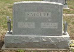
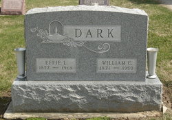
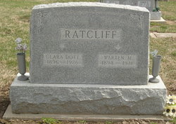
Clara Dorothy “Dot” Dark Ratcliff
| Birth | : | 11 Sep 1896 Fountain County, Indiana, USA |
| Death | : | 3 Feb 1926 Danville, Vermilion County, Illinois, USA |
| Burial | : | Paynes Chapel Cemetery, Bunker Hill, Berkeley County, USA |
| Coordinate | : | 39.2897700, -78.0539900 |
| Description | : | She married Warren M. Ratcliff on February 16, 1912 in Fountain County, Indiana. |
frequently asked questions (FAQ):
-
Where is Clara Dorothy “Dot” Dark Ratcliff's memorial?
Clara Dorothy “Dot” Dark Ratcliff's memorial is located at: Paynes Chapel Cemetery, Bunker Hill, Berkeley County, USA.
-
When did Clara Dorothy “Dot” Dark Ratcliff death?
Clara Dorothy “Dot” Dark Ratcliff death on 3 Feb 1926 in Danville, Vermilion County, Illinois, USA
-
Where are the coordinates of the Clara Dorothy “Dot” Dark Ratcliff's memorial?
Latitude: 39.2897700
Longitude: -78.0539900
Family Members:
Parent
Spouse
Siblings
Children
Flowers:
Nearby Cemetories:
1. Paynes Chapel Cemetery
Bunker Hill, Berkeley County, USA
Coordinate: 39.2897700, -78.0539900
2. Snider Cemetery
Jones Springs, Berkeley County, USA
Coordinate: 39.2912590, -78.0344780
3. Rest United Methodist Church Cemetery
Rest, Frederick County, USA
Coordinate: 39.2919006, -78.0820999
4. Grace Bible Fellowship Cemetery
Clear Brook, Frederick County, USA
Coordinate: 39.2643747, -78.0620388
5. Brucetown United Methodist Church Cemetery
Clear Brook, Frederick County, USA
Coordinate: 39.2524986, -78.0606003
6. Mount Tabor Church Cemetery
Bunker Hill, Berkeley County, USA
Coordinate: 39.3317032, -78.0534286
7. Jabbers Hill Cemetery
Clear Brook, Frederick County, USA
Coordinate: 39.2472000, -78.0505981
8. Bunker Hill Cemetery
Bunker Hill, Berkeley County, USA
Coordinate: 39.3339005, -78.0585022
9. Mountain View Church of the Brethren Cemetery
Inwood, Berkeley County, USA
Coordinate: 39.3320600, -78.0146000
10. Weaver Family Cemetery
Middleway, Jefferson County, USA
Coordinate: 39.2981410, -77.9846050
11. Watson Graveyard
Middleway, Jefferson County, USA
Coordinate: 39.3019000, -77.9822250
12. Hopewell Friends Burial Ground
Clear Brook, Frederick County, USA
Coordinate: 39.2564011, -78.1147003
13. Union Church Cemetery
Middleway, Jefferson County, USA
Coordinate: 39.3041560, -77.9817900
14. Priestfield Pastoral Center Cemetery
Middleway, Jefferson County, USA
Coordinate: 39.3185143, -77.9886678
15. Grace Episcopal Church Cemetery
Middleway, Jefferson County, USA
Coordinate: 39.3035011, -77.9806976
16. Middleway Masonic Cemetery
Middleway, Jefferson County, USA
Coordinate: 39.3035860, -77.9800060
17. Weidman - Suver Cemetery
Bunker Hill, Berkeley County, USA
Coordinate: 39.3335340, -78.1162690
18. Galilee Christian Church Cemetery
Clear Brook, Frederick County, USA
Coordinate: 39.2640991, -78.1341019
19. Welltown United Methodist Church Cemetery
Welltown, Frederick County, USA
Coordinate: 39.2532997, -78.1333008
20. Stones Chapel Cemetery
Clarke County, USA
Coordinate: 39.2261009, -78.0105972
21. White Hall United Methodist Church Cemetery
White Hall, Frederick County, USA
Coordinate: 39.2937012, -78.1489029
22. Prosperity Baptist Church Cemetery
Summit Point, Jefferson County, USA
Coordinate: 39.2387730, -77.9843590
23. Mount Pleasant Cemetery
Gerrardstown, Berkeley County, USA
Coordinate: 39.3338730, -78.1343120
24. Cedar Grove Christian Church Cemetery
Inwood, Berkeley County, USA
Coordinate: 39.3476900, -77.9884700

