
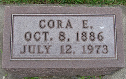
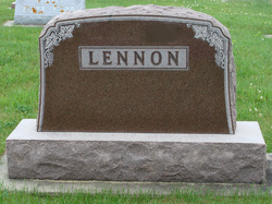
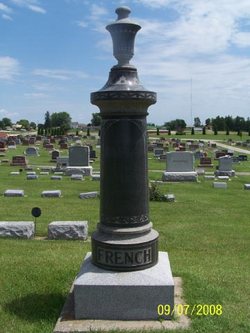
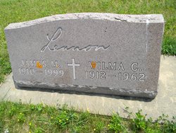
Cora Elnora French Lennon Foels
| Birth | : | 28 Oct 1886 |
| Death | : | 12 Jul 1973 |
| Burial | : | Saint Anne's Church, Woodplumpton, City of Preston, England |
| Coordinate | : | 53.8038130, -2.7621940 |
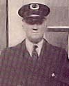
| Description | : | SERVICES HELD FOR CORA LENNON FOELS Services were held in St. Paul Lutheran Church, Monday, July 16, at 10:30 a.m. for Cora Lennon Foels who died at Community Memorial Hospital, Postville July 12, [1973]. The Rev. Norman Ullestad officiated. Cora French, the daughter of Harvey and his wife Orpha Payne French, was born in Post township, Postville, Iowa, October 8, 1886. On September 4, 1904 she was united in marriage to Elmer J. Lennon of Decorah. The couple had three children, Sarah, Howard and James. She spent the greater portion of her married life in the Decorah-Postville area. Cora was... Read More |
frequently asked questions (FAQ):
-
Where is Cora Elnora French Lennon Foels's memorial?
Cora Elnora French Lennon Foels's memorial is located at: Saint Anne's Church, Woodplumpton, City of Preston, England.
-
When did Cora Elnora French Lennon Foels death?
Cora Elnora French Lennon Foels death on 12 Jul 1973 in
-
Where are the coordinates of the Cora Elnora French Lennon Foels's memorial?
Latitude: 53.8038130
Longitude: -2.7621940
Family Members:
Parent

Spouse
Siblings


Children

Flowers:


Nearby Cemetories:
1. Saint Anne's Church
Woodplumpton, City of Preston, England
Coordinate: 53.8038130, -2.7621940
2. St Andrew George Haydock Roman Catholic Churchyard
Cottam, City of Preston, England
Coordinate: 53.7879280, -2.7591570
3. St Mary's Newhouse
Barton, City of Preston, England
Coordinate: 53.8205240, -2.7406500
4. St. John Baptist Churchyard
Broughton-in-Amounderness, City of Preston, England
Coordinate: 53.8033700, -2.7170400
5. St. Lawrence Churchyard
Barton, City of Preston, England
Coordinate: 53.8289213, -2.7366654
6. St. Mary's Churchyard
Lea, City of Preston, England
Coordinate: 53.7733810, -2.7942770
7. St. Andrew's Churchyard
Ashton-on-Ribble, City of Preston, England
Coordinate: 53.7687030, -2.7359180
8. St. John the Evangelist Churchyard
Clifton, Fylde Borough, England
Coordinate: 53.7758600, -2.8158500
9. Christ Church Churchyard
Fulwood, City of Preston, England
Coordinate: 53.7771920, -2.7028700
10. St. Peters Churchyard
Inskip with Sowerby, Wyre Borough, England
Coordinate: 53.8347100, -2.8175200
11. Christ Churchyard
Treales, Fylde Borough, England
Coordinate: 53.8045970, -2.8440710
12. St Walburge's RC Church
Preston, City of Preston, England
Coordinate: 53.7629690, -2.7149620
13. St. Mary's Churchyard
Preston, City of Preston, England
Coordinate: 53.8010830, -2.6779600
14. St. Hilda's Churchyard
Bilsborrow, Wyre Borough, England
Coordinate: 53.8522170, -2.7420090
15. Inskip Baptist Churchyard
Inskip with Sowerby, Wyre Borough, England
Coordinate: 53.8353150, -2.8299610
16. Saint Peter Churchyard
Preston, City of Preston, England
Coordinate: 53.7634100, -2.7080700
17. St Mary Churchyard
Penwortham, South Ribble Borough, England
Coordinate: 53.7551800, -2.7234210
18. Grey Friars' Church
Preston, City of Preston, England
Coordinate: 53.7601480, -2.7084600
19. Holy Trinity
Preston, City of Preston, England
Coordinate: 53.7613030, -2.7030580
20. Friends Meeting House Burial Ground (Defunct)
Preston, City of Preston, England
Coordinate: 53.7610250, -2.7030380
21. Christ Church Churchyard
Preston, City of Preston, England
Coordinate: 53.7573210, -2.7103080
22. St. Ignatius RC Churchyard
Preston, City of Preston, England
Coordinate: 53.7635270, -2.6965870
23. St. George the Martyr
Preston, City of Preston, England
Coordinate: 53.7591220, -2.7025660
24. St. Wilfrid's Catholic Cemetery
Preston, City of Preston, England
Coordinate: 53.7581670, -2.7044930