
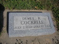
Dewey R Cockrell
| Birth | : | 12 Jul 1897 Wilson, Ellsworth County, Kansas, USA |
| Death | : | 17 Jul 1966 Kingman, Kingman County, Kansas, USA |
| Burial | : | St. Mary the Virgin Churchyard, Eling, New Forest District, England |
| Coordinate | : | 50.9103000, -1.4795700 |
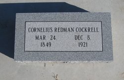
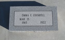
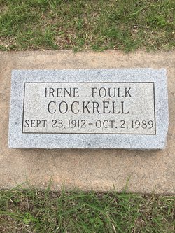
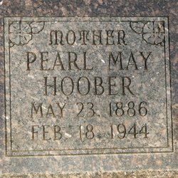
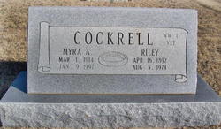
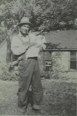
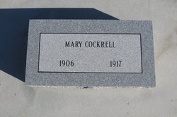
| Description | : | son of Emma E. Sanders and Cornelius R. Cockrell Newspaper Clipping KINGMAN -- Dewey R. Cockrell, 69, died Sunday at his home here after a heart attack. He was a retired section hand for the Missouri Pacific Railroad. Born July 12, 1897 at Wilson, he had lived in Kingman 35 years. He married Irene Foulk Aug. 29 1934. They were divorced. Member: Church of Christ. Survivors: Sons, John and Roy, and brothers, Riley and Seamore, all of Kingman. Funeral: 2 p.m. Wednesday, Livingston Mortuary, Kingman; Joe Wooton. Burial: Harper Cemetery. |
frequently asked questions (FAQ):
-
Where is Dewey R Cockrell's memorial?
Dewey R Cockrell's memorial is located at: St. Mary the Virgin Churchyard, Eling, New Forest District, England.
-
When did Dewey R Cockrell death?
Dewey R Cockrell death on 17 Jul 1966 in Kingman, Kingman County, Kansas, USA
-
Where are the coordinates of the Dewey R Cockrell's memorial?
Latitude: 50.9103000
Longitude: -1.4795700
Family Members:
Parent
Spouse
Siblings
Children
Flowers:


Nearby Cemetories:
1. Eling Cemetery
Eling, New Forest District, England
Coordinate: 50.9092640, -1.4817810
2. Holy Trinity Churchyard
Millbrook, Southampton Unitary Authority, England
Coordinate: 50.9158400, -1.4535100
3. Millbrook Cemetery
Millbrook, Southampton Unitary Authority, England
Coordinate: 50.9164900, -1.4526100
4. Christ Church Churchyard
Ashurst, New Forest District, England
Coordinate: 50.8960200, -1.5054200
5. St. Nicholas Churchyard
Millbrook, Southampton Unitary Authority, England
Coordinate: 50.9139100, -1.4439800
6. St John the Apostle Churchyard
Marchwood, New Forest District, England
Coordinate: 50.8900300, -1.4530700
7. Falklands War Memorial
Marchwood, New Forest District, England
Coordinate: 50.8898280, -1.4533250
8. St. Matthew's Churchyard
Netley Marsh, New Forest District, England
Coordinate: 50.9161620, -1.5285530
9. St James by the Park Churchyard
Shirley, Southampton Unitary Authority, England
Coordinate: 50.9266800, -1.4285800
10. St. James by the Park Cemetery
Southampton Unitary Authority, England
Coordinate: 50.9267988, -1.4283898
11. St Boniface Churchyard
Nursling, Test Valley Borough, England
Coordinate: 50.9464660, -1.4896760
12. Hollybrook War Memorial
Southampton, Southampton Unitary Authority, England
Coordinate: 50.9337420, -1.4311350
13. Hollybrook Cemetery
Southampton, Southampton Unitary Authority, England
Coordinate: 50.9340680, -1.4312970
14. Southampton Old Cemetery
Southampton, Southampton Unitary Authority, England
Coordinate: 50.9202900, -1.4130650
15. All Saints Churchyard
Dibden, New Forest District, England
Coordinate: 50.8753020, -1.4362590
16. St John the Evangelist Churchyard
Rownhams, Test Valley Borough, England
Coordinate: 50.9520900, -1.4541200
17. St Michael the Archangel Churchyard
Southampton, Southampton Unitary Authority, England
Coordinate: 50.8996200, -1.4056900
18. St Lawrence with St John Churchyard
Southampton, Southampton Unitary Authority, England
Coordinate: 50.8977570, -1.4052470
19. Holyrood Churchyard
Southampton, Southampton Unitary Authority, England
Coordinate: 50.8996600, -1.4035300
20. Holyrood Church
Southampton Unitary Authority, England
Coordinate: 50.8997498, -1.4034560
21. All Saints Catacombs and Burial Ground (Defunct)
Southampton, Southampton Unitary Authority, England
Coordinate: 50.9013350, -1.4021500
22. St. Julien's Church
Southampton, Southampton Unitary Authority, England
Coordinate: 50.8965000, -1.4036000
23. St Mary Churchyard
Southampton, Southampton Unitary Authority, England
Coordinate: 50.9027100, -1.3960800
24. Highfield Churchyard
Portswood, Southampton Unitary Authority, England
Coordinate: 50.9295400, -1.3949800