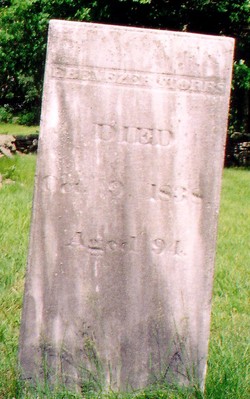
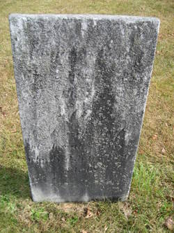
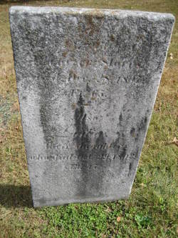
Ebenezer Storrs
| Birth | : | 26 Aug 1741 Mansfield, Tolland County, Connecticut, USA |
| Death | : | 9 Oct 1838 Mansfield, Tolland County, Connecticut, USA |
| Burial | : | Yorkville Cumberland Presbyterian Church Cemetery, Yorkville, Gibson County, USA |
| Coordinate | : | 36.1007996, -89.1231003 |
| Description | : | Private in the Revolutionary War |
frequently asked questions (FAQ):
-
Where is Ebenezer Storrs's memorial?
Ebenezer Storrs's memorial is located at: Yorkville Cumberland Presbyterian Church Cemetery, Yorkville, Gibson County, USA.
-
When did Ebenezer Storrs death?
Ebenezer Storrs death on 9 Oct 1838 in Mansfield, Tolland County, Connecticut, USA
-
Where are the coordinates of the Ebenezer Storrs's memorial?
Latitude: 36.1007996
Longitude: -89.1231003
Family Members:
Parent
Spouse
Children
Flowers:
Nearby Cemetories:
1. Yorkville Cumberland Presbyterian Church Cemetery
Yorkville, Gibson County, USA
Coordinate: 36.1007996, -89.1231003
2. Yorkville Cemetery
Yorkville, Gibson County, USA
Coordinate: 36.0980988, -89.1207962
3. Bethel MB Church Cemetery
Yorkville, Gibson County, USA
Coordinate: 36.0878910, -89.1180910
4. Bethel Cemetery
Yorkville, Gibson County, USA
Coordinate: 36.0871370, -89.1178680
5. Reed Burial Ground
Yorkville, Gibson County, USA
Coordinate: 36.1176420, -89.1372490
6. Cowan Cemetery
Dyer, Gibson County, USA
Coordinate: 36.0978120, -89.0753020
7. Bells Chapel Cemetery
Dyer, Gibson County, USA
Coordinate: 36.1164017, -89.0686035
8. Balentine Family Cemetery
Dyer, Gibson County, USA
Coordinate: 36.0544690, -89.0928070
9. Center Cemetery
Newbern, Dyer County, USA
Coordinate: 36.0835740, -89.1849550
10. Thompson Cemetery
Rutherford, Gibson County, USA
Coordinate: 36.1047220, -89.0553430
11. Hogue Cemetery
Yorkville, Gibson County, USA
Coordinate: 36.0495580, -89.0985780
12. Crenshaw-Wyatt Cemetery
Dyer, Gibson County, USA
Coordinate: 36.0778090, -89.0589010
13. Mount Carmel Church Cemetery
Churchton, Dyer County, USA
Coordinate: 36.1293440, -89.1844930
14. McCorkle Cemetery
Newbern, Dyer County, USA
Coordinate: 36.1260860, -89.1921050
15. Cool Springs Cumberland Presbyterian Cemetery
Cool Springs, Gibson County, USA
Coordinate: 36.1618996, -89.1393967
16. Bethpage Baptist Church Cemetery
Gibson County, USA
Coordinate: 36.1683000, -89.0950000
17. Flowers - Wright Cemetery
Dyer, Gibson County, USA
Coordinate: 36.0951100, -89.0348700
18. North Union Cemetery
Kenton, Gibson County, USA
Coordinate: 36.1652985, -89.0736008
19. Shaw Cemetery
Tatumville, Dyer County, USA
Coordinate: 36.0435982, -89.1868973
20. Mount Olive Cemetery
Dyer, Gibson County, USA
Coordinate: 36.0807991, -89.0278015
21. Flowers Chapel Cemetery
Rutherford, Gibson County, USA
Coordinate: 36.1198820, -89.0265080
22. Pettus Family Cemetery
Yorkville, Gibson County, USA
Coordinate: 36.1797000, -89.1472700
23. Taylor Family Cemetery
Rutherford, Gibson County, USA
Coordinate: 36.1049700, -89.0226300
24. Liberty Grove Cemetery
Rutherford, Gibson County, USA
Coordinate: 36.1439760, -89.0371100


