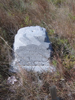
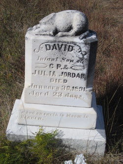
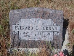
| Birth | : | 6 May 1882 |
| Death | : | 14 Jul 1905 Mellette County, South Dakota, USA |
| Burial | : | St. Martin's Churchyard, Bladon, West Oxfordshire District, England |
| Coordinate | : | 51.8304596, -1.3495430 |
| Plot | : | Grave 3, Lot 8 |
| Description | : | Edwin drowned while attempting to help round up cattle near the family ranch. He tried to swim his horse across a dam and the horse slipped into a waterhole which was obscured by high water. He was thrown off the horse and unable to swim ashore with high boots on and subsequently drowned. Two of his brothers were with him but were unable to rescue him. Source for date of birth is Rosebud Mission Church Records, Book A, #007856517, Image 66 which shows he was born in May of 1882 and baptized on Sunday, 26 Aug... Read More |
frequently asked questions (FAQ):
-
Where is Edwin Everard Jordan's memorial?
Edwin Everard Jordan's memorial is located at: St. Martin's Churchyard, Bladon, West Oxfordshire District, England.
-
When did Edwin Everard Jordan death?
Edwin Everard Jordan death on 14 Jul 1905 in Mellette County, South Dakota, USA
-
Where are the coordinates of the Edwin Everard Jordan's memorial?
Latitude: 51.8304596
Longitude: -1.3495430
Family Members:
Parent
Siblings
Flowers:
Nearby Cemetories:
1. St. Martin's Churchyard
Bladon, West Oxfordshire District, England
Coordinate: 51.8304596, -1.3495430
2. Blenheim Palace
Woodstock, West Oxfordshire District, England
Coordinate: 51.8414993, -1.3611000
3. St Mary Magdalene Churchyard
Woodstock, West Oxfordshire District, England
Coordinate: 51.8472890, -1.3569480
4. Hensington Road Cemetery
Woodstock, West Oxfordshire District, England
Coordinate: 51.8488700, -1.3495500
5. St. Michael's Churchyard
Begbroke, Cherwell District, England
Coordinate: 51.8221520, -1.3218069
6. Lawn Cemetery
Woodstock, West Oxfordshire District, England
Coordinate: 51.8534220, -1.3512110
7. Ss. Peter & Paul Churchyard
Church Hanborough, West Oxfordshire District, England
Coordinate: 51.8125750, -1.3838000
8. Christ Churchyard
Long Hanborough, West Oxfordshire District, England
Coordinate: 51.8247400, -1.3955000
9. Holy Cross Churchyard
Shipton-on-Cherwell, Cherwell District, England
Coordinate: 51.8452170, -1.3043260
10. St Giles Churchyard
Shipton-on-Cherwell, Cherwell District, England
Coordinate: 51.8444550, -1.2981890
11. Kidlington Burial Ground
Kidlington, Cherwell District, England
Coordinate: 51.8266010, -1.2916660
12. North Oxfordshire Memorial Park and Crematorium
Tackley, West Oxfordshire District, England
Coordinate: 51.8647410, -1.3312160
13. St Mary the Virgin Churchyard
Freeland, West Oxfordshire District, England
Coordinate: 51.8116300, -1.4004700
14. St. Bartholomew's Churchyard
Yarnton, Cherwell District, England
Coordinate: 51.8016610, -1.3087620
15. St Peter's Churchyard
Cassington, West Oxfordshire District, England
Coordinate: 51.7923610, -1.3423160
16. Yarnton Cemetery
Yarnton, Cherwell District, England
Coordinate: 51.8004080, -1.3103260
17. St Mary the Virgin Churchyard
Kidlington, Cherwell District, England
Coordinate: 51.8296680, -1.2797360
18. St Mary the Virgin Churchyard
Hampton Poyle, Cherwell District, England
Coordinate: 51.8359630, -1.2780620
19. St Mary the Virgin Churchyard
Wootton, West Oxfordshire District, England
Coordinate: 51.8756430, -1.3636990
20. Eynsham War Memorial
Eynsham, West Oxfordshire District, England
Coordinate: 51.7801562, -1.3736687
21. St Leonard Churchyard
Eynsham, West Oxfordshire District, England
Coordinate: 51.7799470, -1.3738080
22. Stonesfield Cemetery
Stonesfield, West Oxfordshire District, England
Coordinate: 51.8497110, -1.4301480
23. St. Nicholas Churchyard
Tackley, West Oxfordshire District, England
Coordinate: 51.8782400, -1.3102910
24. Saint James the Great Churchyard
Stonesfield, West Oxfordshire District, England
Coordinate: 51.8510437, -1.4303250


