
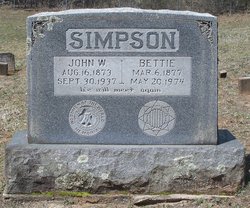
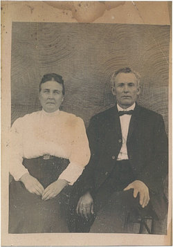
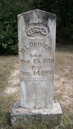
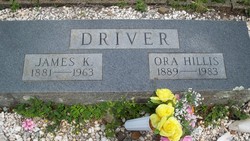
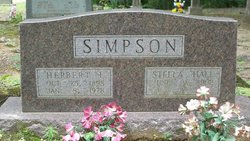
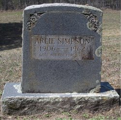
Elizabeth “Bettie” Driver Simpson
| Birth | : | 6 Mar 1877 Van Buren County, Arkansas, USA |
| Death | : | 20 May 1974 Arkansas, USA |
| Burial | : | Springston Cemetery, Lincoln, Selwyn District, New Zealand |
| Coordinate | : | -43.6404360, 172.4509420 |
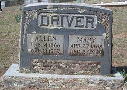
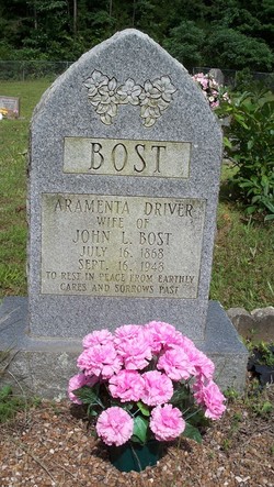
| Description | : | Daughter of William Matthew Driver & Aramentah (Hardy) Driver. Bettie Driver married John Simpson 8 January 1903 in Van Buren County, Arkansas (beta.familysearch.org). |
frequently asked questions (FAQ):
-
Where is Elizabeth “Bettie” Driver Simpson's memorial?
Elizabeth “Bettie” Driver Simpson's memorial is located at: Springston Cemetery, Lincoln, Selwyn District, New Zealand.
-
When did Elizabeth “Bettie” Driver Simpson death?
Elizabeth “Bettie” Driver Simpson death on 20 May 1974 in Arkansas, USA
-
Where are the coordinates of the Elizabeth “Bettie” Driver Simpson's memorial?
Latitude: -43.6404360
Longitude: 172.4509420
Family Members:
Parent

Spouse
Siblings

Children
Flowers:


Nearby Cemetories:
1. Springston Cemetery
Lincoln, Selwyn District, New Zealand
Coordinate: -43.6404360, 172.4509420
2. St Mary's Churchyard
Springston, Selwyn District, New Zealand
Coordinate: -43.6446560, 172.4263590
3. Lincoln Cemetery
Lincoln, Selwyn District, New Zealand
Coordinate: -43.6311790, 172.4862570
4. Prebbleton Cemetery
Prebbleton, Selwyn District, New Zealand
Coordinate: -43.5887200, 172.5053500
5. Shands Road Cemetery
Prebbleton, Selwyn District, New Zealand
Coordinate: -43.5792540, 172.4888630
6. All Saint's Churchyard
Prebbleton, Selwyn District, New Zealand
Coordinate: -43.5781040, 172.5131430
7. Weedons Cemetery
Weedons, Selwyn District, New Zealand
Coordinate: -43.5670010, 172.4015870
8. St Saviours Churchyard
Templeton, Christchurch City, New Zealand
Coordinate: -43.5501420, 172.4714620
9. St. Mary's Anglican Church Cemetery
Halswell, Christchurch City, New Zealand
Coordinate: -43.5794830, 172.5686440
10. Mount Magdala Cemetery
Halswell, Christchurch City, New Zealand
Coordinate: -43.5622700, 172.5672600
11. St Luke's Anglican Churchyard
Brookside, Selwyn District, New Zealand
Coordinate: -43.6903100, 172.3029000
12. St Paul's Anglican Church Cemetery
West Melton, Selwyn District, New Zealand
Coordinate: -43.5261700, 172.3701800
13. Yaldhurst Cemetery
Yaldhurst, Christchurch City, New Zealand
Coordinate: -43.5109640, 172.4765980
14. Church of the Epiphany Churchyard
Teddington, Christchurch City, New Zealand
Coordinate: -43.7016200, 172.6182200
15. Brookside Cemetery
Brookside, Selwyn District, New Zealand
Coordinate: -43.6751800, 172.2683700
16. St Peter's Anglican Churchyard
Upper Riccarton, Christchurch City, New Zealand
Coordinate: -43.5317570, 172.5701330
17. St Cuthbert's Cemetery
Governors Bay, Christchurch City, New Zealand
Coordinate: -43.6326900, 172.6458000
18. Avonhead Memorial Cemetery
Avonhead, Christchurch City, New Zealand
Coordinate: -43.5095390, 172.5503920
19. Sydenham Cemetery
Sydenham, Christchurch City, New Zealand
Coordinate: -43.5582330, 172.6254900
20. St Peters Churchyard
Teddington, Christchurch City, New Zealand
Coordinate: -43.6719000, 172.6590100
21. Addington Cemetery
Addington, Christchurch City, New Zealand
Coordinate: -43.5434880, 172.6235790
22. Halkett Presbyterian Churchyard
Halkett, Selwyn District, New Zealand
Coordinate: -43.5011000, 172.3220900
23. Waimairi Cemetery
Burnside, Christchurch City, New Zealand
Coordinate: -43.4997760, 172.5773860
24. Blessed Sacrament Cathedral
Christchurch, Christchurch City, New Zealand
Coordinate: -43.5384250, 172.6458880