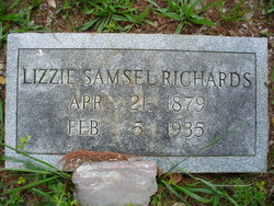
Elizabeth Nannie “Lizzie” Samsel Richards
| Birth | : | 21 Apr 1879 Grainger County, Tennessee, USA |
| Death | : | 5 Feb 1935 Grainger County, Tennessee, USA |
| Burial | : | Dalton Cemetery, Bean Station, Grainger County, USA |
| Coordinate | : | 36.3428001, -83.3296967 |
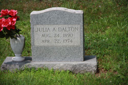
| Description | : | Morristown Gazette & Mail, Wed., 6 Feb 1935, pg 3: "DIED -------- Miss Lizzie Richards Miss Lizzie Richards, 54, died Tuesday afternoon at one o'clock at her residence near Bean Station after a lingering illness. Funeral service were held this afternoon at 2 o'clock from the residence, conducted by the Rev. Matthew Oliver. Interment followed in the Dalton cemetery. Deceased is survived by six brothers, Sam Richards[sic] of Johnson City, and William, Joseph, John, Thomas and Charlie Richards[sic] of Grainger county; two sister, Mrs. Julia Dalton of Grainger county and Mrs. Essie Everhart of Hamblen county." |
frequently asked questions (FAQ):
-
Where is Elizabeth Nannie “Lizzie” Samsel Richards's memorial?
Elizabeth Nannie “Lizzie” Samsel Richards's memorial is located at: Dalton Cemetery, Bean Station, Grainger County, USA.
-
When did Elizabeth Nannie “Lizzie” Samsel Richards death?
Elizabeth Nannie “Lizzie” Samsel Richards death on 5 Feb 1935 in Grainger County, Tennessee, USA
-
Where are the coordinates of the Elizabeth Nannie “Lizzie” Samsel Richards's memorial?
Latitude: 36.3428001
Longitude: -83.3296967
Family Members:
Parent
Spouse
Siblings
Flowers:
Nearby Cemetories:
1. Samsel Lakeview Cemetery
Bean Station, Grainger County, USA
Coordinate: 36.3475800, -83.3189468
2. Samsel Cemetery
Bean Station, Grainger County, USA
Coordinate: 36.3424020, -83.3167060
3. Garrett Cemetery
Grainger County, USA
Coordinate: 36.3414001, -83.3082962
4. Buck Hollow Cemetery
Grainger County, USA
Coordinate: 36.3344120, -83.3589440
5. Moores Chapel Cemetery
Bean Station, Grainger County, USA
Coordinate: 36.3488998, -83.2897034
6. Bean Station Cemetery
Bean Station, Grainger County, USA
Coordinate: 36.3283000, -83.3697000
7. Cobb Cemetery
Grainger County, USA
Coordinate: 36.3189011, -83.3644028
8. Harris Cemetery
Grainger County, USA
Coordinate: 36.3055992, -83.3308029
9. Harrell Cemetery
Bean Station, Grainger County, USA
Coordinate: 36.3074989, -83.3463974
10. DeBord Cemetery
Bean Station, Grainger County, USA
Coordinate: 36.3315000, -83.2834000
11. Central United Methodist Church Cemetery
Bean Station, Grainger County, USA
Coordinate: 36.3422740, -83.2798470
12. Atkins Cemetery
Grainger County, USA
Coordinate: 36.3506000, -83.3792000
13. Meadow Branch Cemetery
Bean Station, Grainger County, USA
Coordinate: 36.3572006, -83.2822037
14. Holt Cemetery #2
Bean Station, Grainger County, USA
Coordinate: 36.3630560, -83.2844440
15. Noeton Baptist Church Cemetery Original
Bean Station, Grainger County, USA
Coordinate: 36.3012600, -83.3342200
16. Helton Cemetery
Bean Station, Grainger County, USA
Coordinate: 36.3451190, -83.3831290
17. Harville Cemetery
Grainger County, USA
Coordinate: 36.3811802, -83.3543986
18. Samsel Cemetery
Bean Station, Grainger County, USA
Coordinate: 36.3114014, -83.2925034
19. Adriel Baptist Church Cemetery
Bean Station, Grainger County, USA
Coordinate: 36.3125000, -83.2897034
20. First Independent Freewill Baptist Church Cemetery
Bean Station, Grainger County, USA
Coordinate: 36.3158860, -83.2855850
21. Meek Cemetery
Bean Station, Grainger County, USA
Coordinate: 36.3207180, -83.2797150
22. County Line Cemetery
Bean Station, Grainger County, USA
Coordinate: 36.3207700, -83.2789850
23. Marys Chapel Cemetery
Grainger County, USA
Coordinate: 36.3011017, -83.3569031
24. Ford Cemetery
Grainger County, USA
Coordinate: 36.2902985, -83.3071976


