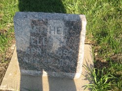
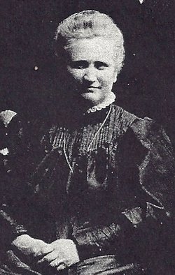
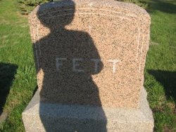
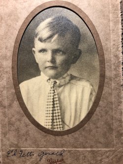
Ella M. Schellhase Fett
| Birth | : | 11 Apr 1892 |
| Death | : | 25 Nov 1974 Dysart, Tama County, Iowa, USA |
| Burial | : | Saint Jude Cemetery, Monroe City, Monroe County, USA |
| Coordinate | : | 39.6528015, -91.7450027 |
| Description | : | Posted By: Linda Vander Linden - Volunteer (email) Date: 2/11/2010 at 11:22:27 Funeral services were held at Dow Funeral Home in Ireton at 2 P.M., November 29 for Mrs. Edward Fett, 82, of Dysart, a former Ireton area resident who died at Dysart November, 25. Services were conducted by the Rev. O. A. Anderson and burial was in Pleasant Hill cemetery. Mrs. Fett, the former Ella Schellhase was born April 11, 1893, in Benton County, Iowa. She was married to Edward Fett February 23, 1910, at Garrison, Iowa. The couple farmed in Plymouth County until Mr. Fett's death in 1936. She then moved to... Read More |
frequently asked questions (FAQ):
-
Where is Ella M. Schellhase Fett's memorial?
Ella M. Schellhase Fett's memorial is located at: Saint Jude Cemetery, Monroe City, Monroe County, USA.
-
When did Ella M. Schellhase Fett death?
Ella M. Schellhase Fett death on 25 Nov 1974 in Dysart, Tama County, Iowa, USA
-
Where are the coordinates of the Ella M. Schellhase Fett's memorial?
Latitude: 39.6528015
Longitude: -91.7450027
Family Members:
Parent
Spouse
Siblings
Children
Flowers:
Nearby Cemetories:
1. Saint Jude Cemetery
Monroe City, Monroe County, USA
Coordinate: 39.6528015, -91.7450027
2. Holy Rosary Cemetery
Monroe City, Monroe County, USA
Coordinate: 39.6528000, -91.7450000
3. Sharpsburg Cemetery
Marion County, USA
Coordinate: 39.6822160, -91.7678850
4. Shaw Family Gravesite
Sharpsburg, Marion County, USA
Coordinate: 39.6874900, -91.7736050
5. Young Burial Ground
Sharpsburg, Marion County, USA
Coordinate: 39.6997200, -91.7611100
6. Howe Cemetery
Marion County, USA
Coordinate: 39.7155991, -91.7630997
7. Saint Stephens Catholic Cemetery
Indian Creek, Monroe County, USA
Coordinate: 39.5925800, -91.7762400
8. DeMoss Chapel Cemetery
Hassard, Ralls County, USA
Coordinate: 39.6044846, -91.6873856
9. Bethlehem Cemetery
Ralls County, USA
Coordinate: 39.6069400, -91.6733300
10. Browne Cemetery
Hunnewell, Shelby County, USA
Coordinate: 39.6737500, -91.8509600
11. IOOF Cemetery
Hunnewell, Shelby County, USA
Coordinate: 39.6736800, -91.8523800
12. Cobb Cemetery
Marion County, USA
Coordinate: 39.7393990, -91.7292023
13. Jeter Cemetery
Monroe County, USA
Coordinate: 39.6175003, -91.8563995
14. Mount Vernon United Methodist Church Cemetery
Sees Branch Settlement, Marion County, USA
Coordinate: 39.7297800, -91.6767200
15. Kincaid Cemetery
Warren, Marion County, USA
Coordinate: 39.7498110, -91.7764030
16. Saint Johns Cemetery
Hunnewell, Shelby County, USA
Coordinate: 39.6617012, -91.8778000
17. Godfrey Cemetery
Hunnewell, Shelby County, USA
Coordinate: 39.6699982, -91.8788986
18. New Oakland Cemetery
The Landing, Ralls County, USA
Coordinate: 39.5660200, -91.6651200
19. Yager Cemetery
The Landing, Ralls County, USA
Coordinate: 39.5600640, -91.6719080
20. Union Chapel Cemetery
Hunnewell, Shelby County, USA
Coordinate: 39.7162323, -91.8602524
21. Brush Creek Cemetery
Ralls County, USA
Coordinate: 39.6197650, -91.6040461
22. Warren Cemetery
Warren, Marion County, USA
Coordinate: 39.7712200, -91.7517200
23. Greathouse Cemetery
Ralls County, USA
Coordinate: 39.6142006, -91.5991974
24. Shannon Cemetery
Woodland, Marion County, USA
Coordinate: 39.7375500, -91.6301000


