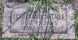
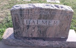
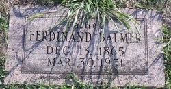
Ferdinand Balmer
| Birth | : | 13 Dec 1865 |
| Death | : | 30 Mar 1951 |
| Burial | : | St. Lawrence Churchyard, Barton, City of Preston, England |
| Coordinate | : | 53.8289213, -2.7366654 |
| Description | : | Balmer, --- Ferdinand, son of Jonah and Mary (Knops) Balmer, was born Dec. 13, 1865, near Tramlau, Switzerland; died March 30, 1951, of cerebral hemorrhage, in Galloway Hospital, at Anthony, Kans.; aged 85 y. 3m. 17 d. At the age of twenty-one he came to the United States and lived near Dalton, Ohio, for six years. From Ohio he moved to Harper, Kans., where he united in marriage to Lena Gerber March 26, 1893. She preceded him in death nearly seventeen years ago. As a child he was brought up in a Lutheran home and became a member of that... Read More |
frequently asked questions (FAQ):
-
Where is Ferdinand Balmer's memorial?
Ferdinand Balmer's memorial is located at: St. Lawrence Churchyard, Barton, City of Preston, England.
-
When did Ferdinand Balmer death?
Ferdinand Balmer death on 30 Mar 1951 in
-
Where are the coordinates of the Ferdinand Balmer's memorial?
Latitude: 53.8289213
Longitude: -2.7366654
Family Members:
Spouse
Children
Flowers:
Nearby Cemetories:
1. St Mary's Newhouse
Barton, City of Preston, England
Coordinate: 53.8205240, -2.7406500
2. St. Hilda's Churchyard
Bilsborrow, Wyre Borough, England
Coordinate: 53.8522170, -2.7420090
3. St. John Baptist Churchyard
Broughton-in-Amounderness, City of Preston, England
Coordinate: 53.8033700, -2.7170400
4. Saint Anne's Church
Woodplumpton, City of Preston, England
Coordinate: 53.8038130, -2.7621940
5. St. Mary the Virgin Churchyard
Goosnargh, City of Preston, England
Coordinate: 53.8266470, -2.6707030
6. St Andrew George Haydock Roman Catholic Churchyard
Cottam, City of Preston, England
Coordinate: 53.7879280, -2.7591570
7. St. Mary's Churchyard
Preston, City of Preston, England
Coordinate: 53.8010830, -2.6779600
8. Whittingham Hospital Cemetery
Goosnargh, City of Preston, England
Coordinate: 53.8208401, -2.6613468
9. St Thomas Churchyard
Claughton-on-Brock, Wyre Borough, England
Coordinate: 53.8752030, -2.7199160
10. St. Peters Churchyard
Inskip with Sowerby, Wyre Borough, England
Coordinate: 53.8347100, -2.8175200
11. Church of St James
Goosnargh, City of Preston, England
Coordinate: 53.8657750, -2.6719410
12. Inskip Baptist Churchyard
Inskip with Sowerby, Wyre Borough, England
Coordinate: 53.8353150, -2.8299610
13. Christ Church Churchyard
Fulwood, City of Preston, England
Coordinate: 53.7771920, -2.7028700
14. St. Helen's Churchyard
Kirkland (Churchtown), Wyre Borough, England
Coordinate: 53.8790700, -2.7901000
15. St. Michael’s Churchyard
St Michael's on Wyre, Wyre Borough, England
Coordinate: 53.8628050, -2.8195430
16. St. Andrew's Churchyard
Ashton-on-Ribble, City of Preston, England
Coordinate: 53.7687030, -2.7359180
17. St. Mary's Churchyard
Lea, City of Preston, England
Coordinate: 53.7733810, -2.7942770
18. St. Michael's Churchyard
Grimsargh, City of Preston, England
Coordinate: 53.7990710, -2.6352530
19. St Walburge's RC Church
Preston, City of Preston, England
Coordinate: 53.7629690, -2.7149620
20. Saint Peter Churchyard
Preston, City of Preston, England
Coordinate: 53.7634100, -2.7080700
21. Christ Churchyard
Treales, Fylde Borough, England
Coordinate: 53.8045970, -2.8440710
22. St. Ignatius RC Churchyard
Preston, City of Preston, England
Coordinate: 53.7635270, -2.6965870
23. Holy Trinity
Preston, City of Preston, England
Coordinate: 53.7613030, -2.7030580
24. St. John the Evangelist Churchyard
Clifton, Fylde Borough, England
Coordinate: 53.7758600, -2.8158500

